Curated OER
United States Map Quiz
For this online interactive geography quiz worksheet, students examine the map that includes all 50 states of the United States. Students match the names of the 50 states to the appropriate places on the map.
DocsTeach
Analyzing a Map of the Louisiana Purchase
With the stroke of a pen, Thomas Jefferson roughly doubled the size of the United States. The Louisiana Purchase not only grew the new country, but also it gave rise to the legends surrounding westward expansion and accelerated the...
University of Richmond
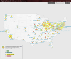
Mapping Inequality: Redlining in New Deal America 1935-1940
Redlining—or the practice of racial discrimination in housing loans—directly led to today's segregated living patterns in America. Using data from the federal Home Owners' Loan Corporation, classmates visualize the impact of policy on...
Curated OER
States in the USA Quiz
In this online interactive geography quiz worksheet, students respond to 50 identification questions about the states in the United States of America. Students have 4 minutes to complete the quiz.
University of Richmond
Canals 1820-1860
While canals are not a common mode of transportation today, they were part of the fuel for America's industrialization. However, most of them were located in the North, also feeding regional differences and sectionalism. Using an...
DocsTeach
Lewis and Clark's Expedition to the Complex West
Lewis and Clark's famous expedition is a prime example of the United States' westward expansion. Aspiring historians examine maps from Lewis and Clark's journey, as well as discuss their interactions with Native American tribes. The...
Curated OER
United States Capitals Map Quiz
In this online interactive states and captials quiz worksheet, students examine the 50 pictured states and try to name all of the state capitals.
Ashbrook Center at Ashland University
Federalist - Antifederalist Debates
Who should have the power—individual states or the federal government? Scholars research the arguments of the Federalists and Anti-Federalists during the formation of the United States Constitution. Online resources, including a vast...
American Battlefield Trust
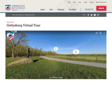
Gettysburg Virtual Tour
Step into one of the most iconic battlefields of the American Civil War with an educational interactive resource. Young historians learn about key moments, locations, soldiers, and turning points in the battle with a clickable map and...
Curated OER
United States Map Quiz
For this online interactive geography quiz worksheet, students respond to 50 identification questions about the shapes of countries shown. Students have 5 minutes to complete the quiz.
DocsTeach
The Civil War: Celebrate or Commemorate? Debate Definitions
Match game for the win! Build learners' historical vocabulary using an interactive matching game. Class members match each term to its definition with a tap. A writing prompt rounds out the lesson, leading to further discussion on how...
The Guardian
A Timeline of Women's Right to Vote
Which countries implemented women's suffrage before the 19th amendment went into effect in the United States? Which countries still do not allow women to vote? Watch the global spread of women's rights in an interactive timeline...
Curated OER
Africa Capitals Map Quiz
For this online interactive geography quiz worksheet, students examine the map that includes 53 African countries. Students match the names of the countries to the appropriate locations.
Curated OER
Biggest Metro Areas in the USA
In this online interactive geography quiz worksheet, students respond to 100 identification questions about metropolitan areas in the United States. Students have 10 minutes to complete the quiz.
Curated OER
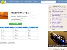
Hottest US Cities Quiz
In this online interactive geography quiz instructional activity, students respond to 20 identification questions about the hottest cities in the United States. Students have 4 minutes to finish the timed quiz.
Curated OER
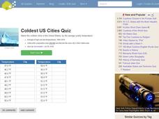
Coldest US Cities Quiz
For this online interactive geography quiz worksheet, students respond to 20 identification questions about the coldest cities in the United States. Students have 4 minutes to complete the quiz.
Curated OER
Lewis & Clark: The Louisiana Purchase
In this facts about the Louisiana Purchase and the Lewis and Clark expedition online interactive worksheet, students read information and observe a map of the Louisiana Purchase to answer questions showing their comprehension skills....
Echoes & Reflections
Timeline of the Holocaust
An interactive timeline uses images, videos, primary source documents, and links to informational text to chronicle the history of the Holocaust from 1933-1945.
Curated OER
How Clean is Your Air?
In this ecology worksheet, students study the Air Quality Index in their area and complete 8 short answer questions related to this topic.
Curated OER
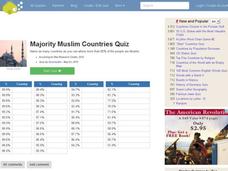
Majority Muslim Countries Quiz
In this online interactive geography quiz worksheet, students respond to 47 identification questions about Muslim cities. Students have 4 minutes to complete the quiz.
Curated OER
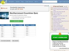
Northernmost Countries Quiz
In this online interactive geography quiz worksheet, students respond to 20 identification questions about cities located in the northernmost regions of the world. Students have 4 minutes to complete the quiz.
Annenberg Foundation
Annenberg Learner: United States History Map: The Nation Expands
After examining a map showing the expansion of the United States, click to read about each addition to the country and see where that addition is. Play Expansion Concentration to test your skills.
Annenberg Foundation
Annenberg Learner: United States History Map: Colonists
Use these interactive maps to see and read about the colonization of the New World by several European nations. When you are finished looking at the maps, test your skills with the European Colonies Challenge.
National Council of Teachers of Mathematics
Nctm: Illuminations: State Data Map
Data can be displayed in a variety of ways. This interactive map of the United States shows data by degrees of color. Choose to display data such as: land area, population, population density, gas use, and much more.


