Alabama Learning Exchange
Coordinate Geometry
Where do the coordinates lead? As children brainstorm ways to find the location of different buildings, they learn about coordinate points and how to use them to locate areas on a grid or map. They practice using ordered pairs by playing...
Novelinks
The Giver: Reading Road Map
Sometimes it's helpful to read certain passages in a novel slowly and carefully, and to read other parts more quickly to move the plot along. Learners tread carefully through Chapter 20 of Lois Lowry's The Giver, noting which parts need...
Curated OER
Understanding "The Stans"
Students explore and locate "The Stans" in Central Asia to create, write and illustrate maps, graphs and charts to organize geographic information. They analyze the historical and physical characteristics of Central Asia via graphic...
Curated OER
Regents High School Examination: Physical Setting Earth Science 2009
Junior geologists address 50 multiple choice questions and 35 short answer questions about the earth system. Plenty of visuals are included for interpretation: diagrams, graphs, maps, photographs, laboratory setups, weather symbols, and...
Curated OER
E-mailing the Chamber of Commerce
Encourage effective internet research and e-mail correspondence as scholars investigate a US capital city they've never visited to find pertinent and relevant information. They begin by picking a city, then visit that city's chamber of...
Curated OER
Regents High School Examination: Physical Setting Earth Science 2006
Test your class on earth science with this extensive resource. This test, created by The University of the State of New York Regents, is made up of 50 multiple choice questions and 32 short answer questions that cover the branches of...
Curated OER
Reading Study Guide: I Know Why the Caged Bird Sings
Meant for use with Maya Angelou's first autobiographical volume I Know Why the Caged Bird Sings, the materials here are designed for a homeschool setting, but they'd suit any classroom or text. Graphic organizers, chapter summary guides,...
Curated OER
Baseball Challenge: Social Studies TCAP
Using a baseball theme, this presentation provides a review of social studies topics covered in sixth grade. Students play a game in which they score based on the answers to various questions involving Ancient Rome, Ancient Greece, map...
Curated OER
The Case of Vanishing Farmland
High schoolers consider decisions about how to use resources that are in short supply. Students role-play different perspectives in a land-use simulation, and examine land use issues around the world. This interesting instructional...
CK-12 Foundation
Intersecting and Parallel Lines
Sometimes line segments just refuse to meet. Young mathematicians connect houses on an interactive map using line segments. They must then determine whether these line segment pairs are intersecting or parallel.
Howard Hughes Medical Institute
Mapping Genes to Traits in Dogs Using SNPs
Genetic analysis has gone to the dogs! Learners use real DNA information collected from dog saliva to study the relationship between genotypes and phenotypes. They analyze alleles to determine correlations to coat color, length, and...
National Endowment for the Humanities
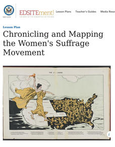
Chronicling and Mapping the Women's Suffrage Movement
While women's suffrage is often believed to be the result of a single constitutional amendment, the effort of women to secure the vote spanned decades and continents. Using primary sources in online archives, class members explore the...
Curated OER
The Treasure Map
Third graders problem solve using drawings and map interpretations. They preview graphs and Cartesian geometry. They follow directions on a map using a grid and compass references while simulating they are reading a pirate map.
Curated OER
Orienteering - Lesson 9 - Declination
What's the difference between true north and magnetic north? Lesson 9 has your class practicing mapping using a compass and taking the correct declination into account. This lesson is one part of a 10 lesson unit on orienteering. There...
Curated OER
Food on the Map
Students work together to examine the tastiest towns in the United States. After discovering the names of the equipment, they identify the seven continents. They take a survey and locate the cities and states of the foods mentioned.
Indian Land Tenure Foundation
Maps and Homelands
You are never too young to learn about maps. To better understand the concept of a homeland, students work together to construct a map of their local area out of paper puzzle pieces. They'll put the maps together and then add details by...
Curated OER
Using Color as a Pre-Writing Tool
To better understand how to compose a clear and well-organized paper, learners read short passages, write summaries, and make colored graphic organizers. This is a fully developed three-day lesson with suggested assessments.
Curated OER
Map the Civil War
Students explore the Civil War through original maps. In this mapping lesson, students calculate distance and show it on an original map. Students examine the type of landscape and its landmarks and draw symbols on the map.
Curated OER
Karnaugh Mapping
In this electrical circuit worksheet, students answer a series of 17 questions using a Karnaugh map to generate a Boolean expression, and identify logic gates and functions. This worksheet is printable and the answers are available on-line.
Curated OER
Analyzing Hurricanes Using Web and Desktop GIS
Young scholars analyze hurricanes. In hurricanes lesson, students use the Internet and GIS to analyze hurricanes. Young scholars view the National Atlas of Maps to discuss the direction hurricanes move. Students study the wind and...
Curated OER
Bluebirds Project: Mapping Species
For this bluebirds project: mapping species worksheet, students create a map based on data for bluebirds in their area, then answer 5 questions about the mapping of the species. This page has numerous links to helpful web resources.
Curated OER
Theme Map- The Rainforest
Learners use graphic organizers to relate information. They read an article and insert information from the article to the theme map using a word processing program.
Curated OER
Local History: Mapping My Spot
Students explore maps to discover historical information about their local area. In this mapping and history instructional activity, students use panoramic maps of their own town/city to interpret historical information. Students also...
Curated OER
Draw a Map
Students draw a map. In this map drawing lesson students draw a map to show where a character is from and where they are going in the story. Students are writing an odyssey.


