Tech Know Teaching
6th Grade Constructed Response Question
Graphs, charts, maps, diagrams. Reading and comprehending informational text is far more than just decoding the words on a page. Here's a packet that provides young readers with practice answering constructed response questions using...
Radford University
The Roanoke Adventure!
Travel about town. Pupils work in pairs to find the distances between landmarks with a map. The teams determine how far to travel on the streets and the length between the landmarks with the distance formula and compare the two. Learners...
Curated OER
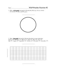
MAP Practice
For this geometry worksheet, students create circle, line and bar graphs using different comparisons of events. There are 24 questions with an answer key.
EngageNY
Grade 9 ELA Module 4, Unit 1, Lesson 2
The second instructional activity in a unit about how writers develop their central ideas and use evidence to support their arguments focuses on the role that scholars at Jundi Shapur, "The World's First True University," played in the...
PBS
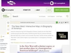
The New West: Interactive Map | A Biography of America
Using this interactive map activity, from A Biography of America, explore how the "New West" evolved during the late 20th century, transforming from the wild, untamed Old Rocky Mountain West into a smaller, more accessible "New West."...
Curated OER
Representing Data 1: Using Frequency Graphs
Here is a lesson that focuses on the use of frequency graphs to identify a range of measures and makes sense of data in a real-world context as well as constructing frequency graphs given information about the mean, median, and range of...
Willow Tree
The Pythagorean Theorem
There isn't a more popular geometry formula than the Pythagorean Theorem! Learners understand the special side relationships in a right triangle. They use the Pythagorean Theorem to find missing sides and to solve problems. They begin...
Happy Housewife
State Notebooking Pages
When learning about US geography, it can hard to remember facts about 50 different states. Help your young scholars organize all of this information with a collection of easy-to-use note-taking guides.
Curated OER
Planning a Garden Using a Grid
Third graders plan for a garden. In this garden planning lesson, 3rd graders investigate the use of a grid to accurately map out and plan for a vegetable garden. Students predict the space requirements for different vegetables.
Curated OER
Orienteering: Map Skills
Students discover orienteering. In this orienteering lesson, students search for six specific landmarks. Students brainstorm how maps and landmarks are helpful.
Curated OER
Some Things You Need to Know to Read a Map
Students study things the you need to know to read a map and explain location.
Curated OER
Jordan's Neighborhood: Using a Compass Rose
A neighborhood map is a great way to practice compass rose and key skills! Use these 2 worksheets to introduce these concepts through reading and comprehension activities. First, students look at 3 compasses, circling their favorite and...
Do2Learn
Brainstorming Map Clusters
Get your class thinking with a graphic organizer made for brainstorming. Pupils note down a topic in the middle and then branch out to write down more ideas in each of the three circles that form the cluster around the topic.
Curated OER
1492: Using Data to Explain a Journey
Students examine how Christopher Columbus made his way across the Atlantic. In this data lesson students use an Internet program to navigate like Columbus.
K-State Research and Extensions
Water
How are maps like fish? They both have scales. The chapter includes six different activities at three different levels. Scholars complete activities using natural resources, learn how to read a map, see how to make a compass rosette,...
Mary Pope Osborne, Classroom Adventures Program
The Backpack Travel Journals
Strap on those backpacks, it's time to travel through history with this literature unit based on the first four books of The Magic Tree House series. While reading through these fun stories, children create story maps, record...
MENSA Education & Research Foundation
Connecting Africa: A Project-Based Learning Adventure
Mission Possible: Your task is to design a new highway route from Tunis, Tunisia to Cape Town, South Africa. If you accept the challenge, you must create a small map of the route that has already been rejected, a...
Curated OER
Latitude and Longitude
Students demonstrate how to locate places on a map using a grid. In this map skills lesson, students are introduced to latitude and longitude lines. Students define these terms and view a large map of a state. Students come up to the map...
Curated OER
Map Keys
In this geography learning exercise, students identify who a cartographer is and what they do specifically. They study an outline map of a fictitious island and then, respond to the three questions that follow. Finally, students add...
Curated OER
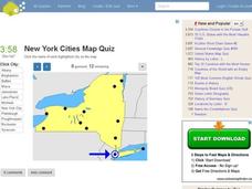
New York Cities Map Quiz
In this online interactive geography worksheet, students examine a map of New York and identify the 11 noted cities on the map using a pull down menu within 3 minutes.
Curated OER
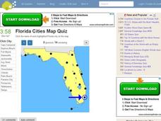
Florida Cities Map Quiz
In this online interactive geography learning exercise, students examine a map of Florida and identify the 12 noted cities on the map using a pull down menu within 3 minutes.
Curated OER
Texas Cities Map Quiz
In this online interactive geography worksheet, students examine a map of Texas and identify the 15 noted cities on the map using a pull down menu within 3 minutes.
Curated OER
Michigan Cities Map Quiz
In this online interactive geography worksheet, students examine a map of Michigan and identify the 14 noted cities on the map using a pull down menu within 3 minutes.


