Curated OER
Playground Mapping
Students convert their physical models of a playground from a previous lesson into a map of the playground that includes a scale and key. They examine and discuss examples of maps, view an image to map photo essay, and create a map using...
Curated OER
Scaling it Down: Caves Have Maps, Too
Measurement and map skills are the focus of this lesson, where students crawl through a "cave" made out of boxes, desks and chairs, observing the dimensions. Your young geographers measure various aspects of the cave and practice...
Curated OER
Tiles, Blocks, Sapphires & Gold: Designing a Treasure Map
Young cartographers in groups hide treasure at school and then create a map to find it using pattern blocks and tiles. They make paintings with clues to create a visual representation of the location of their treasure. Groups present...
Education.com
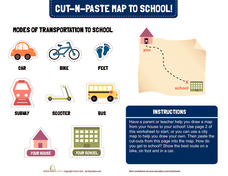
Cut-N-Paste Map to School
How do you get to school? Using the second page of the worksheet, you can draw a map of your route to school and paste on images of a scooter, bus, car, or feet.
Luminations Media Group
Geography: Map Reading Basic Skills
Enhance scholars' map skills using this worksheet displaying the land of Kahitsa’an from the series, The Realm, by K.L. Glanville. The activity helps readers visualize the make believe-land, examine its attributes, and answer...
Public Schools of North Carolina
Democratic Republic of Congo - Map Skills
Work on your map skills with a packet of activities about the river basins in the Democratic Republic on Congo. Learners study the maps provided before answering the geography questions and writing an acrostic poem about the region.
Curated OER
Magical Maps
Second graders discuss the importance of using maps and how they are used. After they listen to a folktale, they develop their own story line maps and write their own folktale to accompany a map. They also identify and locate the seven...
Curated OER
Pirate Map
Students write directions explaining how to get from one location to another by using a map of their town and use simple maps to identify and locate places.
National Endowment for the Humanities
On This Day With Lewis and Clark
Walk in the footsteps of Lewis and Clark as they discover the wonders, beauty, and dangers of the American frontier. After gaining background knowledge about Thomas Jefferson and the Louisiana Purchase, young explorers use primary...
Global Oneness Project
Citizen Photojournalism
Matt Black's photo essay, "The Geography of Poverty" provides a shocking reminder of the poverty that exists in the United States. The resource not only focuses attention on poverty but also conditions that have given rise to situation...
Curated OER
Map Skills
Students explore geography by creating a poster presentation in class. For this mapping lesson, students identify the different components featured on a modern day map and how to utilize them in order to navigate. Students read a book...
Global Oneness Project
Documenting Architectural Heritage
Imagine going from being one of the richest, most important cities in the world to one of the poorest. Imagine the history captured in the architecture of such a city. Imagine these same now abandoned buildings being destroyed. How would...
Angel Island Immigration Station Foundation
How Do Pictures Tell the Story of Angel Island?
Young historians learn more about the history of Angel Island Immigration Station through their analysis of primary source images. Guided by a list of inferential questions, scholars learn how to make and record observations on a...
Curated OER
Fairy Tale Maps
Students study direction as they listen to the stories of Little Red Riding Hood and The Jolly Postman. In this cardinal direction lesson, learners create a map to show the path Little Red Riding Hood took in the story and label the path...
Curated OER
A Map Mystery
Second graders solve a map mystery. In this technology lesson plan, 2nd graders develop an awareness of maps and the symbols associated with maps as they the "Neighborhood Map Machine."
Curated OER
2nd Grade - Act. 21: Me On the Map
Second graders read book, Me On the Map, and create map of their bedroom and of their house.
Curated OER
Mapping the News
Students explore cartography. In this map skills and map making lesson, Students work in groups to create wall size world maps including legends, compass roses, latitude and longitude, and physical features. Students collect...
Curated OER
Every Building Tells a Story
Using the images of Robert Harris, this series of lesson plans invites high schoolers to expand their understanding of Canadian heritage by examining architectural images of Charlottetown. These lessons include activities in writing,...
Curated OER
As the Kids Come and Go: Mapping a Classroom
Map the classroom with your kids to help them understand how maps work and how to read them. The lesson starts off with a story about animals living and moving around the globe, and then kids create maps of their classroom to show how...
Curated OER
A Walk Around the School: Mapping Places Near and Far
After reading Pat Hutchins’ Rosie’s Walk, have your young cartographers create a map of Rosie’s walk. Then lead them on a walk around the school. When you return class members sequence the walk by making a list of how the class got from...
Curated OER
Survivor Stories
Trace a survivor's story using a timeline, map skills, poetry and/or prose and photography, and make a visual representation of a survivor's journey through his or her life as a culminating activity for the class and the survivor....
Curated OER
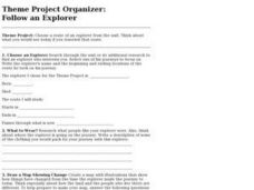
Project Organizer: Follow an Explorer
This is both a great idea and a great way to help your class organize a themed project. They use these worksheets to assist them in writing a creative historical narrative about the life and travels of an explorer. They'll compare and...
US Citizenship and Immigration Services
Thanksgiving 2—The Pilgrim Story and My Immigrant Story
The tradition of the First Thanksgiving is really a story of immigration. Connect the feelings and customs of the early Pilgrims to the experiences of the immigrants in your class with an introduction to the 13 colonies, the Mayflower,...
Curated OER
A More Perfect Union: The Story of Our Constitution
Sit back, relax, and transport to 1787! This lesson on the Constitution begins with guided imagery of the Constitutional Convention. The class reads A More Perfect Union: The Story of Our Constitution in an...
Other popular searches
- Story Mapping
- Story Mapping the Cay
- Story Mapping the Highwayman
- Story Mapping Folktales
- Story Mapping Kira Kira
- Non Fiction Story Mapping
- Mind Mapping a Story
- Comprehension Story Mapping
- Story Mapping Kira Kira
- Story Mapping Worksheets
- Story Mapping Lessons
- Story Mapping for Corduroy


