Curated OER
Designing and Creating Earth Science Lessons with Google Earth
Everything from adding an overlay to uploading images to navigating the software, teachers become apt at using Google Earth™ in the classroom to create Earth Science lessons.
New York State Education Department
Global History and Geography Examination: January 2016
What do the Inca Civilization, Wittenburg Church, and India's economy in the Mughal Period have in common? The well-rounded standardized test challenges scholars to remember all of them. They use different graphics and maps to answer...
Curated OER
Regents High School Examination: Physical Setting Earth Science 2009
In this earth science worksheet students complete a series multiple choice questions. There are 85 questions that include diagrams.
Curated OER
Reading a Local and National Weather Map
Students practice reading a national and local weather map. Using this information, they work together to make predictions about the weather for the next few days. They discuss the use of symbols and maps as a class and discuss how...
Curated OER
Oceania Map Quiz
In this online interactive geography quiz worksheet, students respond to 14 identification questions about Oceania. Students have 2 minutes to complete the quiz.
Curated OER
Australia Cities Map Quiz
In this online interactive geography quiz worksheet, students respond to 17 identification questions regarding Australian cities. Students have 3 minutes to finish the timed quiz.
Curated OER
Chinese Cities Map Quiz
In this online interactive geography quiz worksheet, students respond to 10 identification questions about Chinese cities. Students have 3 minutes to complete the quiz.
Curated OER
United States Map Quiz
For this online interactive geography quiz worksheet, students respond to 50 identification questions about the shapes of countries shown. Students have 5 minutes to complete the quiz.
Curated OER
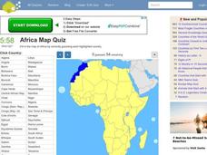
Africa Map Quiz
In this online interactive geography quiz instructional activity, students respond to 53 identification questions about the countries of Africa. Students have 6 minutes to complete the quiz.
Curated OER
Spanish Cities Map Quiz
In this online interactive geography quiz worksheet, students respond to 11 identification questions about Spanish cities. Students have 3 minutes to complete the quiz.
Curated OER
Changing Images of Childhood in America: Colonial, Federal and Modern England
Students compare and contrast maps of New Haven, Connecticut from today and the past. After taking a field trip, they draw sketches of the types of architecture and discuss how the buildings have changed over time. They read journal...
Curated OER
Testing the Waters
Students explore water in depth through discussion, research, and experiment. Students apply map skills to locating particular regions of the world as they relate to water. Students predict water quality based on information researched...
Science 4 Inquiry
An Investigative Look at Florida's Sinkholes
In May of 1981, the Winter Park Sinkhole in Florida first appeared and is now referred to as Lake Rose. Scholars learn about the causes of sinkholes through an inquiry project. Then, they analyze recent data and draw conclusions to...
Curated OER
MAP Test Tips
Students visit sites designed to prepare them for the Missouri Assessment Program tests. They visit Web sites containing skills practice for the test.
Curated OER
Mapping Material Culture Worksheet
In this folk regions worksheet, students study the objects by visiting the URL links, and then decide whether each of the 25 belongs in the North Louisiana, South Louisiana, or New Orleans folk regions.
Curated OER
The Study of the Main Tribal Nations of North Dakota
Fourth graders compare the tribal nations of North Dakota. For this tribal life lesson, 4th graders explore the many different tribes native to North Dakota. By the end of their study, students should be able to explain how the tribal...
Curated OER
Map It Out!
Students open their Alabama history book to the chapter on the Civil Rights Movement noticing how the chapter is broken into headings. They read a passage and as a class, create a story map focusing on the main ideas and details.
Curated OER
Studies of the Eastern Worlds: Cultural Maps
Seventh graders look for similarities and differences in the culture of Eastern World countries by looking at the art from each country. They test their hypothesis and assumptions through further research in the media center. Finally...
Curated OER
Mapping the Ocean Floor
Students study the bottom structure of underwater habitats and how they can be mapped.
Virginia Department of Education
The Writing Process for Persuasive Writing
Get your junior high writers stimulated with the strategies and ideas available in this activity. Learners discuss and debate controversial subjects, and outline their reasons with an online graphic organizer (link included) that creates...
Curated OER
Reference Materials
After a class discussion where kids share how they find answers to their questions, learners explore the world of reference materials such as, an atlas, an almanac, and an encyclopedia. The Internet is also discussed as a way to access...
Curated OER
Capitals, Oceans, And Border States
Students investigate geography by completing games with classmates. In this United States of America instructional activity, students examine a map of North America and identify the borders of Mexico and Canada as well as the Pacific and...
Curated OER
Canadian Provinces Quiz
In this online interactive geography quiz learning exercise, students examine the map that includes 13 Canadian provinces. Students identify the names of the provinces in 3 minutes.
Curated OER
Great Lakes Cities Quiz
In this online interactive geography activity, students examine a map of the Great Lakes region and identify the 20 noted cities on the map using a pull down menu within 4 minutes.


