Curated OER
Volcanoes
Second graders review the characteristics and aspects of volcanoes. Using this information, they write a creative story and draw illustrations to accompany the words. They use geographical terms to describe a location and the physical...
Curated OER
Poetic Justice: A Study of Poe's Famous Works
Students explore Edgar Allan Poe's most famous short stories. In this Edgar Allan Poe lesson, students complete a 25 page packet of activities where they recognize the features of genres and literary devices Poe uses. Students read "The...
Curated OER
A Bird's Eye View of our 50 States
Third graders focus on state birds as they learned absolute location (latitude/longitude) of each state, as well as their relative location (bordering states).
Curated OER
Language Families
Fourth graders identify and locate the three language families of North Carolina. They calculate the physical area covered by each language family and label them on a map.
Curated OER
THE TRAVELS OF BABAR: An Adventure in Scale : Integrating Visual Art and Social Studies
Students comprehend how the use of color impacts a work of art. They research how a theme can be rendered in a variety of ways (words, music, visuals). Students analyze how an artist's choices affect the aesthetic quality of artwork.
Curated OER
Tour De Texas
Young scholars are given a budget and an alternative-fuel vehicle. Using a map of Texas, they are given a starting point and determine how to arrive at their destination within 72 hours. They use the internet to research the...
Curated OER
Know Your Area
Students investigate transit by analyzing their school surroundings. In this local geography lesson, students identify their school in relation to the rest of their state, country and globe. Students discuss their personal travel habits...
Curated OER
GPS Art
Students design their own logo or picture and use a handheld GPS receiver to map it out. They write out a word or graphic on a field or playground, walk the path, and log GPS data. The results display their "art" on their GPS receiver...
Curated OER
The Artifact Problem
Students work in small groups and make a map of a familiar room. In this artifact lesson plan, students decide on a suitable scale for their maps, the tools they will use and how they will make it and decide on strategies they would use...
Curated OER
The Cardiac 100
Middle schoolers make a full scale diagram. In this heart and blood flow lesson, students pretend they must design the cardiac 100 racecourse and they must teach the new blood cells how to get around the heart. Middle schoolers create a...
Curated OER
Estimating Distances
Students investigate distance measurement. For this middle school mathematics lesson, students find the average length of their pace and use their pace to measure various unknown distances in feet and miles. Students relate...
Curated OER
Outlandish Landforms
Seventh graders examine landforms. In this world Geography lesson, 7th graders research and create a physical model of a chosen landform. They then draw a 2-d paper map of that model.
Curated OER
The Middle Ages
Students read books about the Middle Ages. They discuss characteristics of the Middle Ages. In groups, students construct a castle and draw a map to scale. Pupils create a Venn diagram comparing rules in different countries in the...
Curated OER
Land Use Over Time
High schoolers view aerial photos and topographic maps of their local area. They compare and contrast major land use patterns over time by comparing these images to maps that are at least 50 years old. They analyze them using the four...
Curated OER
Castle Builder
Fifth graders discuss the importance of castles in medieval times. Using the internet, they research the parts of a castle and design their own using the components. They use everyday materials to build the castle to a specific scale.
Curated OER
Investigating the Soil
Students explore the Earth's crust by researching pH levels and acidity. In this environmental safety lesson, students identify the pros and cons of acidity within soil and how it affects plants. Students collaborate in a pH level...
Curated OER
Working for Water
Students examine the ways that government works to help improve aquatic habitats. In this water habitats lesson students view a video and plan a school restoration project.
Curated OER
Carving Mountains
Students explore geography by participating in an illustration activity. In this land-form lesson, students define vocabulary terms associated with glaciers and forests. Students utilize pens, cardboard and pottery clay to draw and...
Curated OER
Microsoft Publisher Country Brochure
Students explore geographic information. In this geography and technology lesson, students choose a county and answer related questions on a Webquest. Students create a word web and design a country brochure.
Curated OER
Our Energy
Fifth graders research energy sources used in the United States. In this energy sources lesson, 5th graders work in teams to research various energy sources. Students complete a worksheet for the research and make a short video of a...
Curated OER
Investigation: The Local Bagel Shop
Sixth graders explore economics by solving business math problems. In this ratio and proportion lesson, 6th graders examine different meals to be purchased at a coffee shop and compare which prices make which meals a better purchase....
Curated OER
Change for the future: Redesigning Maquoketa
Sixth graders research a problem to be solved in their town, develop a rationale as to why they should act on this problem, and present their ideas to the class and their community. In this problem solving lesson plan, 6th graders...
Curated OER
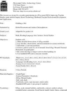
Gridding a Site
Students make observations of effigy mounds and record them in a notebook. In groups, they must determine the scale of measurement and create their own grid to scale part of the Effigy Mounds National Monument. They also practice using...
Curated OER
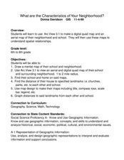
What Are The Characteristics of Your Neighborhood?
Students make a mental map of their neighborhood. Using a software program, they make an aerial and digital map of their school and locate their school on given maps. In groups, they calculate the distances to various locations and...

