Curated OER
What Can a Map Tell You?
Students investigate how maps can provide useful information about health issues. They study a map to draw conclusions about cholera death in London.
Curated OER
Making A Story Map
Sixth graders learn to plan a story by using a story map. They analyze a detailed sample story map and answer 5 questions about it. Then, plan their own story using a story map template.
Curated OER
Exploring Biomes Lesson 1: Mapping Biomes
Environmental science learners examine satellite imagery of temperature, vegetation, precipitation, and productivity. They use these maps to understand how scientists divide the planet into major biomes. As part of a larger unit on...
Curated OER
Lesson 2 Activity 2: Mapping Mount St. Helens
Students use topographic map skills to interpret impact of the May 18, 1980 eruption of Mount St. Helens on the volcano's topography, and draw profile views of Mount St. Helens before and after the May 18, 1980, eruption.
Curated OER
Mapping the Aegean Seafloor
Earth science learners create a two-dimensional topographic map of the floor of the Aegean Sea. They use it to then create a three-dimensional model of the ocean floor features. This comprehensive resource delivers strong background...
Curated OER
Mapping the Brain
A virtual 3-D tour leads students to developing icons representing the function of various parts of the brain. These icons are then used to label hand-drawn maps of the brain. A worksheet, assessment, and detailed procedures are included.
NOAA
Mapping the Ocean Floor: Bathymetry
Bathymetry is not a measure of the depths of bathtubs! Through the three lessons, scholars explore two different types of maps and how they are made. The resource focuses on topographic and bathymetric maps and teaching the techniques...
NOAA
Wet Maps
How do oceanographers make maps under water? Junior explorers discover the technologies and processes involved in creating bathymetric maps in part three of a five-part series designed for fifth- and sixth-grade pupils. The lesson...
Academy of American Poets
Teach This Poem: "Maps" by Yesenia Montilla
After examining a physical map of the world, learners conduct a close reading of Yesenia Montilla's poem "Maps." They note the interesting words and phrases, the way the poem is structured, and list questions they might have. After...
Polar Trec
Playground Profiling—Topographic Profile Mapping
The Kuril islands stretch from Japan to Russia, and the ongoing dispute about their jurisdiction prevents many scientific research studies. Scholars learn to create a topographic profile of a specific area around their schools. Then they...
Curated OER
Fantasy / Art Maps
Ninth graders analyze a fantasy art map by Jeremy Anderson, paying careful attention to the way the topographic features of the land are represented. They create a similar map of Sacramento that includes topographical features as well as...
Curated OER
Customized Topographic Maps and Models
Students explore the information depicted on topographic maps. They construct a 3-D topographic map of a local area. They go on a field trip to the depicted area and compare the 'real world' with their models.
Curated OER
Maps and Modes, Finding a Mean Home on the Range
Fifth graders investigate data from maps to solve problems. In this data lesson, 5th graders study maps and collect data from each map. Students present their data in a variety of ways and calculate the mode, mean, median, and range.
Curated OER
Mapping the Past
Middle schoolers study historical maps to view how the world evolved from medieval times through the Renaissance. They work in groups to examine the maps and present a report on one of the listed maps.
National Geographic
Mapping the Shape of Everest
With Mount Everest as the motivator, your earth science class learns about topographic maps. Begin by showing a film clip from The Wildest Dream: Conquest of Everest, featuring fearsome virtual imagery of a path up world's tallest...
Curated OER
Geo-Class Mapping My Neighborhood
Students create a map of the school and surrounding neighborhood. In this mapping lesson, students discover their school's location and learn about its past. Students use math skills and the steps in the design process to...
NASA
Cloudy vs. Clear - Maps
Find out the science of how clouds keep Earth cooler on hot days. Using guided discussions, investigators analyze and interpret maps of how much solar energy Earth receives at different times of the year. Participants draw conclusions...
Curated OER
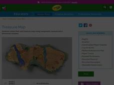
Treasure Map
Students study and recognize topographical symbols on maps. They create their own topographical Treasure Maps using symbols they learned or invent new ones. They create a bird's-eye view and include landscape details such as mountains...
World Globes & Maps
United States Map- Intermediate Directions
Students identify the four intermediate directions. For this map skills lesson, students use post-it notes to label the four intermediate directions on a map. Students locate various states using intermediate directions.
Curated OER
John Smith’s Map of the Chesapeake Bay
Young geographers travel back through time with primary source and map analysis and envision Captain John Smith's arrival at the Chesapeake Bay.
Curated OER
Use Google Maps to Teach Math
Capture the engagement of young mathematicians with this upper-elementary math lesson on measuring time and distance. Using Google Maps, students first measure and compare the distance and time it takes to travel between different...
Nebraska Department of Education
Goal Maps
High school freshmen are asked to think about their future goals and reflect on what they have learned about the barriers they may face and the resources they have to overcome these barriers. Individuals then respond to questions on a...
Curated OER
Orienteering - Lesson 1 - Maps & Map Scales
Lesson 1 of 10 lessons in this orienteering unit is about maps and map scales. After all, orienteering is all about maps, compasses, and finding ones' way around. It is imperative to be able to read maps and understand the relevance of...
Curated OER
Orienteering - Lesson 2 - Topographical Maps
One of the most important skills in orienteering is being able to read a topographical map. Understanding the contour lines and symbols and the scale of the map will make planning your route so much better. In this lesson, partners get...
Other popular searches
- United States Maps
- Weather Maps
- Topographic Maps
- Story Maps
- Maps and Charts
- Types of Maps
- Maps and Globes
- Middle East Maps
- Maps and Flags
- Historical Maps
- Maps of Europe
- Create Character Maps


