Curated OER
Mediterranean Lands: A Pilgrimage Through Time and Space
Students will use context clues and examine several maps to answer series of short answer questions over range of geographical topics, identify specific places, practice using GoogleEarth to compare satellite views to those produced two...
Curated OER
Ancient Egypt: Connecting Literature and Geography
Students brainstorm prior knowledge of Ancient Egypt, locate Egypt on map of Africa and on world map, watch King Tut film, discuss term biography, and map geographical information mentioned in stories and documentaries about Ancient Egypt.
Curated OER
Map Making with Lewis and Clark
Students develop maps based on a virtual internet expedition of The Louisiana Purchase land area. They create the maps based on an actual outdoor expedition of their communities. Student create two maps, one based on the Louisiana...
Curated OER
WORLD GEOGRAPHY
Students identify and analyze map symbols and map grids by completing various worksheets and creating their own map using these skills. Students identify and analyze what latitude and longitude are on a map to play a game of Bingo....
Curated OER
Going to the Zoo
Students choose a map and follow directions to get to the zoo. In this physical education and map skill lesson, students follow a color map to get to the zoo. Students walk, jump or use other movement skills to reach the zoo.
Curated OER
World Map and Globe-Equator, North Pole, and South Pole
Students identify the Equator, North Pole, and South Pole on a map. In this geography lesson, students use a world map and circle the North and South Pole. Students locate the Equator on a globe and use a map marker to highlight it.
Curated OER
The Changing Landscape
Young scholars explore how the landscape is constantly changing. In this landscape instructional activity, students identify a building under construction on the Landscape Picture Map. Young scholars discuss the purpose of the...
Curated OER
Lesson Ten: Direction
Students explore the concept of relative location. In this map lesson, students read I Hate English by Ellen Levine and consider how maps and globes help people to familiarize themselves with an area.
Curated OER
Flat Earth Society
Students explore map distortion. In this geography lesson, students compare Mercator projection maps to globes in order to understand the strengths and weaknesses of projection maps.
Curated OER
Cherstey: What was Cherstey like in the middle ages?
Students examine maps of a medieval village. In this medieval town lesson, students identify major buildings and make inferences about village life. Students could draw a modern day map of medieval Cherstey.
Curated OER
Summertime Travel
Third graders write about a summer event they participated in. In this paragraph writing instructional activity, the teacher models how to write about a place they have visited. Students then write their own paragraphs. Students...
Curated OER
Climb a Mountain, Raft a River on Your Own Land
Pupils are introduced to the characteristics of a map. As a class, they discuss the uses of public lands in their community and develop symbols for each feature. They use the symbols to create a map showing the recreational uses of the...
Curated OER
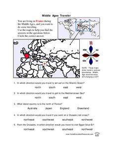
Middle Ages Traveler
In this map worksheet, young scholars are given three maps of France to use to answer multiple choice questions. Students complete an activity from the perspective of a Middle Ages traveler.
Curated OER
Lesson Plan for a 5th Grade Science Class
Sixth graders use the SQ3R reading strategy to learn about the behavior of light. In this behavior of light lesson, 6th graders read a selection about the behavior of light and use the strategy to complete the reading. Students make a...
Curated OER
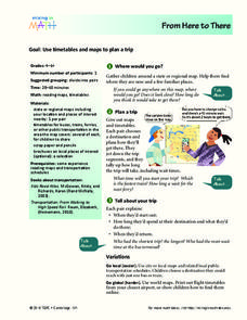
From Here To There
Students plan a trip while using maps and times tables. In this trip planning lesson plan, students work in pairs, and complete problems about gas, travel time, and more.
Curated OER
Latitude and Longitude
Pupils find latitude and longitude on a map or atlas. They create maps with a cruise route. They practice plotting locations given latitiude and longitude.
Curated OER
Quarters from the Coast
Learners discuss Fifty State Quarters Program, compare and contrast location of land and water on map of United States, while also becoming aware of physical shape of nation and home state, and explore coastal areas in United States.
Curated OER
Character, You Say? Prove It!
Students discuss character traits, and complete a character map and a Venn diagram for selected characters in their assigned text.
Curated OER
Treasure Hunt
Pupils find lost "treasure" using a treasure map after being shown a map that you have created where terms and symbols are discussed. The class is divided into small groups where they locate your treasure and then read a section from...
Curated OER
World Map and Globe- Introduction to Symbols
Students investigate picture symbols. In this symbols lesson, students define symbols and discuss symbols that they see in everyday life. Students identify symbols on maps by using post-it notes.
Curated OER
World Map and Globe - Lesson 15 Mountains of the World
Learners locate major world mountain ranges. In this geography lesson, students identify major mountain ranges on 6 on of the 7 continents on a large world physical map.
Curated OER
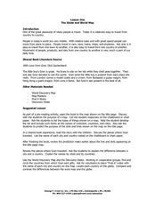
The Globe and World Map
Learners explore how to use maps for travel. In this map skills lesson, students read the text, With Love from Gran and discuss the places the character traveled. Learners list the names of each city and country on chart paper.
Curated OER
Cardinal Directions
Young scholars explore cardinal directions. In this social studies lesson, students create maps of home and school using the cardinal directions.
Curated OER
Natural Features
Students identify natural features on a map. In this map skill lesson, students use a landscape picture map to identify mountains, hills, islands, lakes, and rivers. Students use post-it notes to demonstrate their location.
Other popular searches
- United States Maps
- Weather Maps
- Topographic Maps
- Story Maps
- Maps and Charts
- Types of Maps
- Maps and Globes
- Middle East Maps
- Maps and Flags
- Historical Maps
- Maps of Europe
- Create Character Maps

