Curated OER
Project Jukebox
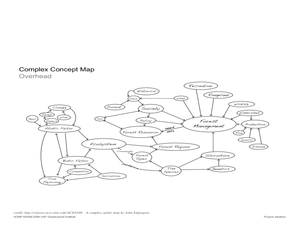
Students analyze an interview with the Climate Change Project Jukebox in order to help them undertand how to use a concept map. In this writing and climate change lesson, pairs of students log onto the Internet site for Climate...
Curated OER
Absolute And Relative Location
Students create a map that takes someone from school to their home using both relative and absolute locations. They assume the person using the map is unfamiliar with the area.
Curated OER
CHARTING THE COURSE
Students uses atlases, maps, and Web resources to determine the distance, driving time, and amount of money they need to make the trip (estimates should include hotel/motel stays, meals, and souvenirs).
Curated OER
Colonial Vacation Planner
Students plan a family vacation to states that were among the original 13 colonies. The groups determine which state they visit, map their route, calculate the mileage, and determine how much money they spend on gasoline.
Curated OER
Hemingway Hangouts
Learners use printed maps and websites to estimate driving distances and plan routes to Hemingway's home. They visit several locations online and record facts about each location.They calculate, distances, driving time, and other factors.
Curated OER
Name That Continent
Students practice locating the seven continents, four hemispheres, and four oceans using a large world map and a review song. They also import a world map to the Kid Pix computer program then type in proper labels on the map. There are...
Curated OER
Geography Skills
Students practice their geography skills. In this geography skills lesson, students locate, plot, and label places on maps and globes.
Curated OER
Consequences of the French and Indian War
In this map skills worksheet, young scholars examine maps that show European land claims in North America in 1753 and 1763. Students respond to 4 short answer questions regarding the information.
Curated OER
Arthur's Tooth
Students practice their reading comprehension by reading a story in their class. For this story map lesson, students read the Marc Brown book Arthur's Tooth and discuss the story, characters and setting. Students create a story map based...
Curated OER
Indianapolis Government
Learners read about a girl who takes a trip during the time of the State Capital moving to Indianapolis and then write their own essay about a trip that they took. In this Indianapolis Government lesson plan, students use maps and...
Curated OER
The Geography of Europe
Learners examine maps of Europe. In this geography skills instructional activity, students interpret several maps to determine the boundaries of the European Union and respond to assessment questions about the maps.
Curated OER
Using Graphic Organizers for Sensemaking
Students create concept maps in order to assess the information that they have gathered during research. They study the concept map to determine if the research is complete.
Curated OER
Follow the Light
Learners investigate the role of lighthouses in navigation and practice the use of cardinal directions through reading activities, discussion, locating geographical features, and mapping lighthouses along the east coast of the United...
Curated OER
Homes Around the World
Pupils investigate houses and homes from around the world and create a map collage. They compare how the homes are similar and different and why houses match the weather and geography.
Curated OER
Community Map
Students examine the relationship they have with the community and the location of the community in relationship to other communities. They practice using a map of their community and photographs to recongize the area.
Curated OER
Defining Regions
Fifth graders will work in cooperative learning groups to research North American regions and create presentations to share with their classmates. To show what they have learned, 5th graders will create maps of North American regions.
Curated OER
The Sexton and the Compass
Students evaluate how movement patterns create and affect interdependence. They analyze the interactions within and between regions and engage in artistic inquiry, exploration, and discovery in collaboration with others. They design...
Curated OER
Direction of River Flow
Middle schoolers determine the direction the river flows. They use a US map with rivers listed, colored pencils and a compass or transparency with directions marked. Students use a color key to determine which direction the river is...
Curated OER
Multimedia Book Reports
Students read a chapter book of 100-200 pages in length. They create a story map and multimedia book report. Pupils review the elements of a story map such as: characters, setting, problem, important events, solution, etc.) Students...
Curated OER
Reading to Learn
Students complete story maps in this instructional activity. Students read "The Magic School Bus", and get into groups to choose their story element. Each group shares their information with the class. They then complete a story map...
Curated OER
Do You Know Your Story Grammar?
Students are introduced to the concept of story structure as a way to aid in reading comprehension. They identify the main parts of the story as they read. Students create a story map of the main plot points of their reading.
Curated OER
First Amendment: Bill of Rights
Twelfth graders explore the First Amendment and the rights that are protected by the First Amendment. They discuss how the First Amendment is important to their daily lives. Students research the amendment and complete a concept map.
Curated OER
World Map and Globe - Lesson 1 Introduction to the Globe
Students explore the earth with maps and globes. For this map lesson, students use maps and globes to locate oceans and continents.
Curated OER
Going, Going, Ghost
Third graders research ghost towns. In this geography lesson, 3rd graders locate ghost towns on a map and choose one location to research. Students construct a research paper and present it to the class.
Other popular searches
- United States Maps
- Weather Maps
- Topographic Maps
- Story Maps
- Maps and Charts
- Types of Maps
- Maps and Globes
- Middle East Maps
- Maps and Flags
- Historical Maps
- Maps of Europe
- Create Character Maps
