Hi, what do you want to do?
National Geographic
National Geographic: Create a Weather Map
Students will learn about symbols that are used to represent weather and then use the day's weather to create a weather map for their state. Includes handouts and website links, as well as links to downloadable coloring books full of...
PBS
Pbs Learning Media: Global Earthquakes Activity and Seafloor Features
Students will examine patterns between volcanic activity and seafloor features. NASA tracked volcanic activity for 15 years and created an animated map from their data. Compare this map to a map of seafloor features to reveal interesting...
National Geographic
National Geographic: Mapping Ocean Currents
An unfortunate spill of 92,000 rubber ducks into the ocean in 1992 elicited invaluable information about global ocean currents as scientists tracked their journeys around the world. In this lesson, students first learn about the Ocean...
PBS
Pbs Learning Media: Visualizing Topography
Explore the topography of a hill, a valley, and a cliff in this interactive activity featuring visualizations of three-dimensional topography in two dimensions. Adapted from Stephen Reynolds' "Visualizing Topography."
Georgia Department of Education
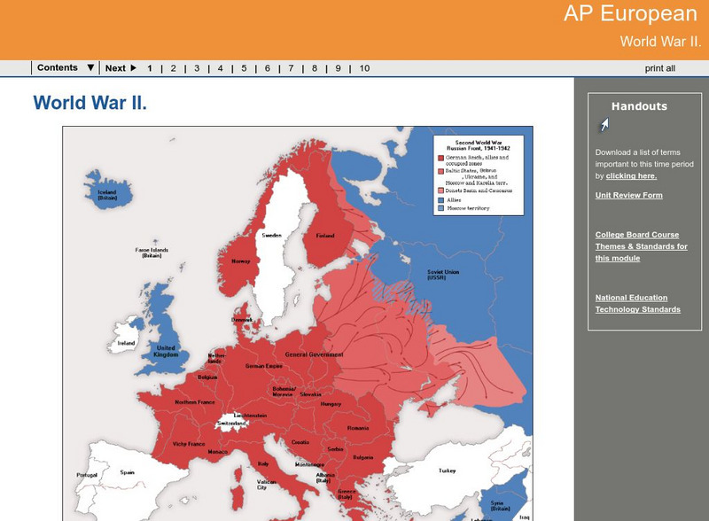
Ga Virtual Learning: Ap European: World War Ii
AP European History learning module on World War II traces the beginnings of the war from a dissillusioned Europe through the course of the war. Module includes assignments, enrichment activities, downloads, maps and assessment for...
TeachEngineering
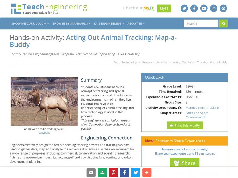
Teach Engineering: Map a Buddy
This activity serves to introduce the concept of tracking and spatial movements of animals in relation to the environment in which they live. The following activity will aid student understanding of animal tracking and how technology...
Enchanted Learning
Enchanted Learning: All About China
At this site from Enchanted Learning, you can learn all about China, view a map, and try some of the activities provided. Activities include printing out China's map and coloring it and learning Chinese numbers from 1 to 10.
Alabama Learning Exchange
Alex: Don't Get Lost in Story Writing: Follow the Map!
In this lesson, teachers will guide the students, as a group, through the process of writing a meaningful story using a story map. First the teacher will review the parts that make up a successful story. Then, the students will be guided...
PBS
Pbs Learning Media: Nature Cat: Story Exploration Packet
As you watch Nature Cat, use these tools to guide discussions and learning activities. Includes printables on story elements, alternate endings, vocabulary words, character traits, an episode map, and a Venn diagram.
PBS
Pbs Learning Media: Atchafalaya Bay Deltas
The Mississippi Delta is disappearing because of rising sea levels and the construction of levees, yet the deltas in the Atchafalaya Bay are growing. View this video from NASA showing images collected over 31 years showing the growth of...
National Geographic
National Geographic: Places in the Park
Modeling the use of maps in and out of school can help students to recognize the value of maps and gain confidence with them. Using maps of places that are familiar to students will strengthen their spatial thinking skills before...
University Corporation for Atmospheric Research
Ucar: Hurricanes and Climate
Young scholars investigate maps and data to learn where and when hurricanes form and how climate change may be affecting them.
NASA
Nasa: World Map Puzzle
This site from the National Aeornautics and Space Administration provides an interesting activity with a relief map and its correlation with space. "Wouldn't it be fun to make your own miniature world, complete with mountains, valleys,...
PBS
Pbs Learning Media: The Lowdown: Life Expectancy: Finding Ratio Relationships
In this interactive map, learn how life expectancy, obesity, hypertension, and physical activity rates have changed dramatically throughout the United States over the last three decades. The accompanying classroom activity supports...
Adventure Learning Foundation
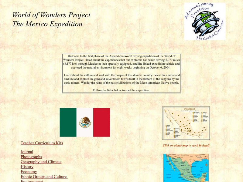
Adventure Learning Foundation: The Mexico Expedition
Take a tour through the country of Mexico in this enchanting site. Students will learn about the culture and visit with the people as they explore the geography, history, and environment of Mexico. It includes maps, classroom activities,...
Geographypods
Geographypods: Theme 3: Economic Development: Energy Systems
This learning module looks at human-made systems of energy, covering different types of energy and power stations. Includes handouts, slideshows, maps, activities, photographs, an interactive animation, and videos.
Geographypods
Geographypods: Theme 3: Economic Development: Water Resources
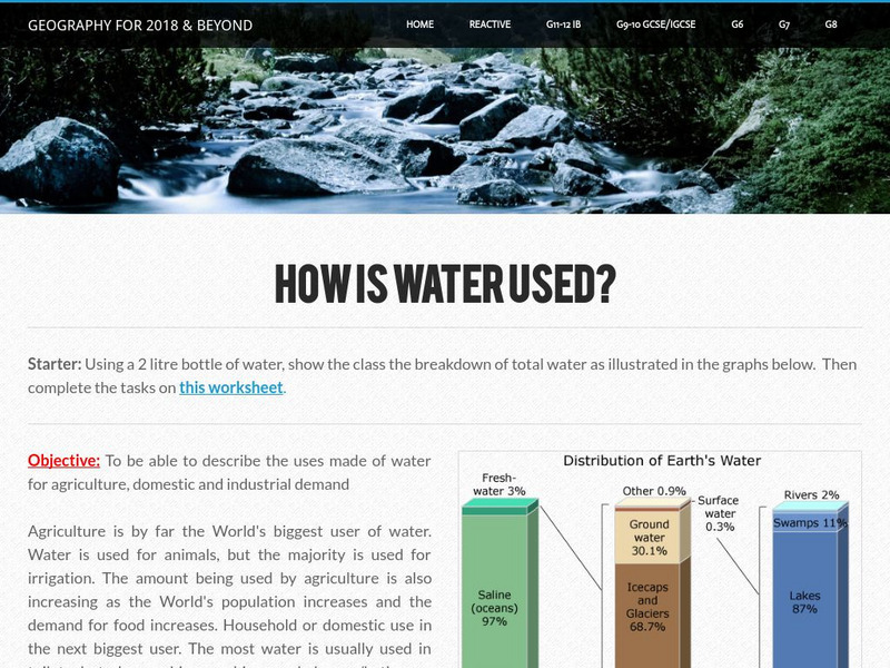
This learning module looks at economic issues related to our water resources. Looks at how water is used by industry, the distribution and availability of water, water use footprint, domestic use of water, water shortages, and water...
Smithsonian Institution
Smithsonian Institution: Time and Navigation
Explore navigation methods by sea, air, and space, what latitude and longitude mean, how GPS works, about satellite navigation, and learn about professional navigators. Includes a timeline of developments in navigation from 1280 to the...
TeachEngineering
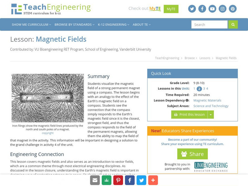
Teach Engineering: Magnetic Fields
Learners visualize the magnetic field of a strong permanent magnet using a compass. The lesson begins with an analogy to the effect of the Earth's magnetic field on a compass. Students see the connection that the compass simply responds...
US Geological Survey
Us Geological Society: Hawaiian Volcanoes
This is an online book about Hawaiian volcanoes. You can learn about the past, present and future of the Hawaiian volcanoes.
TeachEngineering
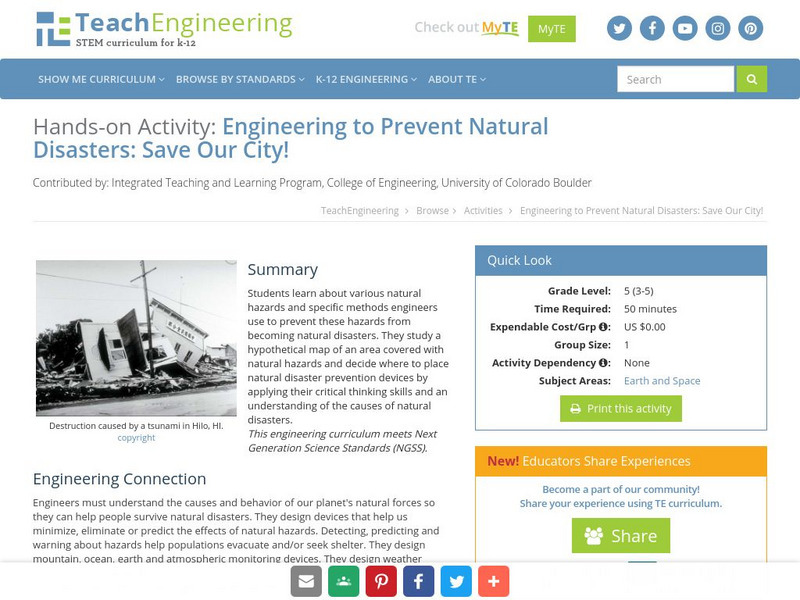
Teach Engineering: Save Our City!
Students learn about various natural hazards and specific methods engineers use to prevent these hazards from becoming natural disasters. They study a hypothetical map of an area covered with natural hazards and decide where to place...
Discovery Education
Discovery Education: Geography of South America
Introduce your students to South America with this physical map activity. The resource contains a detailed lesson plan to help students learn about the geography, people, and environment of South America.
TeachEngineering
Teach Engineering: On the Move
Looking at models and maps, students explore different pathways and consequences of pollutant transport via the weather and water cycles. In an associated literacy activity, students develop skills of observation, recording and reporting...
National Geographic
National Geographic: Introduction to Latitude and Longitude
In this lesson, students learn to determine the latitude and longitude of locations within the United States, while making observations about climate and the ways in which these measurements can be useful. Includes maps and discussion...


