US Geological Survey
U.s. Geological Survey: Magnitude 9.0 Near the East Coast of Honshu, Japan
Facts and figures on the earthquake and tsunami in Japan in March, 2011. Be sure to click on the tabs across the top that provide: summary, maps, scientific and technical information, as well as information on the tsunami.
Curated OER
University of Texas: Mauritius: Political Map
This map of Mauritius from the Perry-Castaneda Collection shows the island of Mauritius in isolation as well as a map inset showing its location east of the mainland of Africa and an inset of one of the smaller islands making up the...
Curated OER
University of Texas: Saudi Arabia: Small Political Map
This map of Saudi Arabia is very easy to read. It shows the major cities and its location in relation to other countries in the Middle East. From the Perry-Castaneda Collection.
Curated OER
Educational Technology Clearinghouse: Maps Etc: East Indies, 1920
A map from 1920 of the Indonesian region showing the political boundaries and foreign possessions at the time for the Sunda Islands, Borneo, Celebes, the Moluccas, the Philippines, the Province of Malay Peninsula, and portions of Siam...
United Nations
United Nations: Cartographic Section: Great Lakes Region (Map 2) [Pdf]
This map of the Great Lakes region in Africa from the United Nations shows the large lakes, the countries the lakes touch, and rivers that flow into and out of the lakes.
United Nations
United Nations: Cartographic Section: Great Lakes Region (Map 1) [Pdf]
The United Nations offers this very clear map of part of the Great Lakes region in eastern Africa. The lakes, of course, are labeled, as are the rivers, major cities, and countries.
Columbia University
Columbia University: East Asia in Geographic Perspective: Standard 1
How to use maps and other geographic representations, tools, and technologies to acquire, process, and report information from a spatial perspective
Columbia University
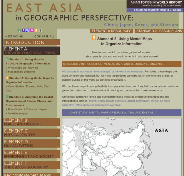
Columbia University: East Asia in Geographical Perspective
How to use mental maps to organize information about people, places, and environments in a spatial context
ClassFlow
Class Flow: Middle East Map
[Free Registration/Login Required] Using interactive tools, students will discover the many regions of the Middle East using graphic maps and finally, rearrange the jigsaw pieces to recreate the full map.
US Geological Survey
Usgs: Learning Directions on a Map (Lesson Plan)
This site provides a lesson plan in which students will learn to use north, south, east, and west to identify relative locations and provide directions.
Ducksters
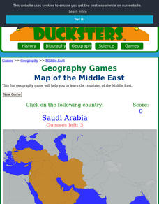
Ducksters: Geography Games: Map of the Middle East
Play this fun geography map game to learn about the locations of the countries of the Middle East.
Khan Academy
Khan Academy: Art History: Map of Ancient Near East
A short introduction to the ancient Near East, followed by sections providing an in-depth coverage. Includes links to additional information.
National Geographic
National Geographic: Places in the Park
Modeling the use of maps in and out of school can help students to recognize the value of maps and gain confidence with them. Using maps of places that are familiar to students will strengthen their spatial thinking skills before...
E-learning for Kids
E Learning for Kids: Math: Bus Station: Position on a Map
Help Jamal read maps, describe directions, and identify coordinates in this series of interactive exercises.
Alabama Learning Exchange
Alex: Primary Technology Maps
This hands-on, inquiry-based lesson combines maps skills which include identifying map elements, applying an understanding of cardinal directions, interpreting resource maps, and identifying a location. Students will have the opportunity...
NOAA
Noaa: Cpc: Regional Climate Maps
Provides large colorful maps of climate data about each continent for the current week, month, or previous quarter.
Curated OER
Educational Technology Clearinghouse: Maps Etc: East Kent, 1908
A detailed travel map of southeastern England from 1908, showing portions of Kent County. The map shows first class and secondary roads, railways, cities, towns, ferry routes across the Strait of Dover with distance in miles, rivers,...
Curated OER
Educational Technology Clearinghouse: Maps Etc: East Boston, 1919
A road map of the vicinity of eastern Boston and Boston Harbor from the Official Automobile Blue Book (1919), keyed to show the best auto routes, other auto routes, unreported roads, railroads, and canals. The map shows cities and towns,...
Internet History Sourcebooks Project
Fordham University: East Asian History Sourcebook: East Asian History Sourcebook
Fordham University, known for its excellent primary historical resources in English translation, provides one for Chinese, Japanese, Korean and Vietnamese history.
Other
Islam Project: Maps
A series of historical and near-present-day maps that span Islamic history. Starting with A.D. 750, the maps illustrate both the spread of Islam (from Medina outward to Africa, the Middle East, Europe, and other parts of the world) and...
ClassFlow
Class Flow: Maps Globe Skills
[Free Registration/Login Required] This flipchart discusses landforms, mapping and the Compass Rose. Students can practice using Cardinal Directions and use Activotes.
CBS
Cbs News: Mideast Conflict
An overview of the Middle East. Provides an in-depth analysis of the Middle East and and how events and people have influenced the region. Gives interactive maps, video, and biographies of the world leaders that have impacted the region....
Other
Smis: Daily Satellite Photo: European Russia, Western Siberia, North East Europe
This site offers weather maps for three areas: European Russia, Western Siberia, and Northeast Europe. The maps show very current weather conditions for each area.
Other popular searches
- Middle East Maps
- Blank Middle East Maps
- Middle East Maps Trade
- Ancient Middle East Maps
- Medieval Middle East Maps
- East Asia Geography Maps
- Middle East Maps Puzzles
- Far East Maps
- Maps South East Asia
- East Africa Maps
- Sou East Asia Maps


