Curated OER
Giants Stalk the High Street
Learners explore consumerism in Great Britain. In this current events lesson, students visit selected websites to determine how shopping habits have changed in Britain throughout the years. They also evaluate changes in market shares of...
Curated OER
Wasting Times
Learners examine Britain's waste management proposals. In this environmental stewardship lesson plan, students visit linked websites to gain an understanding of proposals to reduce waste in the nation.
Curated OER
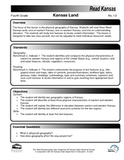
Kansas Land
Fourth graders discover the geographic regions of Kansas. In this geography lesson, 4th graders explore the different regions of Kansas and determine how the different geography affects daily life in Kansas.
Curated OER
Using Cinderella Stories to Study Venn Diagrams
Seventh graders read Cinderella stories and complete graphic organizers for the various versions. In this story analysis lesson, 7th graders read versions of the story Cinderella. Students organize the story's information using a variety...
Curated OER
Planning a Tourist Resort
Students work in teams of 2 to complete the presentation portion of the assignment. They may be required to work alone or may work with their partner to complete the "Board Member's Responses."
Curated OER
Natural Hazards
Learners evaluate the hazards of naturally occurring events. After watching a video concerning safety hazards, students work in groups to discuss the safety issues involved in taking a trip to a mountainous region. Recommendations are...
Curated OER
Immigration Push and Pull Factors
Eighth graders examine significant ideas, beliefs, and themes; organize patterns and events; and analyze how individuals and societies have changed over time in Maryland, the United States, and the world.
Curated OER
WEATHER SATELLITE PREDICTION PROJECT
Young scholars compile weather satellite data from three satellites for one month, obtain weather reports and data from professionals, then create a document with predicted results.
Curated OER
Creating and Analyzing Graphs of Tropospheric Ozone
Students create and analyze graphs using archived atmospheric data to compare the ozone levels of selected regions around the world.
Curated OER
Chart the Weather for Cities Around the World
Learners orally describe Northern and Southern hemispheres, identify 7 continents, and point out specific countries and cities. They locate and record weather information.
Curated OER
Where In The World?
Learners identify the goods and services from the United States and Mexico. Using postage stamps, they describe the various images they see and place them into categories. They use those categories to determine what is important in...
Curated OER
Rivers to the West
Middle schoolers discuss the Lewis and Clark expedition, and the reasons they may have chosen to follow certain rivers. They list the rivers that start from St. Louis and follow the route of Lewis and Clark. Students trace and label the...
Curated OER
Earthweek
Students explore the ongoing changes in the relationship between human beings and their physical world. They read articles on environmental changes. Students write a short analysis of the effect of the event on the residents of the area...
Curated OER
Patterns of Settlement in Early Alabama
Fourth graders study the settlement of Alabama. They collect data from the U.S. census website and answer questions regarding settlement patterns in the counties of Alabama in 1820. They write a paagraph describing where they would have...
Curated OER
Geography: Analyzing the Local Environment
Students, in groups, explore the school grounds and organize their findings according to the five themes of geography. They take notes and sketch the grounds. Students divide the school and grounds into regions based on use.
Curated OER
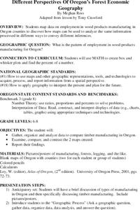
Different Perspectives of Oregon's Forest Economic Geography
Learners locate the many forests located in Oregon. In groups, they use the internet to research employment data on wood products made in the state. They discuss how looking at information presented in a different way can change their...
Curated OER
Community Brochures
Second graders research facets of their community in order to create an informational brochure. After brainstorming ideas of what could be included in the brochure, student groups get information from the internet, the library or a...
Curated OER
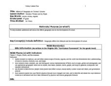
Affects of Geography on Colonial Cultures
Sixth graders examine the effects of geography on the development of culture. They discuss how geography can affect the lifestyles and development of a society's culture. Students examine the geography and climate of New England and the...
Curated OER
Western Hemisphere
Fourth graders use a database to compare countries in the western hemisphere. They describe a variety of regions in Texas and the Western Hemisphere such as political, population, and economic regions that result from patterns of human...
Curated OER
Circle the Earth - Explore Surface Types on a Journey around Earth
Students use CERES percent coverage surface data with a world map in locating landmasses and bodies of water at Earth's Equator.
Curated OER
Discovering Demographics
Students analyze demographic data including a statistical overview of India. Students synthesize their findings and create an informational poster about India.
Curated OER
Dr. Teeth and Dr. Gums To The Rescue
Second graders role play as dentists researching teeth and their care. They create a slide show showing how a character, Bear, can take care of this teeth explaining habitats, diets and teeth.
Other popular searches
- Analyze Maps and Charts
- Reading Maps and Charts
- Charts and Maps
- Ireland Maps and Charts
- Tables, Maps and Charts
- Maps, Charts, Globes
- Graphs Charts and Maps
- Interpreting Charts and Maps
- Tables Maps and Charts
- Graphs, Charts and Maps
- Graphs\, Charts and Maps
- Charts, Graphs, Maps


