Curated OER
Geography With Dr. Seuss
Learners read the book, The King's Stilts by Dr. Seuss and discuss the geographical information given in the book. Then they discuss and locate on a map the physical features that make up the continent of Africa. They create an original...
Curated OER
Follow Your Dreams: Career Goals
It is so important for impending high school graduates to start thinking about their potential careers. Here, they discuss the persistence of Blondie Hasler and his impressive transatlantic trip. They follow various routes on a map and...
Curated OER
United States Map
Students compare the United States on a globe and on a map. In this map instructional activity, students relate the sizes of the continents and locate the United States. Students identify the location of the continental US as well as...
Curated OER
Where Is Japan? What Direction Is It?
First graders locate countries on maps and globes and learn about the hemispheres and the cardinal directions. They listen to books read out loud and dicuss geography.
Curated OER
Cattle Trails
Students identify and locate cattle trails on a globe. In this map skill lesson, students use a marker to locate Texas and Montana and use the map scale to calculate the distance of the cattle trail.
Curated OER
The Gold Rush
Students identify the routes involved in the Gold Rush on a map. In this map skills lesson, students use a United States map to locate the routes used to travel to California during the Gold Rush. Students demonstrate how to use the map...
Curated OER
Post Roads
Students locate the major cities in the colonies during the Revolutionary War. In this map skills activity, students use a globe to locate cities such as Charleston and Boston using latitude and longitude coordinates.
Curated OER
An Early American Culture
Students identify the locations of the Hopewell culture. In this map skills lesson, students use a globe to mark several locations of the Hopewell culture.
Curated OER
Country Capitals
Learners locate country capitals on a world map. In this map skills lesson, students review the definition of the word country and discuss what a capital is. Learners locate and label capital cities on a world map using a map marker.
Curated OER
Getting to Know the Seven Continents
Students are introduced to basic map and globe skills. Using the internet, they identify and locate the seven continents and complete a blank map to reinforce the names of the continents. They also distinguish between land masses and...
Curated OER
Where Is Japan? How Far Is That?
First graders use literature and hands-on activities with maps and globes to explain distance and tools used to measure distance. They select tools to measure various objects in the classroom, then apply those concepts to their map...
Curated OER
The Pilgrims
Students use distance measuring tools to follow directions and chart the path the pilgrims made from Plymouth, England to Boston, Massachusetts. In this Pilgrim voyage instructional activity, students use a map to chart the distance...
Curated OER
Where Is Japan? How Are We Alike And Different?
First graders use literature, maps, and globes to explain how physical environments in various parts of the world are similar to and different from one's own, and that certain areas have common characteristics and can be called regions.
Curated OER
Follow the Yellow Brick Road
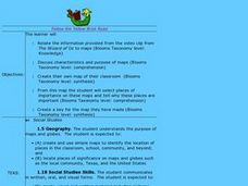
Students watch a portion of "The Wizard of Oz" and discuss how a map could be useful to Dorothy. They identify key components of maps and design a map of their classroom, including a key.
Curated OER
The Water Around Us
Pupils discuss importance of reading maps and knowing about the geography of the United States, and locate bodies of water on different types of maps and examine how they are used in the state or local community.
Curated OER
Ancient Egypt: Connecting Literature and Geography
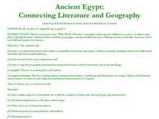
Students brainstorm prior knowledge of Ancient Egypt, locate Egypt on map of Africa and on world map, watch King Tut film, discuss term biography, and map geographical information mentioned in stories and documentaries about Ancient Egypt.
Curated OER
Summertime Travel
Third graders write about a summer event they participated in. In this paragraph writing instructional activity, the teacher models how to write about a place they have visited. Students then write their own paragraphs. Students...
Curated OER
Finding Their New World
First graders place stickers on maps indicating their understanding of the cardinal directions. They locate Jamestown, England, the Atlantic, and Virginia.
Curated OER
Cardinal Directions
Young scholars explore cardinal directions. In this social studies lesson, students create maps of home and school using the cardinal directions.
Curated OER
What Color is the Ocean?
Students view satellite pictures of the ocean, and discuss the presence of phytoplankton and the colors of the ocean. Students compare/contrast ocean satellite images with maps and globes, then color world maps to replicate the satellite...
Curated OER
Christopher Columbus
Help first graders gain an understanding of the beginnings of our nation by learning more about Christopher Columbus. They begin by listening to a read aloud of Christopher Columbus and His Voyage to the New World (another title...
Curated OER
Finding Your Way Around A Map
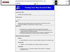
Students use the Internet to learn and/or review map and globe skills and will recognize the difference in perspectives as shown on maps.
Curated OER
World Projections
Learners identify map projections and examine polar maps. In this map skills lesson, students use a flat world map to identify various projections and calculate the distances between locations by using a map scale.
Curated OER
New: Around the World
First graders identify and demonstrate how symbols and models are used to represent features of the environment. They use a map and a globe to label where the students in the book came from, point out the continent, and show which ocean...
Other popular searches
- Comparing Maps and Globes
- Reading Maps and Globes
- Communities Maps and Globes
- Examining Maps and Globes
- Using Maps and Globes
- Free Maps and Globes
- Maps and Globes Activity
- Maps and Globes Migration
- Globes and Maps
- Maps, Globes and Atlases
- Atlases Maps Globes
- Globes and Maps Continents


