Curated OER
Educational Technology Clearinghouse: Maps Etc: Campaign Against Vicksburg, 1863
The region surrounding Vicksburg, Mississippi in 1863, showing battle sites and fortifications during the Union campaign.
Curated OER
Gettysburg Battle Map
A short biography of Dan Sickles, a Union solider in the American Civil War. Includes an audio interview of a Dan Sickles biographer and links to other resources.
Curated OER
Map of Democratic Republic of Congo
A profile of the Congo after its civil war. Article provides facts, names of leaders, rebels and opposition as well as media sources. Updated April 2008.
Independence Hall Association
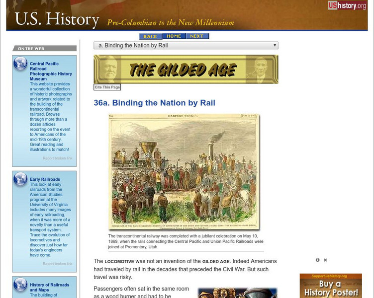
U.s. History: Binding the Nation by Rail
Read about the explosive growth of railroad track across the United States after the Civil War. Find out about the building of the Transcontinental Railroad, the men who made fortunes from the railroads, and the first American regulatory...
Curated OER
Etc: Operations About Marietta, June 14 28, 1864
A map of Marietta and vicinity during the Atlanta Campaign of the American Civil War (June 14-28, 1864). The map shows the positions of the Union and Confederate armies, and the sites of the Battle of Pine Mountain (June 14), the Battle...
Curated OER
Etc: Vicinity of Gettysburg, July 1 3, 1863
A map of the vicinity of Gettysburg during the Civil War. The map shows roads and railroads, Steven's Run and Rock Creek, and the terrain features of Seminary Ridge, Benner's Hill, Culp's Hill, Wolf Hill, Little Round Top, and Round Top.
Curated OER
Etc: England During the Stuart Period, 1603 1714
This is a map of England and Wales during the Stuart Period, from the ascension of King James I in1603 to the death of Queen Anne in 1714. This map shows major cities of the time, major river ways, topography, and political boundaries....
Curated OER
Battle of Stone's River or Battle of Murfreesboro, December 31, 1862
A plan of the Battle of Stone's River (Battle of Murfreesboro) in the American Civil War.
Curated OER
Etc: Reconstruction in the South, 1862 1877
The process of Reconstruction in the South after the Civil War.
Curated OER
Etc: The United States Secession, 1860 1861
A map showing the secession of the Confederate States from the Union, from the secession of South Carolina (December 20, 1860) to the secession of Tennessee (June 8, 1861). The map is color-coded to show the Federal States and territory...
Curated OER
Etc: Campaign in the East, 1864 1865
A map of the parts of Georgia, South Carolina, and North Carolina showing the area of Sherman's campaign in late 1864 to early 1865. The map shows the route of Sherman's March from Atlanta to Savannah, and his northward route from...
Curated OER
Etc: Memphis to Vicksburg, 1862 1863
A map showing the area between Memphis and Vicksburg on the Mississippi River during the Vicksburg Campaign of 1863. The map shows cities and towns, railroads, rivers, and terrain features of the area.
Curated OER
Etc: Operations Around Petersburg, 1864 1865
A map of the region surrounding Petersburg, Virginia, site of the Battle of Petersburg and the Siege on Petersburg. Map shows June 1864-April 1865.
Curated OER
Etc: North Virginia Shenandoah Valley, 1862
A map of northern Virginia and the Shenandoah Valley area in 1862. The map shows the area from Harpers Ferry on the Potomac River to Staunton in the valley, the Alleghany, Kittatinny, and Blue Ridge mountains, Charlottesville, Richmond,...
Library of Congress
Loc: Today in History: July 21: First Battle of Bull Run & Ernest Hemingway
Library of Congress presents historical material for the date July 21. Primary source documents including photos, letters, diaries and historical text. Looks at the First Battle of Bull Run and the author Ernest Hemingway.
Curated OER
Karabakh Conflict
This site contains links to many articles about the Karabakh conflict with Armenia. Links to the history of the war, discussions, refugees, maps, and photos in articles from 1997 - 2000.
Library of Congress
Loc: African American Mosaic: Migrations
The Library of Congress surveys the migration of African Americans to out of the South after the Civil War. Features include statistics, maps, and reasons for the migration.
Curated OER
Map of Illinois Showing
This site provides historical information and pictures regarding the Fifth Lincoln Douglas debate in 1858.
Other popular searches
- American Civil War Maps
- Civil War Maps
- Us Civil War Maps
- U.s. Civil War Maps
- Civil War Maps Printable
- Civil War Battle Maps
- Civil War and Maps


