Hi, what do you want to do?
Curated OER
Worksheet #13 Questions - Columbus in the New World
In this Columbus in the New World worksheet, learners test their knowledge on various terms relating to the aforementioned topic in ten fill in the blank questions.
Curated OER
University of Texas: Dominican Republic: Relief Map
This relief map of the Dominican Republic clearly shows the mountains that run through the middle of this island nation. From the Perry-Castaneda collection.
Curated OER
University of Texas: Dominican Republic: Political Map
On this map of the Dominican Republic you can find the province boundaries, major highways and cities, and its position on the island of Hispaniola. Clicking on the map will enlarge it. From the Perry-Castaneda collection.
Curated OER
University of Texas: Dominican Republic: Economic Activity
This map from 1971 shows the economic activity in Dominican Republic at that time. You can find the crops that were grown and the manufacturing activity. From the Perry-Castaneda collection.
Climate Zone
Climate of Dominican Republic
Presents climate information for the Central American country of the Dominican Republic including facts about average monthly temperature, rainfall, and snowfall.
AllRefer
All Refer Reference: Dominican Republic: Introduction & Country Profile
Inviting reference source for material about the country of Dominican Republic. Significant facts are included about geography, economy, history, government, and the people. Take a look at the map and the flag.
Encyclopedia of Earth
Encyclopedia of Earth: Dominican Republic
The Encyclopedia of Earth provides an overview of Dominican Republic, including its geography, natural resources, history, government, economy, and much more. Maps and images are also included, along with sources used to create the entry.
Hans Lohninger
Photo Globe: Dominican Republic
Offers background as well as many general country facts and statistics about the Dominican Republic in a well organized chart form. This site is enriched by links to maps and an image of its flag.
Latimer Clarke Corporation
Atlapedia Online: Dominican Republic
A complete profile of the Dominican Republic including highlights on its geography, climate, people, modern history, economy, communications, and military. Click on the maps to enlarge them.
Curated OER
Map of Dominican Republic
Explore the geography, history government, and facts of the Dominican Republic. Maps and current flag are included.
Curated OER
Flag of Dominican Republic
Explore the geography, history government, and facts of the Dominican Republic. Maps and current flag are included.
Curated OER
Science Kids: Science Images: Map of the Dominican Republic
A map featuring the Dominican Republic and its neighboring countries.
Curated OER
Science Kids: Science Images: Map of the Dominican Republic
A political map of the Dominican Republic.
Curated OER
Photo Globe: Dominican Republic
Offers background as well as many general country facts and statistics about the Dominican Republic in a well organized chart form. This site is enriched by links to maps and an image of its flag.
Biblioteca Virtual Miguel de Cervantes
Biblioteca Miguel De Cervantes: Republica Dominicana
This Bibliotica Virtual Miguel de Cervantes site in Spanish for the Dominican Republic provides a wealth of information, including the national flag, a map, holidays, and statistical data on land size, climate, population, life...
Other
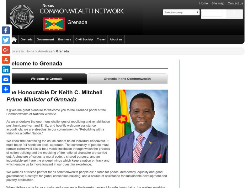
Commonwealth Secretariat: Grenada
The Commonwealth Secretariat offers a country profile of Grenada with information on its geography, society, economy, history, constitution, and politics. Includes a map and image of the flag.
Curated OER
Perry Castaneda Map Collection: Latin America Map
This political map of Latin America and South America is in color and features major cities.
Curated OER
Etc: Maps Etc: Cuba, Jamaica, and Haiti Islands, 1901
A map from 1901 of Cuba, Jamaica, and an inset of Hispaniola (Haiti and Santo Domingo or Dominican Republic), showing provinces and province capitals, major cities, towns and ports, railroads, terrain and coastal features, and smaller...
Curated OER
Educational Technology Clearinghouse: Maps Etc: West Indies, 1920
A map from 1920 of the Greater and Lesser Antilles, and the Bahama Island group, showing capitals, major cities, towns and ports, railroads, submarine telegraph routes, terrain, and coastal features. The foreign possessions in the region...
Houghton Mifflin Harcourt
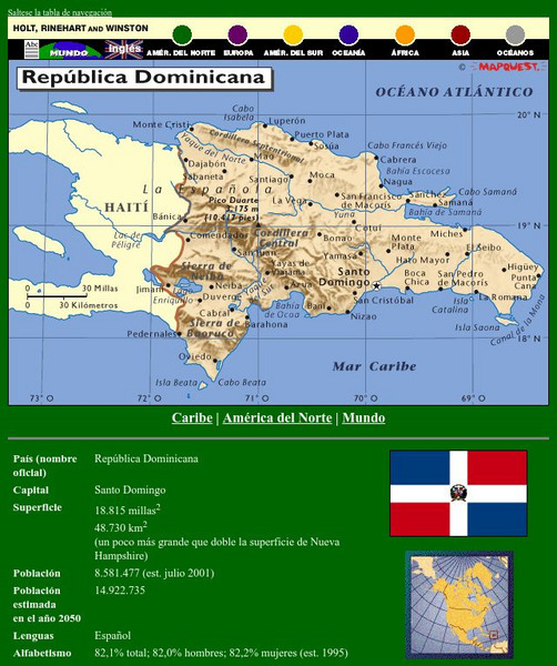
Holt, Rinehart and Winston: Caribe: Republica Dominicana
This site has a map of the Dominican Republic in Spanish, with informational data also presented in Spanish about the country. Land mass, population, life expectancy, literacy, industry, agriculture, minerals, and resources are among the...


