Curated OER
Europe: Political Map
In this Europe political map worksheet, students examine each country's boundaries. The map also highlights each of the nation's capitals with a star.
Curated OER
European Map
In this blank outline map worksheet, students explore the political boundaries of the continent of Europe and those of the countries located there.
Curated OER
Europe Outline Map (Labled)
In this blank outline map worksheet, students study the political boundaries of the labeled European nations.
Curated OER
Europe Map Quiz
In this Europe map quiz worksheet, students examine an outline map of the continent and label the names of each of the countries.
Curated OER
Europe Physical Map
In this Europe physical map activity, students make note of the major landforms and bodies of water located on the continent.
Curated OER
Europe 1914
In this Europe 1914 map worksheet, students note the 9 regions of the Europe labeled on the map and their relevance to World War II.
Curated OER
Open Cities: Europe
In this European cities worksheet, 10th graders find the countries of Europe on a map, match countries with capital cities, categorize different types of cities and identify cities from pictures and on a map.
Curated OER
Europe Map Quiz (Easy)
For this online interactive geography quiz worksheet, students respond to 35 identification questions regarding the countries of Europe.
Curated OER
Mapping World War II: During and After
In this World War II worksheet, students follow the provided instructions to mark 2 maps according to events and outcomes of the war.
Curated OER
Map of Italy
In this map of Italy worksheet, students find, color and label cities, surrounding countries, bodies of water and landforms in the country of Italy.
Curated OER
European Language Groups, 1850
Document the linguistic diversity and major language groups common to Europe in 1850. A map and a list of regions, countries, and water ways is provided.
Curated OER
Europe Outline Map
In this outline map activity, students examine the political boundaries of the continent of Europe. The map may be used in variety of activities that individual teachers create to accompany it.
Curated OER
Europe Outline Map
In this blank outline map worksheet, students explore the political boundaries of the continent of Europe and those of the countries located there.
Curated OER
Travel in Europe
In this European travel activity, students respond to 11 short answer questions that require them to research travel throughout the countries in Europe.
Curated OER
Europe Lakes Map Quiz
In this online interactive geography quiz activity, learners respond to 10 identification questions about major lakes located in Europe.
Curated OER
Europe Mountain Ranges Map Quiz
In this online interactive geography quiz worksheet, students respond to 6 identification questions regarding the mountain ranges of Europe.
Curated OER
Getting to Know France
In this map skills worksheet, students answer 14 questions about the geography of France. Students then draw a rough map of France. It is assumed that access to an atlas is available.
Curated OER
Eastern Europe Map Quiz
In this online interactive geography quiz worksheet, students respond to 25 identification questions regarding the nations of Eastern Europe.
Curated OER
Western Europe Map Quiz
In this online interactive geography quiz worksheet, students respond to 35 identification questions regarding the countries of Europe.
Curated OER
Europe Map Quiz (Hard)
In this online interactive geography quiz worksheet, students respond to 40 identification questions regarding European countries.
Curated OER
European History
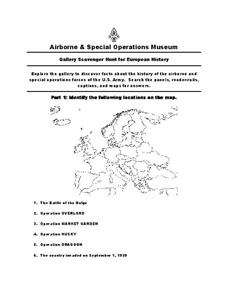
In this world history worksheet , 5th graders look for information related to the history of Europe. They view the facts from a map and apply them to different activities.
Curriculum Corner
Earth Day Book
This Earth Day, celebrate our beautiful planet with an activity book that challenges scholars to show off their map skills, complete a crossword puzzle, write acrostic poems, alphabetize, and reflect on their personal Earth-friendly habits.
Curated OER
Africa Capitals Map Quiz
In this online interactive geography quiz worksheet, students examine the map that includes 53 African countries. Students match the names of the countries to the appropriate locations.
Curated OER
Europe after World War I
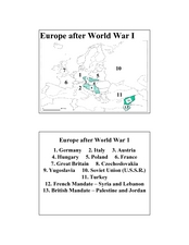
In this Europe after World War I map worksheet, learners note the 11 regions of the Europe labeled on the map.
Other popular searches
- Blank Maps of Europe
- Outline Maps of Europe
- Geography Maps of Europe
- Maps of Europe 1914
- Maps of Europe Political
- Maps of Europe Ppt
- Maps of Europe Pot
- Maps of Europe 1919
- Europe Maps
- Europe Outline Maps
- Europe Geography Maps
- Western Europe Maps


