Curated OER
Anne Frank: Courage and Responsibility
Sixth graders examine attitudes toward discrimination. They increase their sensitivity to diversity. After a lecture/demo, 6th graders read about people who exhibit courage and complete a writing assignment about them.
Curated OER
Exploring the Continents Through the Arts
Students examine the continents and explore geographic components in the fifteen lessons of this unit. The location of the continents, the equator, the four major oceans, and the music, food, literature, dance, and drama from each of the...
Curated OER
Focused Learning Lesson: American History
Eleventh graders compare and contrast the type of immigrant that came to America during the 19th and 20th centuries. They write letters as if they were immigrants coming to America and what they faced and their hopes for the future.
Curated OER
Around The World
Students search the Internet through a sequence of steps to reach the country of their nationality. They research and collect information about their country.
Curated OER
The New Californians
Students identify the groups of immigrants who came to California. They trace the route they possibly took to American on a world map. They discuss the reasons why they left their homeland and what challenges they faced once they arrived.
Curated OER
Immigration in Massachusetts, 1880-1920
Students, in groups, research immigration in America at the turn of the century. They put together a series of original written essays, letters, newspaper columns, etc. that show what it was like to live as an American citizen and as an...
Curated OER
Arabia Before Islam
Students explore the geographical, socio-economic, political, and religious background of Arabia before Islam began. They discuss why the rich merchants of Mecca opposed and oppressed Muhammed. Students discuss the influence of geography...
Curated OER
Jamestown Journey Part 2
Fourth graders create a chart or web to display qualities and characteristics of a good leader.
They write a paragraph describing the qualities of a good Jamestown leader. Finally, 4th graders contribute to small group discussion about...
University of Texas at Austin
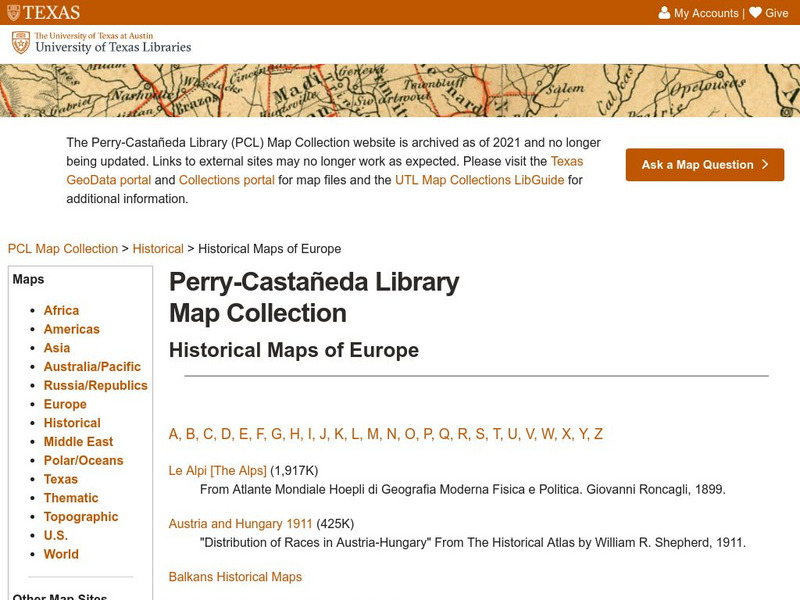
Perry Castaneda Library Map Collection: Historical Maps of Europe
This collection from the University of Texas Library Online of historical maps contains a wide variety of maps from various parts of Europe and from different parts of history. Each map is accompanied by a brief description and is clear...
Cool Math
Coolmath: Coolmath Games: Map Snap: Europe
You are presented with an outline map of Europe and you must place each country in its correct position. It clicks into place if you're in the right spot. You may want to start with the practice mode which has the shape outlines of the...
University of Texas at Austin
Perry Castaneda Library Map Collection: Historical Maps: Europe, a.d.1560
Detailed map of Europe around A.D. 1560.
W. W. Norton
W.w. Norton & Company: Map of Europe After the Congress of Berlin, 1878
Contains a map of Europe after the Congress of Berlin in 1878.
Library of Congress
Loc: World War Ii Military Situation Maps
World War II Military Situation Maps contains maps showing troop positions beginning on June 6, 1944 to July 26, 1945. Starting with the D-Day Invasion, the maps give daily details on the military campaigns in Western Europe, showing the...
BBC
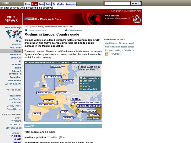
Bbc: Muslims in Europe: Country Guide
Information about the Muslim population in Europe can be obtained by clicking on this interactive map. (23 December 2005)
BBC
Bbc News: Inside Europe
This site focuses on the current events of the European Union. The items included are news stories, photos, country profiles, maps, and much more on this thorough site.
Ducksters
Ducksters: Geography Games: Map of Europe
Play this fun geography map game to learn about the locations of the countries of Europe.
University of California
Earthguide: Maps: Shaded Relief: Europe [Pdf]
View a digital image of a colored shaded relief map of Europe.
That Quiz
That Quiz: Practice Test: Europe
This resource provides a practice test which allows users to test their geographical knowledge of Europe.
University of Calgary
University of Calgary: The End of Europe's Middle Ages
This useful tutorial includes information about the economy, feudalism, the Holy Roman Empire and other important topics pertaining to Europe in the fourteenth and fifteenth centuries, a time of transition in European history. Easy to...
National Geographic Kids
National Geographic Kids: Europe: Spain
Welcome to Spain! Follow this interactive overview of the country's history, geography, people, government, nature, and more. A map and video are included.
National Geographic Kids
National Geographic Kids: Europe: United Kingdom
Welcome to the United Kingdom! Follow this interactive overview of the country's history, geography, people, government, nature, and more. A map and video are included.
NOAA
Noaa: Cpc: Regional Climate Maps
Provides large colorful maps of climate data about each continent for the current week, month, or previous quarter.
University of Texas at Austin
Perry Castenada Collection: Europe in the 12th Century, the Age of the Crusades
Large map of 12th century Europe and the Christian states in the East during the Crusades. From the historical maps in the Perry-Castaneda Collection.
Other popular searches
- Blank Maps of Europe
- Outline Maps of Europe
- Geography Maps of Europe
- Maps of Europe 1914
- Maps of Europe Political
- Maps of Europe Ppt
- Maps of Europe Pot
- Maps of Europe 1919
- Europe Maps
- Europe Outline Maps
- Europe Geography Maps
- Western Europe Maps


