Curated OER
Europe: Political Map
In this Europe political map worksheet, students examine each country's boundaries. The map also highlights each of the nation's capitals with a star.
Curated OER
Eastern Europe in 1989
Major political shifts occurred in Eastern Europe during the late 1980s. Locate, identify, and label 90 different areas on the provided map. A list of cities, countries, and water ways is provided.
Curated OER
Eastern European Studies
One learning exercise, three projects. Learners explore Eastern Europe and mark Eastern European countries on a map. They then collect and record census data on thirteen different countries, and write a 3-5 page expository essay on one...
Curated OER
Europe Labeled Map
In this Europe political map activity, students examine the national boundaries. The map also highlights each of the nation's capitals with a star. The countries and capital cities in this map are labeled.
Curated OER
European Country Map
In this Europe political map learning exercise, learners examine the national boundaries. The country names are labeled on the map.
Curated OER
Map Activities
In this geography instructional activity, learners follow the directions and shade 3 different regions of a UK political map, shade European Union countries on a political map of Europe, match 4 physical feature of Africa to their...
Curated OER
Europe Map
In this blank outline map activity, students explore the political boundaries of the continent of Europe. This map may be used in a variety of classroom activities.
Curated OER
Blank Europe Outline Map
In this blank outline map instructional activity, learners explore the political boundaries of the continent of Europe and those of the countries located there. This map may be used in a variety of classroom activities.
Curated OER
Blank Europe Outline Map 2
In this blank outline map worksheet, students explore the political boundaries of the continent of Europe and those of the countries located there. This map may be used in a variety of classroom activities.
Geography 360°
Introducing Europe
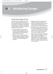
Provide your learners with a comprehensive introduction to Europe with this great set of worksheets. Map activities include matching European countries to their capitals and places on a political map, as well as exploring different...
Curated OER
Western Civilizations, Chapter 23: Modern Industry and Mass Politics, 1870-1914
Looking for an interactive way to supplement your western civilization course? Check out this comprehensive website, designed to accompany the Western Civilizations text (although it is valuable independently). Scholars investigate...
Curated OER
Denmark Outline Map
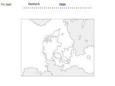
For this blank outline map worksheet, students explore the political boundaries of Denmark located in Europe. This map may be used in a variety of classroom activities.
Curated OER
Spain Outline Map
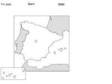
In this blank outline map instructional activity, students explore the political boundaries of Spain located in Europe. This map may be used in a variety of classroom activities.
Curated OER
European Map
In this blank outline map worksheet, students explore the political boundaries of the continent of Europe and those of the countries located there.
Curated OER
Europe Outline Map (Labled)
In this blank outline map worksheet, students study the political boundaries of the labeled European nations.
Curated OER
Europe Outline Map
In this blank outline map worksheet, students explore the political boundaries of the continent of Europe and those of the countries located there.
Curated OER
Writing Exercise: The Age of Reaction
Explore the French Revolution of 1830, The Age of Reaction. The class answers five short essay questions where they define political philosophies, summarize the Revolution of 1830, and discuss the effects of the Metternich system and...
Curated OER
Romania
In this blank outline map worksheet, students explore the political boundaries Romania located in Europe. This map may be used in a variety of classroom activities.
Edline
How Did the Unification of Germany Change the Course of World History?
Here you'll find a nice guided notes worksheet on Otto von Bismarck, which details Bismarck's plan to unify Germany, as well as asks learners to analyze his motivations and overall impact.
Curated OER
Western Civilizations, Chapter 9: The High Middle Ages: Religious and Intellectual Developments
If you are looking for a comprehensive guide to western civilizations, explore this online resource! Although designed for use with the Western Civilizations text, this site can be implemented in any course. A chapter quiz challenges...
Curated OER
Causes of World War II
In this World War II worksheet, learners view a PowerPoint presentation on the war and then respond to 82 short answer questions about the content of the presentation. The PowerPoint presentation is not included with this worksheet.
Curated OER
Constitutions and Mindmap of Government
In this European Union studies worksheet, students examine governments in the United Kingdom and other European nations as they respond to 10 short answer questions and complete a graphic organizer.
Curated OER
Most Livable Cities Quiz
In this online interactive geography quiz worksheet, learners respond to 20 identification questions about the most livable cities in the world. Students have 4 minutes to complete the quiz.


