Hi, what do you want to do?
Curated OER
Educational Technology Clearinghouse: Maps Etc: Economic Map of Europe, 1910
A map showing the chief industries and industrial districts, coal fields, agricultural and fishing districts, major cities, navigable rivers and principal railways throughout Europe in 1910. Chief industries are indicated by letter, with...
W. W. Norton
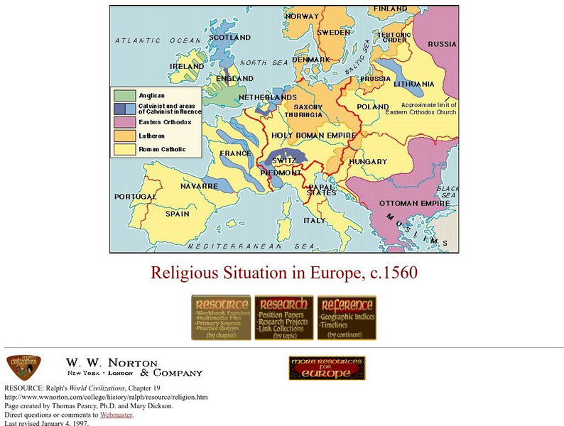
W.w. Norton & Company: Map of Religious Situation in Europe, C.1560
Colored map that illustrates the religious situation in Europe at the end of the Protestant Reformation.


