Baylor College
People and Climate
Model how the sun's energy strikes the planet and help your class relate it to a climate map. Assign small groups an individual climate zone to discuss. They reflect on and research how humans survive in the assigned climate and write a...
Baylor College
Pre-Assessment Activity: What Do You Know About Microbes?
In an introductory lesson, youngsters take a pre-assessment quiz, get a grasp of a gram of mass, and then estimate the mass of microorganisms that live within a human body. Using Glo Germ™, a material that allows you to simulate the...
Curated OER
Exploring United States V. Hirabayashi
Students review the case of the United States V. Gordon Hirabayashi. Students order the events leading up to the Hirabayashi case on a timeline and analyze the final decision, including identifying any alternative outcomes.
Curated OER
Our States, My State
Students examine the Louisiana state quarter and locate Louisiana on a map of the U.S. They relate the location of Louisiana to other states (and vise versa) using directions and the compass rose.
Curated OER
The Power of Maps & Native American Cultures
Sixth graders discover where and how five Native American cultures lived in North America in what is currently the United States. They examine their way of life and the regions they inhabited. Additionally, 6th graders will understand...
Curated OER
Map Creation
Second graders identify a map, symbol, key, and compass rose. Students create and print a map for teacher evaluation using the computer. Students identify the symbols on their map and orally present them to the class.
Curated OER
We the People: 270 out of 538
Students engage in a lesson that helps them better explain the quadrennial ritual surrounding the election of a president in the United States of America.
Curated OER
Beyond Louisiana
Eleventh graders examine the challenges that faced United States as a new nation. For this American History lesson, 11th graders study the chronology of events leading up to the expedition of Lewis and Clark. Students...
Curated OER
Balanced Literacy: Presidents
Students participate in a unit (all lessons on the same page) to explore the Presidents of the United States. They choose one President to write a mini-book about, create a puppet and an original puppet show to perform about their chosen...
Curated OER
Isla Story Map and Time-line
Fourth graders arrange five major events from the story Isla in correct order on a quiz. They represent the sequence of at least five story events through a story map based on the book, Isla.
Curated OER
Grade 8 Unit 4
Eighth graders analyze aspirations and ideals of the people of the new nation, in terms of its physical landscapes and political divisions, and the territorial expansion of the United States during the terms of the first four presidents.
Curated OER
Roles of the President
Students read a document which explains the roles and responsibilities of the President of the United States. In groups, they tour the George Bush Presidential Museum and participate in a Presidential scavenger hunt. Once back in the...
Curated OER
Find a Cave
Students locate their own communites and the nearest caves on a United States map. They calculate the distance to the nearest cave using rough scale.
Curated OER
Discovering Descriptions
Delve into the journey of Lewis and Clark using this instructional activity on Missouri. After sharing books on Lewis and Clark's journey across the United States, pupils discuss the descriptive language used in their writing, and come...
Curated OER
Oh, the Regions
Focus on the geography of Oklahoma. In this activity, learners compare different geographic regions in Oklahoma, create a collage to share their results, and identify important landforms throughout the United States, such as the...
Curated OER
Culture Regions of the U.S.
Students identify the location of different cultural groups within the United States (agricultural, retirement, urban, etc.) They map these areas and analyze the correlation between the landscape of a given region and the type of...
Curated OER
The Constitution: A New Federation
Students explore political parties by researching world history in class. In this Australian government instructional activity, students identify the term "federation" and discuss the elements of Australian politics. Students analyze a...
Curated OER
Lesson #3: Internet Map Activity
Young scholars label assembly centers and relocation camps on a given map of the United States in order to create a better understanding of the relocation experience of Japanese-American citizens and the distance that families had to...
Curated OER
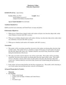
Where Are We?
Second graders identify the correct location of their city and state on a map. Through a matching activity, 2nd graders correctly identify their state on a shaped cookie map of the Unites States. They identify their city on a shaped...
Curated OER
The Distribution of Woodland in the United States, 1873
Learners investigate a map of 1873 that shows woodland in the United States. They examine this map to explore the different ways trees have been used in the United States and predict how the way we use woodlands today could affect them...
Curated OER
Children in the United States and Japan
Students locate Japan on a map or globe and describe the relative location of Japan. They use the Internet to investigate cultural characteristics of children in the United States and in Japan. They use a Venn Diagram as an...
Curated OER
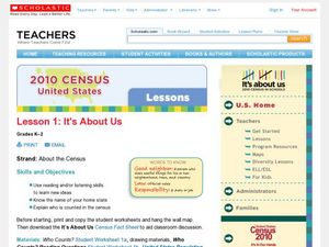
2010 Census Lesson 1: It's About Us
Students analyze data from the 2000 census to learn how the census works. In this civics instructional activity, students read a story to find out about the census, then use a map and census data to analyze changes. Lesson includes...
Curated OER
Geography Puzzles
Students study the continents of the world. In this Internet geography lesson plan, students connect to online mapping games. Students collaborate in order to develop their understanding of world geography, including countries and...
Curated OER
Who Wants to Be a Millionaire in the U.S.A.?
Students research the states, gathering information and creating questions and answers. They play a form of Who Wants to be a Millionaire? using the student-generated questions and answers.
Other popular searches
- United States Maps
- United States Maps Regions
- Northeast United States Maps
- 50 United States Maps
- Create United States Maps
- Western United States Maps
- Custom United States Maps
- Outline Maps United States
- Blank United States Maps
- United States Landforms Maps
- United States Geography Maps
- United States Political Maps


