Agriculture in the Classroom
Farmland: GMOs and Organic Agriculture
Learn more about genetic modification, organic farming, and the role of biotechnology in agriculture by watching a documentary that shows how newly gained knowledge can be applied to specific situations involving farmers and the choices...
Curated OER
Victory in Europe, 1944-1945
High schoolers examine the overall strategy pursued by the Allies in the final moths of World War II in Europe by examining military documents and consulting an interactive map of the European theater.
Baylor College
The Heart is a Pump
Circulate this news: the heart is a pump containing one-way valves! Following the previous lesson on the external structure of the heart, learners now take a look at the inside. They use a three-color diagram to label a black-and-white...
National Endowment for the Humanities
Ending the War, 1783
The various peace proposals, made by both sides, to end the Revolutionary War come under scrutiny in this final lesson of a three-part series on the war. Class members read primary source documents and compare them with military...
Curated OER
The Bozeman Trail
Eighth graders are introduced to the Bozeman Trail. Using the internet, they research the trail to discover the forts located on its path. They must also locate and label landmarks on a map using symbols they create. They answer...
Curated OER
Geography: Map Making
Students, working in groups, share notes and maps collected during a study of the Lewis and Clark Expedition. They draw large composite maps of the western United States on butcher paper including land formations, bodies of water, and...
Curated OER
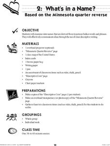
What's in a Name?
Students examine state names that are derived from American Indian words and phrases. They effectively communicate ideas through the use of clear descriptive writing. The reverse of the Montana Quarter is used as inspiration for this...
Curated OER
Bentonville Battleground State Historic Site
Learners examine the Civil War battles of First Manassas in 1861 and Bentonville in 1865. They explore medical care in the field, how Union surgeons determined locations of field hospitals, and how battle affected nearby families
Curated OER
Sense of Place Through the Eyes of an Inuit Children's Author
Students read books by Michael Arvaaluck Kusugak to explore life in the Artic Circle. After reading the books, students compare and contrast life in the Artic Circle to life in the United States. They write and illustrate a story about...
Curated OER
Just The Facts
Students investigate a state of choice. They conduct research looking at various important aspects of the state. The information is organized into a presentation for the class. The additional reading of target books should help students...
Curated OER
National expansion of the United States (1815 to 1850), and its connection to local Illinois history.
Students discuss the importance of establishing the I & M Canal water route. They watch a video about the canal's history. They collect and write a personal migration story by interviewing a family member. They analyze trends and...
Curated OER
Emancipation Proclamation
Students analyze key components of a portrait and relate the elements to the historical context. In this lesson students evaluate the "Emancipation Proclamation" and it's significance.
Curated OER
The Battle Over Reconstruction: The Aftermath of War
Students explore public sentiment regarding Reconstruction. In this Reconstruction lesson, students analyze primary sources for evidence of the political, social and economic stability of the U.S. following the Civil War. Students...
Curated OER
Choices and Commitments: The Soldiers at Gettysburg
Students investigate the Gettysburg Campaign and the major actions for each day of the battle. They read primary source documents, write a diary entry, analyze the Gettysburg Address, and write a persuasive speech regarding an issue in...
Curated OER
Time Around the World
Seventh graders investigate the characteristics of a time zone map. They read and interpret time zone maps. Students compare the time in various time zones. Students solve time zone problems.
National Endowment for the Humanities
The 1828 Campaign of Andrew Jackson: Territorial Expansion and the Shift of Power
Young scholars make connections between changes in voting participation and the election of 1828, and describe regional factors evidenced by the voting results of the election of 1828.
Curated OER
Westward Expansion
Students locate California and New York on a map and explore available means of travel in the 19th century. Students explore the role of trade in pioneer America and simulate various barter transactions.
Curated OER
Lewis and Clark and the Native Americans
Students practice using maps and identifying landmarks on the Lewis and Clark expedition. They research Lewis and Clark's relationship with the Native Americans and report their findings to the class. They identify the impact of the...
Curated OER
Immigrating to America
Students study the American immigration experience. In this Ellis Island lesson, students research primary documents from the immigration station, take a tour of the station, and then prepare and perform dramatic presentations based on...
Curated OER
Thomas Jefferson and the Declaration of Independence
Students examine readings and symbols to learn about the War of Independence and Thomas Jefferson. For this War of Independence lesson, students explore the role of Thomas Jefferson in the Declaration for Independence. Students answer...
Curated OER
My Secret War: Lesson 8
Fifth graders explore American history by viewing videos on the Internet. In this Japanese internment instructional activity, 5th graders discuss the politics that took place between America and Japan during WWII and why it was necessary...
Curated OER
Lesson 4: Fighting for Peace: The Fate of Wilson's Fourteen Points
Students analyze foreign policy. In this Fourteen Points lesson, students examine Wilson's Fourteen Points, explore Allied reaction to the Points, and compare Wilson's foreign policy to the Versailles Treaty.
Curated OER
I Will Meet You In The Middle
Young scholars use the 50 States Quarter Reversal as a context of learning a curriculum concept based from the state of Utah. They research the concepts of cause and effect. Also, they use customary units of measurement to find length...
Curated OER
This Land Is Your Land, This Land Is My Land
Students review and evaluate the ways land is covered and used in their local community. They consider the environmental effects of the different types of land use. Students act as community planning engineers to determine where to place...
Other popular searches
- United States Maps
- United States Maps Regions
- Northeast United States Maps
- 50 United States Maps
- Create United States Maps
- Western United States Maps
- Custom United States Maps
- Outline Maps United States
- Blank United States Maps
- United States Landforms Maps
- United States Geography Maps
- United States Political Maps

