Curated OER
U.S. Geography: The Northeast
Students investigate U.S. Geography by creating a map in class. In this natural resource lesson, students create a map of the United States and research the Northeast based on their resources and recyclable materials. Students...
Curated OER
Treasure Hunt!
Students follow directions on a worksheet to follow directions on a map of the United States and Territories of the United States. In this directions worksheet, students use a compass rose and learn the directions.
Curated OER
The American Land
Students identify the 5 major regions of the United States on a map and then research one of the regions in groups. In this regions lesson plan, students use their textbooks to research.
Curated OER
Our Country's Geography
Third graders study geography. In this United States landforms lesson, 3rd graders create a map of the U.S. made out of dough. They use various edible treats to mark the country's capital, the plains, the mountains and the rivers &...
Curated OER
Rice Farming History
Second graders map the progress of rice farming by using a map of the United States. In this rice farming lesson plan, 2nd graders draw a line on the map from where rice farming started to the progression of its growth.
Curated OER
Natural Features as a Resource
Young scholars identify resources provided by nature for basic human needs. In this natural features activity, students discuss the various regions of the United States. They explore one region in depth and complete activities that...
Curated OER
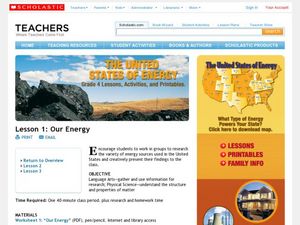
Our Energy
Fifth graders research energy sources used in the United States. For this energy sources lesson, 5th graders work in teams to research various energy sources. Students complete a worksheet for the research and make a short video of a...
Curated OER
Using Google Squared to Compare and Contrast Canada and the US
Sixth graders compare and contrast Canada and the United States. In this geography skills lesson, 6th graders use Google Squared to research information so that they may compare the geography of Canada and the United States.
Curated OER
Welcome to New York State
Students choose one region of New York state, and create a travel brochure that includes information such as geographical features, tourist attractions, accesibility, economic features, and historical events that occured in that region.
Curated OER
American Symbols
Students explore the symbols of the United States. In this U.S. history lesson, students create an American flag puzzle and research facts on the flag. Students view a Powerpoint presentation on other symbols of America.
Curated OER
Using Maps to Uncover a Soldier's Life
Young scholars investigate maps to examine the life of a Confederate soldier based on troop movements as well as letters and diaries.
Curated OER
Tropical Regions/Mapping Biodiversity
Students use a world map to locate the country of Puerto Rico. In groups, they identify the various types of vegetation found on the island. They compare and contrast the biodiversity of the country to the United States. To end the...
Curated OER
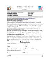
Train Of States
Fourth graders create a class book with information about each of the United States. After students draw a state name out of a hat, they use various resources to fill in a facts chart about their state. Students draw the state flag and...
Curated OER
U.S. Possessions
Ninth graders research the United States acquisition of the Philippines and their fight for independence. They locate the Philippines on a map and brainstorm how its geography has benefits. They access the Internet and complete a student...
Curated OER
Farming Idaho
Young scholars use a digital atlas to explore areas in the Western United States that depend heavily upon water. They explore the type of soil and the farming that is compatible with the soil. As a class, students explore Idaho's...
Curated OER
U.S. Immigration Policy
Students are introduced to the immigration policy of the United States. Using the Internet, they identify major trends in immigration patterns, noting the origins and numbers of immigrants. They analyze the reasons why people came to...
Curated OER
Day-to-Day Life in a Small African Village
Students experience just a bit of what it's like living in a village in Tanzania-from language to geography to health and hygiene issues. They compare aspects of school and home life in the United States with those in Tanzania and...
Curated OER
Quarters from the Coast
Students discuss Fifty State Quarters Program, compare and contrast location of land and water on map of United States, while also becoming aware of physical shape of nation and home state, and explore coastal areas in United States.
Curated OER
The Water Around Us
Students discuss importance of reading maps and knowing about the geography of the United States, and locate bodies of water on different types of maps and examine how they are used in the state or local community.
Curated OER
Four Learning Styles
Young scholars play a game where they insert the states of the United States onto a map, and discuss the four learning styles as they play. In this learning styles lesson plan, students discuss how each learning style would play and...
Curated OER
Planting Time
High schoolers research crops grown in the United States. For this agriculture lesson, students identify various crops cultivated across the United States as they create charts and maps that note the information.
Curated OER
Map Studies
Young scholars analyze maps of Europe, and research and discuss current wars in Europe, and compare them to World War I and World War II.
Curated OER
Follow the Light
Students investigate the role of lighthouses in navigation and practice the use of cardinal directions through reading activities, discussion, locating geographical features, and mapping lighthouses along the east coast of the United...
Curated OER
The Southeast Region
Students write a song about the southeast region. In this southeast region lesson plan, students view pictures of landforms, hear music, look at maps of states, and more.
Other popular searches
- United States Maps
- United States Maps Regions
- Northeast United States Maps
- 50 United States Maps
- Create United States Maps
- Western United States Maps
- Custom United States Maps
- Outline Maps United States
- Blank United States Maps
- United States Landforms Maps
- United States Geography Maps
- United States Political Maps


