Curated OER
Scaling it Down: Caves Have Maps, Too
Measurement and map skills are the focus of this lesson, where students crawl through a "cave" made out of boxes, desks and chairs, observing the dimensions. Your young geographers measure various aspects of the cave and practice math...
Curated OER
Mapmaker, Mapmaker, Make Me a Map
Second and third graders practice with basic map skills. They create their own map including a legend and a compass rose. This fabulous plan has many excellent websites linked which allow learners to explore maps of all kinds; including...
Curated OER
Basic Mapping Skills
Establish and study the parts of a map with your class and, then they will work in small groups to create their own detailed map, including a legend. There are specific instructions to follow on what needs to be included.
Curated OER
Map Adventures
Students explore the relationship between a scale drawing and actual distance. In this mapping lesson, students use an amusement park map to determine distances and what they would be like in real life.
Curated OER
Map Making/Floor Plans/Map Reading
Learners apply their knowledge of scale when mapping the classroom. They determine the use of a map legend and orient a map using a compass. They create the classroom maps using transfer graph paper.
Curated OER
Map Scale and the Pioneer Journey
Fourth graders, using a map, ruler and calculator, determine the distance the pioneers traveled from Nauvoo, Ill. to the Salt Lake Valley.
Curated OER
Exploring the Hudson in 1609
While this lesson focuses on a study of the Hudson River, it could be used as a template for a discussion of map skills, converting measurements, and plotting a route. The lesson includes vocabulary and other resources to make it a...
Curated OER
Spatial Connections
Students use maps, scales, and describe locations in order to learn about spatial sense. In this spatial sense lesson plan, students participate in many activities for this spatial sense unit that should last throughout the year.
Curated OER
Cartography Project
A lesson involving mapping, the use of a compass, writing and following directions, and exploring the first two themes of geography is here for you. Learners create original maps that show the routes they take through their own...
Curated OER
Lesson 3: Seven Day Road Trip
Students plan a seven day road trip. In this travel lesson plan, students plan a driving trip that includes five major cities or attractions in Florida or another state of their choice. They show the trip on a map, calculate distances...
Curated OER
Alaska Virtual Field Trip
Students participate in an on-line virtual field trip to the state of Alaska. In this U.S. Geography lesson, students research several Internet sites dealing with travel to Alaska and activities to participate in. Students create story...
Curated OER
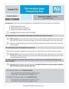
The Weather Page: Comparing Data
Students analyze data from maps. In this comparing data lesson, students use comparative and superlative statements to draw comparisons among the weather in different American cities based on USA Today weather maps.
Curated OER
The Legend of the Poinsettia
Students explore the poinsettia and its symbolism as a Christmas flower. Students will listen to a story about the poinsettia and its origins in Mexico and discuss what they know about Mexico. They will discuss the poinsettia's...
PBS
Home, Sweet, Home!
Students investigate the local history and architecture of their community. They draw maps, conduct Internet research, discuss varied architectural designs, take a walking tour of their town and work in teams to record their community's...
Curated OER
Harding Black: Taking It To Another Level
Students complete a variety of activities related to the pottery of Harding Black and the uses of clay in San Antonio, Texas. They watch a video about the life of Harding Black, conduct a clay percolation experiment, compare and...
Curated OER
What Are The Characteristics of Your Neighborhood?
Middle schoolers make a mental map of their neighborhood. Using a software program, they make an aerial and digital map of their school and locate their school on given maps. In groups, they calculate the distances to various locations...
Curated OER
Hoosier Artists
Pupils examine the paintings of various Indiana artists. Using the internet, they relate the landscapes shown to the history of the state and how it affected Native Americans. Using the information they gathered, they write story...
Curated OER
Dramatizing Fables
Students familiarize themselves with fables by listening to several of them. They define fables. They identify the moral of a specific fable. They identify characters, plot and sequence of events. They create a mask of a character in a...


