Hi, what do you want to do?
Curated OER
Geography Skills
Students practice their geography skills. In this geography skills instructional activity, students locate, plot, and label places on maps and globes.
Curated OER
Create Your Own Country!
Students create their own countries. In this geography skills lesson, students establish governments, cultural backgrounds, atlas/geography components, national anthems, and national symbols for a country they create.
Curated OER
How Does Temperature Change With Respect To Latitude and Longitude?
Learners research the concept of predicting the weather. The research focuses on how some weather facts intuitively make sense. Students answer key questions based upon the mathematical concept of covariance.
Curated OER
The Global Grid System-World Map Activity
Students demonstrate how to use the global grid system. In this map skills lesson, students use a world map to locate various locations. Students identify locations based on the global grid system. Students complete a worksheet as an...
Curated OER
Give Me a B: North Dakota Quarter Reverse
Young scholars examine the North Dakota quarter reverse and note the bison. and Badlands displayed on it. After practicing as a group making the B sound, they explore the classrom for more words beginning with that letter. Working in...
Curated OER
Students Become Mapmakers
Students practice making a map of a continent and correctly plotting five cities on that map. They place latitude and longitude lines on a map, determine the need for various map projections and explain why map scales are necessary.
Curated OER
Africa
Second graders explore Africa. They label the popular places in Africa on a map. Students label the different cities and monuments that are popular in Africa. They discuss the similarities and differences between cities in Africa and...
Curated OER
Walking that Line
Learners attempt to describe and use longitude and latitude. They will identify different countries, their neighbors, and borders around the world. Included in the lesson plan the students identify natural features that control the...
Curated OER
Baseball Challenge - Basic Geography Skills
A fabulous presentation/activity based on geography. The author has designed a "baseball game" where batters advance to the next base if they correctly answer a multiple choice question about geography. Geographic terms are used, along...
Curated OER
Crossing Time Zones
Young scholars explore the concept of differing time zones. Students refer to maps to identify the time zones in particular regions. They role play phone calls from different time zones. This lesson plan is intended for young scholars...
Curated OER
Making a Globe
Students participate in a creative project where they construct globes. They label specific places on the globe that helps them learn how to read an actual globe.
Curated OER
Globe Lesson 4 - Intermediate Directions
Students explore the concept of intermediate directions. In this geography skills lesson, students use map skills in order to identify intermediate directions as they complete a map activity.
Curated OER
Geology Word List
In this science worksheet, students review the vocabulary words for the separate categories related to the concept of geology.
Curated OER
Greenwich
In this literacy instructional activity, students complete a transcript that is based upon the geographical location of Greenwich. There is also a search for numbers that are found in the text.
Curated OER
MAP UNIT
First graders investigate how maps are used to identify different locations. They will also appreciate how there are different types of maps for their purposes. Finally students study how maps contain symbols that represent real places.
Oxfam
What Is the Meridian Line?
What is the meridian line? Find out and see all the countries it runs throughout. Obtain information on the creation of standard time.
Oxfam
Ofxam: Welcome to Spain (Guidebook and Virtual Tour)
Developed in 2000-2001 to explore and celebrate the lives of people living in eight countries that lie along the prime meridian, this "welcome to Spain" guidebook and tour includes sections on Spain's history, geography, environment,...
Other
Greenwich Guide: The Prime Meridian
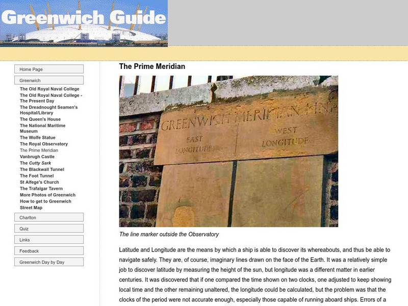
Examine how the prime meridian came to be, where it is located, and see actual pictures of the prime meridian.
Other
Boat Safe Kids: Longitude and Latitude
This website starts at the very beginning and explains how round globes are transferred to flat maps. Then they explain the use of longitude and latitude.
City University of New York
Brooklyn College, Cuny: Latitude and Longitude
Students can read about how lines of latitude and longitude form a grid that makes it easy to pinpoint one's location on Earth. Then they can take an online quiz to check their understanding.
PBS
Pbs Nova Online: Lost at Sea the Search for Longitude
"The quest for a reliable method to find your way at sea was one of the thorniest problems of the 1700s." Find out about the search for longitude at this NOVA site. Includes interactive Shockwave game, learning activities and more.
Diffen
Diffen: Latitude vs. Longitude
Find out about the basics of latitude and longitude with this comparison chart. Then read the article and watch the video to dig a little deeper into the topic.
Other
Boat Safe Kids
This is a delightful site about boats and boating. Lots of games plus a terrific overview of the history of navigation. Includes a visit to a reproduction of Columbus' Nina.


