Curated OER
National And International
Students participate in a series of geography lessons in which they identify the meaning of national and international. They discover the regions of the US after identifying the planet on which they live, the continents, the oceans and...
Curated OER
Get the Point!
First graders, after reading about cattle drives, measure the width of the horns on drawings of longhorn cattle and then convert the measurements from inches to centimeters and from inches to feet. Ranching and the American cattle...
Curated OER
GET THE POINT!
The student will measure the width of the horns on drawings of longhorn cattle and then convert the measurements from inches to centimeters and from inches to feet.1. Review with learners the steps required to measure an item and to...
Curated OER
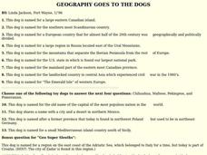
GEOGRAPHY GOES TO THE DOGS
Students use countries and dogs from around the world to answer the questions.
Curated OER
Old Man River
Young scholars place the four reservoirs of the Kansas-Lower Republican Basin correctly on a map adding creeks and rivers flowing into them. Students explain uses for the reservoirs.
Curated OER
The Fugitive Slave Law and Migration
Students examine the Fugitive Slave Law as a motivating factor for slaves to emigrate outside the United States. After discussing the relationships between fugitive slaves and North American and Caribbean countries, they write essays...
Curated OER
Border Icons
Students examine the artistic definition of "icon" and articulate its importance in the popular art of the border. They paint, draw, their favorite icon or design a new icon that represents an important aspect of border life.
Curated OER
Scaling the Map
Students practice determining map distances using the map scales. They discover how much an area represents on the map in relation to the actual area. They decide on the best place to build their cavern.
Curated OER
Hawks Migrate
Students examine the types of hawks found in Illinois and compile a list of them. Using different species of hawks, they compare and contrast their characteristics. They work together to create their own hawk model for the classroom.
Curated OER
Nebraska Does Business with the World
Tenth graders examine the connections between Nebraska and the international economy. They identify the countries involved in trade with Nebraska firms and investigate specific Nebraska companies that export and their international ties.
Curated OER
What's Your Reference
In this reference material worksheet, young scholars choose the correct reference for each question given. Students discover the differences in the materials found in the dictionary, the almanac, the atlas, the newspaper, and the thesaurus.
Curated OER
Subsidence/ Erosion
Students utilize prior knowledge about the Pontchartrain Basin. In this subsidence/erosion lesson, students study the chart on land subsidence and must them identify and find solution for problems caused by erosion.
Curated OER
Wood A Natural Renewable Resource
Students discuss the harvest of trees as a renewable resource. In this renewable resource lesson, students evaluate the importance of how man harvest trees and uses wood as a renewable resource.
Curated OER
Translating Traditions
Students analyze art reflective of traditions and cultural heritage. In this art analysis lesson, students complete image based discussion.
Other popular searches
- Mexico City and Countryside
- Mexico City Map
- Population Mexico City
- Pollution in Mexico City
- Mexico City Class Projects
- Mexico City Earthquake
- Mexico City Bus Tour
- Environment Mexico City
- Mexico City and Pollution
- Mexico City Air Pollution
- Mexico City Air Polution


