Hi, what do you want to do?
Foundation for the Advancement of Mesoamerican Studies
Famsi: Gulf Coast Area
The map here shows the Gulf Coast area of Mexico and the locations of modern and ancient cities and towns, including Olmec sites.
Mex Connect
Mex Connect: Jalisco
MexConnect offers a map showing all the major cities located in Jalisco, Mexico.
Other
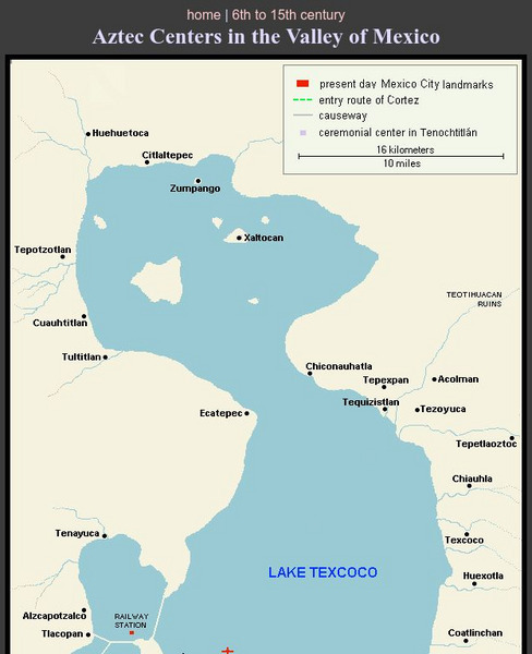
Aztec Centers in the Region of Lake Texcoco
A map of Lake Texcoco, showing the Aztec centers in the region at the time of the Spanish conquistadors. The entry route of Cortes into the city of Tenochtitlan, the Aztec capital, is designated along with causeways into the city. A few...
Curated OER
Etc: The Mexican American War, 1846 1848
A map of Mexico and southwestern United States showing the seat of war during the Mexican-American War (1846-1848). The map shows the campaign routes of Kearney, Taylor, Doniphan, Wool, and Scott, with battle sites indicated by...
Curated OER
Etc: Central America and Isthmian Routes, 1846 1860
A map of Central America during the period of westward expansion in the United States when the need to find a shorter practical shipping route from the east coast to the west coast was a principle concern. This map shows the proposed...
ClassFlow
Class Flow: Texas Revolution
[Free Registration/Login Required] This flipchart gives an overview of the Texas Revolution. Using a mind map and a time line, students are visually drawn in to the events leading up to Texas gaining independence from Mexico. Links to...


