Curated OER
The Mesoamerican Mystique
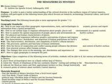
Students gain a better understanding of the cultural diversity in the northern region of Central America. They engage in a lesson which focuses on research, archaeology, historical videos, and travel highlights.
Curated OER
THE MESOAMERICAN MYSTIQUE
Students research, archeology, historical videos, and travel highlights in the northern region of Central America. They identify the various archaeological / historical sites along with a date of probable existence and the title of the...
Curated OER
It's Not My Problem!
Students examine how rivers flow through the country to sea level. Students study how upstream pollution effects the water and people downstream.
Curated OER
Subsidence/ Erosion
Students utilize prior knowledge about the Pontchartrain Basin. In this subsidence/erosion lesson plan, students study the chart on land subsidence and must them identify and find solution for problems caused by erosion.
Curated OER
Etc: Maps Etc: Mexico, Central America, and the West Indies, 1906
A map from 1906 of Mexico, Central America, and the West Indies showing the political boundaries at the time, capitals and major cities, mountain systems, coastal features, and islands of the region. An inset map shows the entire North...
Curated OER
Educational Technology Clearinghouse: Maps Etc: Mexico and Central America, 1910
A map from 1910 of Mexico and Central America showing political boundaries at the time, capitals and major cities, rivers, terrain and coastal features, reefs, and neighboring islands (Cuba and Jamaica). A map note shows the Panama Canal...
Curated OER
Etc: Maps Etc: Drawing Mexico and Central America, 1872
A map exercise from 1872 for drawing Mexico and Central America. The map shows the general outline of the coasts, major waters and rivers.
Curated OER
Educational Technology Clearinghouse: Maps Etc: Drawing North America, 1872
A map exercise from 1872 for drawing North America. The map shows the general outline of the coasts, major waters and rivers, and a vertical profile cross-section of the continent from the San Francisco Bay area to Cape Hatteras....


