Center for Educational Technologies
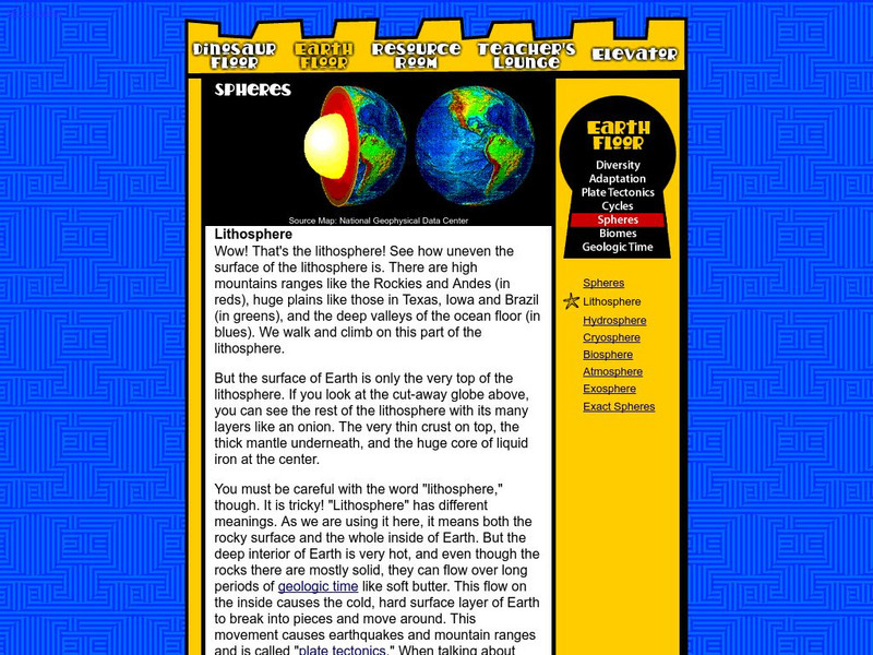
Nasa: Classroom of the Future: Spheres: Lithosphere
At this site from the NASA Classroom of the Future, you can learn about the many different layers of the earth and see what the earth would look like cut in half.
Curated OER
Etc: Maps Etc: Mexico, Central America, and the West Indies, 1898
A map from 1898 of Mexico, Central America and the West Indies. The map includes an inset map of Cuba and the Isthmus of Nicaragua. "The surface of the Rocky Mountain highland in Mexico is quite similar to that of the great plateau...
Curated OER
Etc: Maps Etc: Orographic Chart of North America, 1891
An orographic map from 1891 of North America showing the principal mountain systems, rivers, and terrain features of the region. The map is coded to show high lands and mountain regions, and shaded regions of plains, with dark lines...
Curated OER
Etc: Maps Etc: Physical Map of South America, 1898
A map from 1898 of South America showing the general physical features including mountain systems, prominent peaks and volcanoes, river and lake systems, plateaus, and coastal features. The map includes an insert of the Isthmus of...
Curated OER
Educational Technology Clearinghouse: Maps Etc: Relief Map of Africa, 1890
A relief map from 1890 of Africa showing the major mountain, desert, river, and lake systems on the continent. "The whole continent is a moderately-elevated plateau surrounded of all sides by marginal mountains which either slope...
Curated OER
Educational Technology Clearinghouse: Maps Etc: Orographic Chart of Asia, 1891
A base map from 1891 showing the mountain systems of Asia. The map shows highlands in white, lowlands as shaded, and shows major mountain ranges with heavy black lines. Major rivers are shown. The map is keyed to show the Himalaya...
Curated OER
Unesco: India: Nanda Devi and Valley of Flowers National Parks
Nestled high in West Himalaya, India’s Valley of Flowers National Park is renowned for its meadows of endemic alpine flowers and outstanding natural beauty. This richly diverse area is also home to rare and endangered animals, including...
Curated OER
Educational Technology Clearinghouse: Maps Etc: North America, 1899
A study map from 1899 using North America to illustrate various geographic terms commonly found on maps. The map shows examples of continent, river valley, peninsula, strait, bay, political boundary, lakes, island, ocean, cape, sound,...
Latimer Clarke Corporation
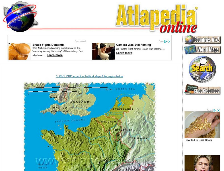
Physical Map of France
Map of France showing mountain ranges, rivers, and coastlines.
Curated OER
Etc: Maps Etc: Africa Before the Berlin Conference, 1882
A map of Africa as it was known in 1882 before the Berlin Conference of 1885, when the most powerful countries in Europe at the time convened to make their territorial claims on Africa and establish their colonial borders at the start of...
Curated OER
Etc: Maps Etc: Africa Before the Berlin Conference, 1884
This is an interesting map of Africa showing the continent before the Berlin Conference of 1885, when the most powerful countries in Europe at the time convened to make their territorial claims on Africa and establish their colonial...
Curated OER
Educational Technology Clearinghouse: Maps Etc: Australia, 1912
A map of Australia showing major political subdivisions, mountain ranges, railroads, waterways, and cities. Includes insert maps of Tasmania and New Zealand.
Curated OER
Educational Technology Clearinghouse: Maps Etc: Europe, 1885
A map of Europe showing major mountain ranges, rivers, and other landforms.
Curated OER
Educational Technology Clearinghouse: Maps Etc: Europe, 1880
A map of Europe in 1880 after the establishment of the New German Empire. Shows the location of political borders as well as cities, waterways, and mountain ranges.
Curated OER
Educational Technology Clearinghouse: Maps Etc: France, 1912
A map of France showing cities, waterways, mountain ranges, railroads, and canals in 1912. France's Departments are referenced and indicated on the map. An insert map of Corsica is also included.
Curated OER
Educational Technology Clearinghouse: Maps Etc: India, 1904
India, showing country, province and native state borders current to 1904, major cities, railroad lines, and navigable rivers. Physical features include mountain ranges with elevation measured in feet, major rivers and watersheds, and...
Curated OER
Educational Technology Clearinghouse: Maps Etc: Ireland, 1904
A geo-political map of Ireland that shows province and county borders current to 1904, major cities, railroad lines, canals and navigable rivers. Physical features such as mountain ranges with elevation measured in feet, major rivers,...
Curated OER
Educational Technology Clearinghouse: Maps Etc: Italy, 1912
A map of Italy in 1912 showing provinces, cities, mountain ranges, waterways, and railroads.
Curated OER
Educational Technology Clearinghouse: Maps Etc: Italy, 1904
A geo-political map of Italy showing country and region borders current to 1904, major cities, railroad lines, and navigable rivers. Physical features include mountain ranges with elevation measured in feet, major rivers and watersheds,...
Curated OER
Educational Technology Clearinghouse: Maps Etc: Nevada, 1903
A map from 1903 of Nevada showing counties and county seats, principal cities and towns, mountain ranges, and rivers. "Nevada, one of the most western of the States of the American Union, was formed from a portion of the territory...
Curated OER
Educational Technology Clearinghouse: Maps Etc: New Hampshire, 1912
A map from 1912 of New Hampshire showing the capital of Concord, counties and county seats, principal cities and towns, railroads, rivers, and mountain ranges. A grid reference in the margins of the map lists counties, principal cities,...
Curated OER
Educational Technology Clearinghouse: Maps Etc: New Hampshire, 1903
A map from 1903 of New Hampshire showing the capital of Concord, counties and county seats, principal cities and towns, railroads, rivers, and mountain ranges. "New Hampshire, one of the New England States of the American Union, lies...
Curated OER
Educational Technology Clearinghouse: Maps Etc: New Mexico, 1903
The Territory of New Mexico before it became a state showing counties, cities, rivers, mountain ranges, and railroads.
Curated OER
Educational Technology Clearinghouse: Maps Etc: New Zealand, 1904
A geo-political map of New Zealand current to 1904, showing major cities, railroad lines, and navigable rivers. Physical features include mountain ranges with elevation measured in feet, major rivers and watersheds, and the 100-fathom...
Other popular searches
- Major Mountain Ranges
- World Mountain Ranges
- Maps of Mountain Ranges
- Us Major Mountain Ranges
- Us Mountain Ranges
- Asian Mountain Ranges
- Greece Mountain Ranges
- Western Us Mountain Ranges
- Formation of Mountain Ranges
- Western u.s. Mountain Ranges
- U.s. Mountain Ranges
- Mountain Ranges Worksheet


