Varsity Tutors
Varsity Tutors: Web English Teacher: Langston Hughes
This resource focuses on the works of famous African-American author, Langston Hughes.
Smithsonian Institution
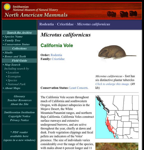
National Museum of Natural History: American Mammals: California Vole
The California Vole occurs throughout much of California and southwestern Oregon, with disjunct subspecies in the Mojave Desert, the White Mountain/Panamint ranges, and northern Baja California. California Voles construct surface runways...
Smithsonian Institution
National Museum of Natural History: American Mammals: Golden Mantled Ground Squirrel
Restricted to the Cascade Mountains of Washington State and British Columbia, Cascade golden-mantled Ground Squirrels are so similar to golden-mantled Ground Squirrels that some scientists consider them the same species. However, their...
Smithsonian Institution
National Museum of Natural History: American Mammals: Olive Backed Pocket Mouse
The striking olive dorsum of the Olive-backed Pocket Mouse is set off by a yellowish stripe on the side and a white underside. This is the only species of pocket mouse east of the Rocky Mountains whose range extends well into Canada....
Smithsonian Institution
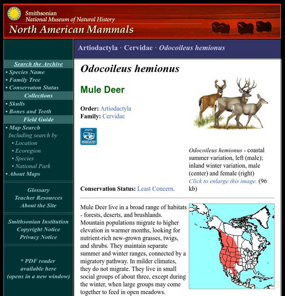
National Museum of Natural History: American Mammals: Mule Deer
Mule Deer live in a broad range of habitats - forests, deserts, and brushlands. Mountain populations migrate to higher elevation in warmer months, looking for nutrient-rich new-grown grasses, twigs, and shrubs. Learn more about the...
Smithsonian Institution
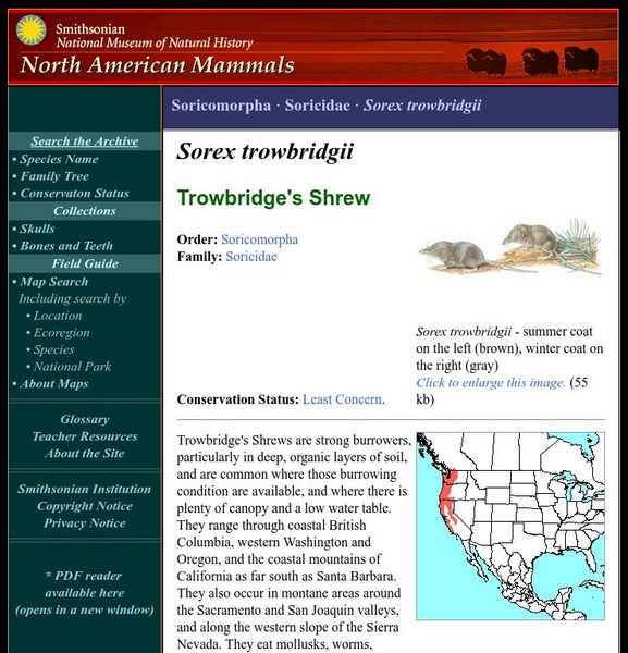
National Museum of Natural History: American Mammals: Trowbridge's Shrew
Trowbridge's Shrews are strong burrowers, particularly in deep, organic layers of soil, and are common where those burrowing condition are available, and where there is plenty of canopy and a low water table. They range through coastal...
Smithsonian Institution
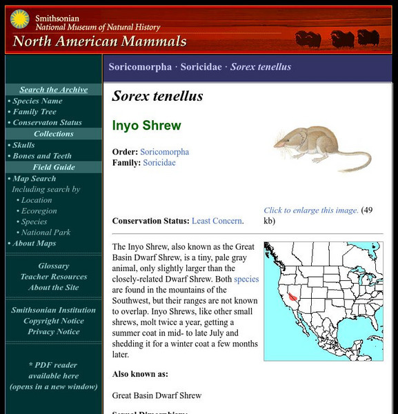
National Museum of Natural History: American Mammals: Inyo Shrew
The Inyo Shrew, also known as the Great Basin Dwarf Shrew, is a tiny, pale gray animal, only slightly larger than the closely-related Dwarf Shrew. Both species are found in the mountains of the Southwest, but their ranges are not known...
Smithsonian Institution
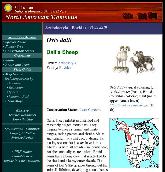
National Museum of Natural History: American Mammals: Dall's Sheep
Dall's Sheep inhabit undisturbed and extremely rugged mountains. They migrate between summer and winter ranges, eating grasses and shrubs. Learn more about the Ovis dalli, more commonly known as a Dall's Sheep, in this easy-to-read...
Smithsonian Institution
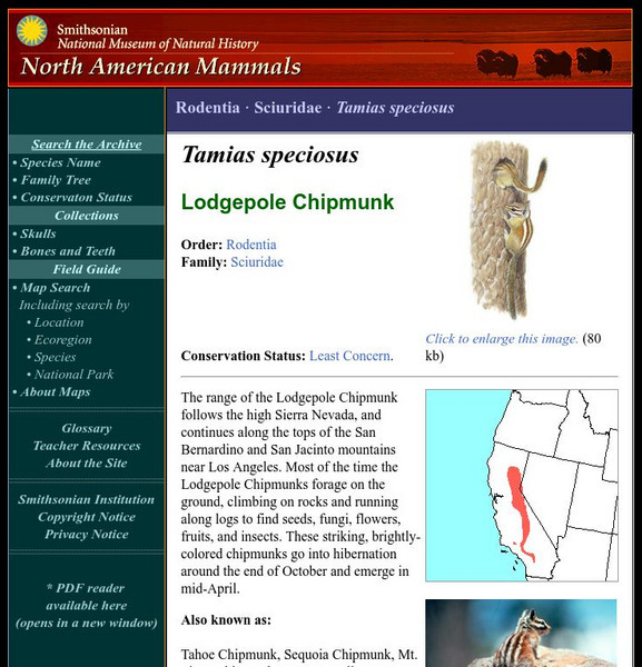
National Museum of Natural History: American Mammals: Lodgepole Chipmunk
The range of the Lodgepole Chipmunk follows the high Sierra Nevada, and continues along the tops of the San Bernardino and San Jacinto mountains near Los Angeles. Most of the time the Lodgepole Chipmunks forage on the ground, climbing on...
Curated OER
Educational Technology Clearinghouse: Maps Etc: South China, 1971
"South China comprises the drainage basins of the middle and lower Yangtze River, the basin of the His Chiang (West River) in Kwangtung and Kwangsi; and the mountainous coastal provinces of Fukien and Chekiang. The division between the...
Curated OER
Educational Technology Clearinghouse: Maps Etc: Southern Rockies, 1911
A map from 1911 of the southern Rockies showing the main topographic features of the region, including; the eastern foothills (hogback topography); the Colorado or Front Range and Wet Mountains; the Park, Sawatch (or Saguache), and...
Curated OER
Etc: Gateway Through the Appalachians, Late 1600s Early 1700s
A map of the Appalachian Mountain region showing the three primary routes of the early 1700's through the natural barrier from the English colonies to the Mississippi Valley. "The Appalachian ranges separated the French and the English,...
Curated OER
Educational Technology Clearinghouse: Maps Etc: Physical Europe, 1916
A physical map of Europe from 1916 showing color-coded elevations and water depths for the area extending from Iceland to the Ural Mountains in Russia Proper, and the Arctic Circle to the Mediterranean Sea. Land elevation colors range...
Curated OER
Educational Technology Clearinghouse: Maps Etc: Physical Map of Europe, 1916
A physical map of Europe from 1916 showing color-coded elevations and water depths for the area extending from Iceland to the natural boundary between Europe and Asia (Ural Mountains to the Caspian Sea), and the Arctic Circle to the...
Curated OER
Etc: Maps Etc: Relief of the United States, 1910
A relief map from 1910 of the United States showing the physical features of the New England Highlands, Adirondacks, Appalachian Plateau and Mountains, Piedmont Plateau, Coastal Plains, Lake Superior Highlands, Red River Valley Plains,...
Curated OER
Educational Technology Clearinghouse: Maps Etc: The United States, 1890
A map from 1890 of the United States showing physical features, and annual mean temperatures and rainfall. The map shows high mountains and lower ranges, watershed division boundaries, rivers, lakes, coastal features, and is color-coded...
Curated OER
Educational Technology Clearinghouse: Maps Etc: Bear Valley Region, 1911
A map of a portion of the San Bernardino Mountains near Big Bear Lake in 1911. The map is based on the USGS San Gorgonio quadrangle, with contour intervals of 500 feet. "Bear Valley and the adjacent country exhibit the subdued relief...
Curated OER
Educational Technology Clearinghouse: Maps Etc: Northeast China, 1971
"Northeast China - the provinces of Heilungkiang, Kirin, and Liaoning - is the most important region of the country and a nationally significant and still-developing center of agricultural production. Most of the Northeast remained...
Curated OER
Educational Technology Clearinghouse: Maps Etc: North America, 1901
A map from 1901 of North America, Central America, the Caribbean, and Greenland showing general land elevations, mountain systems, rivers, coastal features, and ocean currents. The map is color-coded to show land elevations ranging from...
Curated OER
Etc: Maps Etc: Physical Map of South America, 1916
A map from 1916 of South America showing the general physical features including mountain systems, prominent peaks and volcanoes, river and lake systems, plateaus, and coastal features. The map is color-contoured with land elevations...
Curated OER
Etc: Maps Etc: Physical Map of South America, 1910
A physical map from 1910 of South America showing color-contoured land elevations and water depths. Elevations range from sea level to over 6,500 feet, and water depths range from sea level to below 13,000 feet. This map shows the...
Curated OER
Wikipedia: Natl Historic Landmarks in Mn: Hull Rust Mahoning Open Pit Iron Mine
The Hull-Rust-Mahoning Mine in Hibbing, Minnesota, is the largest open pit iron mine in the world. The mine, located in the Mesabi Range, supplied as much as one-fourth of all the iron ore mined in the United States during its peak...
Curated OER
Educational Technology Clearinghouse: Maps Etc: Physical Asia, 1910
A map from 1910 of Asia, showing physical features and general elevations. This map uses color-contours to show land elevations ranging from below sea level around the Caspian Sea to over 6,500 feet, and water depths from sea level to...
Curated OER
Educational Technology Clearinghouse: Maps Etc: Physical Asia, 1916
A map from 1916 of Asia, showing physical features and general elevations. This map uses color-contours to show land elevations ranging from below sea level around the Caspian Sea to over 15000 feet, and water depths given in fathoms....
Other popular searches
- Major Mountain Ranges
- World Mountain Ranges
- Maps of Mountain Ranges
- Us Major Mountain Ranges
- Us Mountain Ranges
- Asian Mountain Ranges
- Greece Mountain Ranges
- Western Us Mountain Ranges
- Formation of Mountain Ranges
- Western u.s. Mountain Ranges
- U.s. Mountain Ranges
- Mountain Ranges Worksheet

