Curated OER
Stargazers and Skywatchers
Students observe the daily motions of the sun and relate them to the functions of a sundial. They determine the locations of sunrises and sunsets and determine how the elevation of the sun effects temperature.
Curated OER
Regions of Utah - Mapping
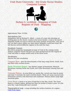
Fourth graders draw a rudimentary map of the state of Utah, dividing it into the three regions: the Great Basin, the Colorado Plateau, and the Rocky Mountain Region.
Curated OER
Sharing The Land
Students investigate different geographical terms and concepts. This is done with practicing with maps of the United States to find major coasts, lakes, and rivers. They also put together a floor map of the United States. Students create...
Curated OER
Mapping the Ocean Floor
Students study the bottom structure of underwater habitats and how they can be mapped.
Curated OER
Right Angles--Algebra Vocabulary
In this secondary mathematics worksheet, students create a crossword review of algebra vocabulary. The students must determine the correct answer to each clue and then determine the correct placement for the term in the 12 by 12...
Curated OER
Rivers Run Through It
In this mapping practice activity, 5th graders read an informational paragraph and answer 7 questions about the parts of a map along with places shown on a given map.
Curated OER
Mapping Your Local Community
First graders take a walking tour of their community to discover the names of numbered locations on a premade map. They then, create their own map of the community on the computer using Kidspiration software.
Curated OER
Burt County, NE, Soil Survey
Students identify the soil types and textures, and locate the waterways in or near the towns of Lyons and Decatur, Nebraska. They analyze soil profile maps, and answer conclusion questions.
Curated OER
A Capital Idea
Students write a description of the spatial organization of the former and present location of New Hampshire's state capital. They analyze maps, participate in a class discussion, and calculate the distance of Concord from the borders...
Curated OER
Where Exactly Am I, Anyway?
Students are introduced to the components of an URL. They explore several websites in groups and evaluate the reliability of each. Students identify sites that they believe will provide reliable information and complete a worksheet.
Curated OER
Why Archaeologists Dig Square Holes
Students examine how archaeologists establish and maintain the context of artifacts. They interpret a plan view of an archaeological site and explain the importance of the grid system.
Curated OER
Social Studies For Elementary School
Fourth graders become familar with maps and work in groups to get an overview of what Europe is like. The real assignment is in the form of students creating their own trip if it could really be taken.
Curated OER
Sub-Saharan Africa: Physical Geography
In this geography skills activity, students respond to 22 short answer and map skills questions about the location and geographic features of sub-Saharan Africa.
Virginia Department of Education
Hurricanes: An Environmental Concern
Hurricanes, typhoons, and tropical cyclones are the same type of storm, but their names change based on where they happen. Scholars use a computer simulation to learn about hurricanes. Then they hypothesize ideas to prevent hurricanes...
Curated OER
Third Grade Social Studies- Quiz
In this social studies worksheet, students complete a 25 question multiple choice quiz about early American colonial life and the Cherokee and other Native American tribes.
Curated OER
Canada, O Canada
Students study the similarities and differences between Canada and the United State in this unit. They examine geography, government and culture as they "travel" through Canada.
Curated OER
Seasons Worksheet #2
A tilted Earth is shown in relation to the rays of light from the sun. Earth science superstars determine latitude, month, and time of day. They compare number of daylight hours for different points on Earth. The five multiple choice...
Curated OER
Problems in Context
In this Pythagoras' Theorem worksheet, students read through an explanation of how to solve problems with Pythagoras' Theorem and answer 4 questions in the explanation. Then, students use Pythagoras' Theorem to answer 6 problems. They...
Curated OER
Puerto Rico: The 51st State?
Learners research the history of Puerto Rico, its culture, and geography. In this Puerto Rico instructional activity, students find Puerto Rico on a map and find specific regions or cities. Learners discuss Puerto Rico's statehood and...
Curated OER
Angles and Turns
In this angles activity, students solve 24 problems in which angles and measurements on a compass are calculated. There are also some map problems to solve. The page is intended for online use but can be done on paper.
Curated OER
Latitude on World Maps - World Map Activity 2
Learners explore the concept of latitude. In this geography activity, students discover the global grid system and complete a map activity which require them to record the latitude of various cities in the world.
Curated OER
Single-Step Vector Worksheet
In this forces activity, students draw the indicated vector and show the components into which it is resolved and then calculate for acceleration, speed, or momentum. This activity has 12 word problems.
Curated OER
Unemployment in the UK
In this unemployment worksheet, students use the 16 sentences provided in the answer bank to complete a graphic organizer pertaining to unemployment in the United Kingdom.
Curated OER
Negative Numbers on the Number Line
In this negative numbers on number lines practice worksheet, learners sharpen their problem solving skills as they solve 6 story problems.


