Curated OER
Utah: State History
In this Utah state history worksheet, students read two and a half pages of information about Utah and complete 10 true and false questions.
Curated OER
Project Map: Latitude And Longitude Worksheet
For this latitude and longitude worksheet, learners find the coordinates of 14 cities around the world and use this information to complete 14 short answer questions. This worksheet includes online atlas web links.
Curated OER
India and Its Climate
The climate found in different regions of India is the focus of this brief presentation. Learners discover that India has three main seasons; winter, summer, and monsoon. There isn't a lot for pupils to do with this PowerPoint, but it...
Curated OER
Creating the Future
Students work together to develop and write scenerios for the future of hazardous waste cleanup. They share their scenerios with the class. They complete activities as well.
Curated OER
The American Trail System
Students research a trail system. They create a display board of the trail system, generate a map of the trail system, and develop a commercial advertising of the trail system. They design a display board featuring facts about the...
Curated OER
Winter and Summer Storms Scenarios
Fourth graders discover the patterns that create summer and winter storms. Working in groups, they create model storms for summer and winter. Students discuss the reasons why summer storms and winter storms are different and explain...
Curated OER
Greece
In this comprehension activity on Greece, students read the article presented and then answer the questions that follow. There are 12 short answer questions to complete about Greece, where it is located, the people, celebrations, and the...
Curated OER
New Food Saves Lives, Could End Hunger
Learners locate the country of Niger, then read a news article about a new type of food that is being used to fight childhood hunger in Africa. In this current events lesson, the teacher introduces the article with map and vocabulary...
Curated OER
Musical Plates-Earthquakes
In this plotting earthquake data learning exercise, learners use a large world map and given web sites showing the latitude and longitude for the epicenter of recent earthquakes around the world. Students plot 2 weeks of earthquake data...
Curated OER
Using Math To Make Decisions About Animal Habitat
In this animal habitat activity, students read, analyze and solve 5 scenarios involving mathematics and animal habitats. Students work out each decision they decide as correct and write out a proposal for each one.
Curated OER
Phonics Test #30 - (End of the Year Review)
In this recognizing vowel sounds worksheet, students read the first word on each line, determine its underlined vowel sound, and identify the other word that has the same sound. Students circle 65 words.
Curated OER
Applications and Writing Functions
In this college level Pre-Calculus worksheet, students use polynomial and rational functions to solve application word problems. The three page worksheet contains forty-four problems. Answers are not included.
Curated OER
Latitude on World Maps
Sixth graders examine the purposes of maps. In this Geography lesson, 6th graders practice using latitude and longitude on a map.
Curated OER
Angles
In these angles worksheets, students complete several activities for angles. Students complete 34 problems about angle measurement.
Curated OER
Heritage: Make a Model of a Typical Utah Settlement
Fourth graders examine the different types of settlements used in Utah. They take a community map of Utah past and present and compare the two. They create a model of the early types of settlements used by pioneers in Utah.
Curated OER
Viewpoints
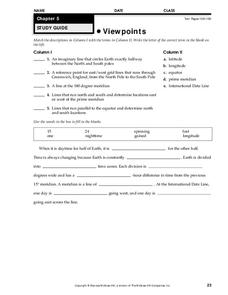
In this map worksheet, students review latitude, longitude, equator, and prime meridian. This worksheet has 5 matching and 8 fill in the blank questions.
Curated OER
Descriptive Statistics
Students demonstrate how to use frequency and scatter diagrams. In this statistics lesson, students are introduced to different techniques of representing data. Students sort and graph data on a worksheet and use a frequency diagram to...
Curated OER
How Does Temperature Change With Respect To Latitude and Longitude?
High schoolers research the concept of predicting the weather. The research focuses on how some weather facts intuitively make sense. Students answer key questions based upon the mathematical concept of covariance.
Curated OER
Retrograde Motion
Students study the motions of the heavenly bodies. In this space lesson students use models to show a variety of schemes explaining the motions.
Curated OER
Antarctica Vocabulary Quiz
In this Antarctica vocabulary activity, students match vocabulary words about Antarctica with definitions, 15 words total. Worksheet contains a link to additional activities. Labeled as a quiz, but may be used for practice or review.
Curated OER
Why Do You Live Where You Do?
Eighth graders identify reasons why settlers bought land from the railroad and not a Homestead grant. Using that information, they compare and contrast the types of land given in each situation. They discuss the reasons why given...
Curated OER
Thermal Energy Transfer - Conduction
Students examine how heat passes through a pane glass window. In this energy transfer lesson students complete a lab activity.
Curated OER
Teaching English: Northern Ireland
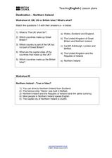
In this northern Ireland activity, students complete a matching activity, and true/false and short answer questions after reading short paragraphs of text.
Curated OER
Vocabulary for Robin Hood
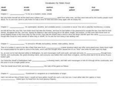
In this vocabulary worksheet, students fill in the blanks to sentences from the story Robin Hood. Students complete 24 problems on this worksheet.
