Curated OER
The Historical Geography of Mesopotamia
Students show how the geography of the Mesopotamia region has impacted the beginnings of civilization. They show how this area has long been the site of the rise and fall of great empires, and how the geography of this region has a lot...
Curated OER
Rocking the Vote
Students explore how a presidential candidate can win the popular vote but not receive enough electoral votes to win the election. They analyze various regions' voting trends, explore how these trends reflect the outcome of the 2004...
Curated OER
Sports Franchises: The Demographic Dimension
Students examine how U.S. population patterns have changed over time. Using the growth of major league baseball to illustrate these patterns, students create maps, examine regional migration patterns, and make predictions for the future.
Curated OER
The Power of Maps & Native American Cultures
Sixth graders discover where and how five Native American cultures lived in North America in what is currently the United States. They examine their way of life and the regions they inhabited. Additionally, 6th graders will understand...
Curated OER
A-maizing Facts
Students research the lives of Native Americans living in the Northeast Woodlands region, focusing on how the climate, location, and physical surroundings affected their way of life.
Curated OER
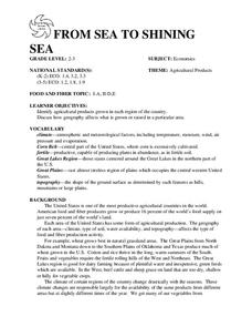
FROM SEA TO SHINING SEA
Identify agricultural products grown in each region of the country.
Discuss how geography affects what is grown or raised in a particular area.1. Hand out a copy of the two activity sheets "Food From Sea to Shining Sea" to each student....
Curated OER
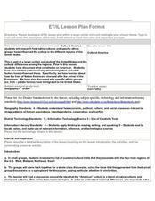
Cultural America
Seventh graders investigate the cultural differences that can be found in America. They discuss what it means to be called an American. The patterns of migration to America are discussed with the use of maps and geographical terms....
Curated OER
Connecticut Reading Comprehension Activity
In this reading comprehension activity worksheet, students read 5 paragraphs pertaining to the history of Connecticut and then respond to 30 true or false, multiple choice, and short answer questions.
Curated OER
Searching the Net
Students create a Native American Nation flip book. In this Native American lesson, students choose one of four Native American Nations: The Iroquois, Hopi, Seminoles, Sioux. They research them on the Internet using teacher given...
Curated OER
Journey to Gettysburg
Students use latitude and longitude to map the path of the Battle of Gettysburg.
Smithsonian Institution
African American Music: Let’s Sing and Play Clapping Games
Two lessons focus on making a beat. Using popular African American music of its time, scholars listen and analyze the rhythm then recreate it with hands drums, and cups.
Curated OER
Find a Cave
Students locate their own communites and the nearest caves on a United States map. They calculate the distance to the nearest cave using rough scale.
Curated OER
Learning Landscapes
Fifth graders analyze a landscape depicting Yosemite during the time of the Wild West. They compare their perceptions of the West from film and television to this representation. They observe the use of scale and color to depict size and...
Curated OER
Exploring the Hudson in 1609
While this lesson focuses on a study of the Hudson River, it could be used as a template for a discussion of map skills, converting measurements, and plotting a route. The lesson includes vocabulary and other resources to make it a...
Curated OER
Exploring the Hudson in 1609
Learners follow the journey of Henry Hudson down the river with his name. Using journal entries and maps, they learn about its exploration. They use maps to identify stages of the journey, and practice converting distances into miles.
Curated OER
4th Grade Geography Multiple Choice
In this grade 4 geography worksheet, 4th graders complete a total of 25 multiple choice questions relating to 4th grade geography concepts. An answer key is provided.
Curated OER
Vermont History True / False
In this Vermont history worksheet, learners read two and a half pages of information about Vermont history. After reading, students complete 10 true or false questions about what they read.
Curated OER
Using Data to Determine the Location of the Stiffest Opposition to School Desegregation in the 1970's
Students analyze historical data. In this school desegregation lesson, students make predictions about opposition to desegregation, examine the provided desegregation data, and determine if their predictions were correct.
Curated OER
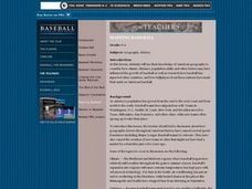
Mapping Baseball
Students research how climate, distance, population shifts and immigration have influenced American baseball. They also consider how players from other countries have made their mark on American baseball.
Curated OER
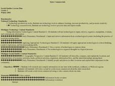
State Commercials
Third graders create a travel commercial for an eastern state. They form small groups to do internet research on the state using guide questions. They use this information to write a script for the commercial. Then all group members...
Curated OER
Signs in the Stitching
Young scholars exercise their creativity by designing an original quilt and a written explanation of its meaning. They use primary sources to develop an understanding of Underground Railroad routes through Indiana.
Curated OER
U.S. Geography for Children: State Capitals
In this United States map skills instructional activity, students locate and label specified states and their capitals, and create icons and a map key to show something for each state that is famous. Students answer 5 questions.
Curated OER
Fourth Grade Social Studies
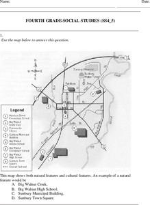
In this social studies worksheet, 4th graders answer multiple choice questions on state maps, city maps, road maps, political maps, and more. Students complete 25 multiple choice questions.
Curated OER
Civil War and Beyond
Sixth graders play a game. In this Civil War lesson, 6th graders discuss the beginnings of the Civil War and define vocabulary words associated with the war such as abolitionist and Emancipation Proclamation. Students play a game of...
Other popular searches
- U.s Northeast Region
- Northeast Region Map
- Us Northeast Region
- Northeast Region of Us
- U. S. Northeast Region
- Usa Northeast Region
- Northeast Region of the u.s
- The Northeast Region
- Northeast Region in Usa
- Us Northeast Region Map
- Northeast Region of the Us
- Art Northeast Region Map


