Curated OER
Northern Hemisphere Map
In this Northern Hemisphere polar projection map instructional activity, students examine this region of the world. The continents shown are labeled.
Curated OER
Maps and Globes: Where in the World are We?
Students explore maps and globes. In this introduction to map and globe concepts lesson, students identify features of physical maps, political maps, and globes. Students locate land and water, and recite a poem about the names of the...
Institute for Geophysics
Understanding Maps of Earth
Here is your go-to student resource on primary geography concepts, including facts about the surface of the earth and its hemispheres, latitude and longitude, globes, types of maps, and identifying continents and oceans.
Curated OER
A Map as a Tool
Students study the concept of using a map as a tool with the usage of a balloon designed to mimic the features of the Earth with the major features marked and shown on the balloon.
Curated OER
5th grade social studies geography
In this geography worksheet, 5th graders complete multiple choice questions about hemispheres, maps, cities, ecology, and more. Students complete 25 questions.
Curated OER
Transatlantic Travel
Students design an interactive map with modes of transportation that actually move across the ocean. They construct transatlantic maps of the northern hemisphere and imagine what it would be like to operate various modes of...
Curated OER
Kid Maps: Reading and Creating Maps with Human Characteristics
Students look at maps. For this map lesson, students listen to the book My Map Book by Sara Fanelli and they see the difference between human characteristics (buildings, etc.) and natural characteristics (rivers, etc.). They create...
Curated OER
Rivers, Maps, and Math
Students use maps to locate and label the major rivers of North and South America. Using the internet, they identify forests, grasslands, mountain ranges and other landforms on the continents as well. They compare and contrast the...
Curated OER
"Yarning" About Latitude and Longitude
Students identify various locations using latitude and longitude. In this map skills lesson, students use yarn and labels to create a "human globe." Students identify the Prime Meridian, the Equator, and Northern and Southern Hemisphere.
Curated OER
Leapin' Landmarks: Locating 10 Man-made Landmarks Around the World
Third graders label continents, oceans, and major mountain ranges on maps and use the maps to write an informational report about landmarks. In this landmarks lesson plan, 3rd graders write about 1 major landmark.
Curated OER
Getting to the Core of World and State Geography
Students create topography relief maps. In this geography skills lesson, students review geography core knowledge skills, design and make a state relief map, and compile a student atlas.
Curated OER
Where Am I?
Students apply map reading skills by locating places through the use of latitude and longitude.
Curated OER
We've got the whole world in our hands
Students explore spatial sense in regards to maps about the globe. In this maps lesson plan, students label oceans, locate the continents and poles, follow directions, and explain the symbols on a map.
National Center for Case Study Teaching in Science
Mask of the Black God
Finally, an astronomy lesson for the high schooler! Explorers are able to read star maps for finding objects in the night sky by determining celestial coordinates. In particular, they locate the Pleiades and read about a Navajo legend...
Curated OER
Exploring the Continents Through the Arts
Students examine the continents and explore geographic components in the fifteen lessons of this unit. The location of the continents, the equator, the four major oceans, and the music, food, literature, dance, and drama from each of the...
Curated OER
Why Do Geese Fly South For the Winter?
Fifth graders examine migration by tracing animal migration routes on a map. In this animal life lesson, 5th graders observe a map of North America and read about the migration patterns of geese. Students trace the path most geese take...
Curated OER
Northernmost Cities Quiz
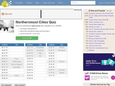
In this online interactive geography quiz worksheet, students respond to 27 identification questions about world cities in the northern hemisphere. Students have 5 minutes to complete the quiz.
Mr. Head's 6th Grade Classroom
Absolute Location
How do we know where we are in the world? A presentation for middle schoolers explains absolute location and other geography terms such as relative location. It also gives scholars the opportunity to practice finding absolute location on...
Curated OER
Nina Bonita: Culture and Beauty
Students read Nina Bonita by Ana Maria Machado. In this reading comprehension/ geography lesson, students recall various parts of the story and create a map of where the rabbit traveled throughout the story. They participate in group...
Curated OER
A Book Is A Window To the World
Second graders listen to pieces of literature that take place in different regions of the world. Using a map, they identify and locate the continents and oceans mentioned in the story. They describe the physical and human characteristics...
Curated OER
G'Day Mate
Students understand that Australia is the smallest continent, locate it on a map and sing about the continents. In this Australia lesson, students listen to facts about Australia and complete a book about information they have learned.
Curated OER
Vikings in Vinland
Students examine the role of archaeology in gaining information about past civilizations. After reading an article, they discover evidence of the Viking settlement of North America. They summarize the information in the article by...
Curated OER
Regions of South America
Students explore facts about South America in the four lessons of this unit. Booklets are created from the materials produced as the class delves into the topic.
Curated OER
Ocean Currents
Fourth graders work in groups to research ocean currents and create posters with their findings. They locate the patterns and names of major ocean currents and identify them on a map. Students also use red pencil to show ocean currents...


