Curated OER
Yo-Yos, Tow-Yos and pH, Oh My!
Learners explore how hydrothermal vents are formed and where they are located on the ocean floor. They study how scientists use CTDs to locate hydrothermal vents.
Channel Islands Film
Island Rotation: Lesson Plan 1
How do scientists provide evidence to support the theories they put forth? What clues do they put together to create these theories? After watching West of the West's documentary Island Rotation class members engage in a series of...
NOAA
Wet Maps
How do oceanographers make maps under water? Junior explorers discover the technologies and processes involved in creating bathymetric maps in part three of a five-part series designed for fifth- and sixth-grade pupils. The lesson...
Curated OER
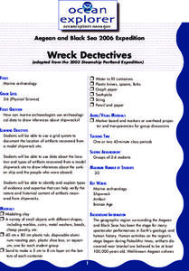
Wreck Detectives
Junior archaeologists examine types of artifacts from the Bronze Age on the internet. In collaborative groups, they create a story about a ship from this period and then construct a model of the ocean floor after their ship has sunk....
Curated OER
Weather History
Students study how weather is measured. In this climate lesson plan, students research how samples of the ocean floor reveal facts about the climate thousands of years ago. Students use clay samples to create layers that simulate real...
Curated OER
Sea Floor Spreading I
Learners use Excel to explore the geodynamics Model equation for ocean depth around a sea-floor spreading center. They use an equation relating ocean floor depth to sea floor spreading rate and distance from spreading center for a...
Curated OER
science: Light Up the Ocean
young scholars investigate light levels under the ocean by conducting several simulations. After creating solutions representing seawater, they shine a light sensor on it to discover how light diffuses and is absorbed by the impurities...
Curated OER
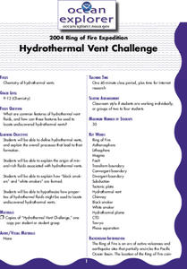
Hydrothermal Vent Challenge
Students discover common features of hydrothermal vent fluids. They use this knowledge to locate possible undiscovered hydrothermal vents on the ocean floor.
Curated OER
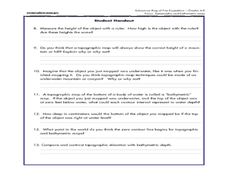
A Watered-Down Topographic Map
Eighth graders explore the ocean floor. In this topography activity, 8th graders compare topographical maps to bathymetric charts. They will create a topographic map and note landmarks and other land features.
Discovery Education
Sonar & Echolocation
A well-designed, comprehensive, and attractive slide show supports direct instruction on how sonar and echolocation work. Contained within the slides are links to interactive websites and instructions for using apps on a mobile device to...
Curated OER
Tracking Ocean Ecology
Students look at the data maps given to them about how chlorophyll affects the algae blooms and make predictions about the harm they will cause. For this data maps lesson plan, students manipulate data sets from the website.
Curated OER
Oceans of the World
Second graders demonstrate their ability to find the five oceans on a globe and on a world map and relate their knowledge of mountains and other physical characteristics of land masses to the physical characteristics of the ocean floor.
Curated OER
The Great Ocean Conveyor
Students investigate water density. In this water density lesson plan, students conduct an experiment with food coloring, water and salt to see how the salt effects bodies of water.
Curated OER
TE Activity: Survive That Tsunami!
Students examine the causes of tsunamis and observe a table top wave making machine. They make model houses while working in groups so that the can see how different construction types work. They discuss how engineers can design and...
Curated OER
Normal (dip-slip) Earthquake!
Students label the fault lines and tectonic plate boundaries on the world map. For this earth science lesson, students simulate ocean floor formation using CEENboTs. They explain the causes of earthquakes.
Curated OER
Mapping the Ocean Floor
Students study the bottom structure of underwater habitats and how they can be mapped.
Curated OER
The Oceans Below
Young scholars investigate the geological characteristics of the ocean environment and create a labeled drawing of the ocean floor's geography. Students view videos and conduct Internet research about the ocean's floor and then create...
Curated OER
Sonar Mapping
Students use a shoe box to create a seafloor model and use cardboard for layering inside of the shoe box to simulate the ocean floor. They probe the ocean floor to simulate sonar echoes. Finally, students graph their data to get a...
Curated OER
Cut-off Genes
Investigate the relationships between different deep-sea organisms by DNA sequencing. A worksheet provides instructions for DNA sequencing and space to work. They simulate gel electrophoresis by cutting out paper "DNA strands."...
Curated OER
The Distance Between Us and Them: Sea Floor Spreading in the Atlantic Ocean
Students examine how geologists determine rates of sea floor spreading between two tectonic plates. They apply mathematical concepts such as the calculation and use of velocities and conversion from one set of units to another.
Curated OER
Snack Tectonics
Yum! Using graham crackers, dried fruit sheets, and frosting, tectonics technicians demonstrate the different types of plate boundaries. If you want to encourage youngsters with an activity that is both educational and edible, then this...
California Academy of Science
Academy Seafood Market and Fishery
What fishing method is the most sustainable? Find out through a fun, but meaningful game in which your little fishermen use different techniques to see what they catch. After the fishing activity is over, there are several discussion...
Curated OER
Map Puzzles
Students make puzzles from world maps, dramatizing how much of the globe is covered by ocean.
Curated OER
Friend, Foe, or . . .
As a result of this lesson, upper elementary ocean explorers will be able to describe several interrelationships: symbiosis, mutualism, commensalism, and parasitism. They learn that the biological richness is increased near seamounts and...


