Curated OER
A Model of Three Faults
Students observe fault movements on model of the Earth's surface, find fault movements associated with different types of plate boundaries, research examples of non-plate boundary faults, and research and report on the types of faults...
Curated OER
Top to Bottom
Marine science classes read about the 2005 North Atlantic Stepping Stones Expedition and review climate change. They use maps to locate the seamount chains. In collaborative groups, they research how climate change may be altering the...
Curated OER
Mapping Ancient Coastlines
Most of this instructional activity is spent working on the "Bathymetry Worksheet." It includes a graph of the changes in sea level over the past 150,000 years and a bathymetric map of changes in an imaginary coastline over time....
Curated OER
A Model of Three Faults
Students investigate faults. In this science lesson, students explore the many stresses and strains in the earth's layers and research the types of faults in their state.
Curated OER
Reading Satellite Images
Learners analyze satellite images. In this astronomy lesson, students examine 3 satellite images in order to understand how satellite images are taken and what they can teach scientists.
Curated OER
Destructive Impact of Environment on Artifacts
Middle schoolers recognize that artifacts are destroyed over time. In this environmental factors on artifacts lesson, students experiment and observe through the microscope to find the environmental impact on artifacts. ...
Curated OER
Island Research
Students will work in small groups to gather information about the geography, history, economy, climate, culture, and other aspects of life on the island of Eleuthera. Lesson contains adaptations for all levels.
Curated OER
Life of an Island: From Mountain to Atoll
Students research the evolution of a volcanic island from origin to erosion. They determine the relative ages of the Northwestern Hawaiian Islands given their position in the archipelago.
Curated OER
Where's King Solomon when we need him?: Good decisions on resources
Students use geographic information to suggest how to manage natural resources through a simulation. They engage in a simulation, and decide how to protect, allocate, and exploit the resources of a hypothetical location.
Curated OER
Plate Tectonics
Learners complete a data sheet. In this Earth composition lesson, students learn what happens when the Earth's plates push against each other. They watch a teacher demonstration and complete a data sheet.
Curated OER
Continents and Oceans on the Move
Students create an awareness of the vast percentage of water covering the earth. They relate similarities/differences between topographical maps and other maps of various time periods. Students examine how to use a topographical map.
Curated OER
Drawing Fish
Students practice creating art by imitating the camouflage of fish. For this animal characteristic lesson, students identify certain fish and their ability to change colors in order to survive in the wild. Students utilize coloring...
Curated OER
Locating Vent Fields Using CTD Data
Students describe the way hydrothermal vents work. Students work on locating vent regions through remote collection of data about water temperature and density. Comparing density and temperatures graphs, students search for indicators...
Curated OER
Reading Maps of the East Pacific Rise
Pupils make qualitative and quantitative observations and use various maps to investigate the features of the East Pacific Rise The study actual bathymetric maps of the EPR region. They identify key features of the ridge and explore the...
Curated OER
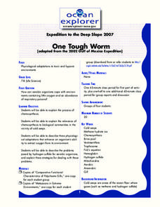
One Tough Worm
Young scholars explain the process of chemosynthesis and its relevance to biological communities. In this investigative lesson students discuss chemosynthetic communities, then in groups they are assigned a species and are to calculate...
Curated OER
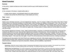
Island formation
Students explain what an island is, and distinguish islands from similar landforms. They compare and contrast the different ways in which islands are formed.
Curated OER
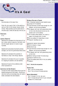
It's a Gas!
Students explore the conditions under which hydrates form. They use the Internet to access information and conduct experiments to examine how the greenhouse effect works.
Curated OER
Breaking Away (Or Not...)
Learners compare and contrast common reproductive strategies used by benthic invertebrates. They describe the most common reproductive strategies among benthic invertebrates on a seamount, and explain why these strategi
Curated OER
Tides
Learners graph 40 days of high and low tide data for a site in Baja, Mexico near the Wetlands & Fisheries Live! research center. They identify patterns in the data and finally to make a connection between tidal heights and the phase...
Curated OER
How Volcanoes Grow
Pupils study volcanoes including rock fragments, ash, aerosols and gases. In this volcano lesson students divide into groups and build models of the three major types of volcanoes.
Curated OER
Geography Terms
Students identify different landforms and fill out a worksheet where they explain what each landform is. In this geography lesson plan, students fill in a landform map and then use landform words as they describe the landforms.
Curated OER
Sailors and Sharks
Learners use the skills of fleeing and dodging in order to avoid being tagged. They begin standing on the ships (mats). One student, the shark, wears a pinney. At the signal from the teacher of "Sailors swim", the sailors scatter to a...
Curated OER
Triangular Trade and Its Effects
Students investigate the trade routes and investigate goods and services were transported along each route. Given a primary source document, that represents a personal story related to the triangle trade, they discuss given questions.
Curated OER
TE Lesson: Tsunami Attack!
Students examine how earthquakes, volcanoes, and landslides can trigger tsunami waves. They determine how engineers use sensors to detect the dangerous wave, and how they help design building that will survive the wave force and water.
