Curated OER
Oceans of the World
Second graders demonstrate their ability to find the five oceans on a globe and on a world map and relate their knowledge of mountains and other physical characteristics of land masses to the physical characteristics of the ocean floor.
Curated OER
Map Skills: Explorers, Continents, and Oceans
Third graders use a software program to make and label a map of the world. On the map, they locate the seven continents, oceans and the countries of Europe. They also draw the routes of Christopher Columbus, Juan Ponce de Leon and...
Curated OER
Learning About the Equator, The Seven Continents and the Four Oceans
Students use a globe or map to locate the equator, oceans and continents. Using the internet, they spend time surfing through predetermined websites on continents and oceans. They write facts on different parts of the globe on index...
Curated OER
Introduction to the United States Map
Students explore the United States using a map. In this map instructional activity, students discover how to use a United States map and a globe to locate places.
Curated OER
Map Keys
Third graders examine maps and map keys. In this locating map features lesson, 3rd graders use crayons, markers and colored pencils to label maps. Students work in partners to read map keys and locate given places and things.
Curated OER
Memorable Maps
Students draw an assigned map from memory about the United States or any other region they are studying. In this maps lesson plan, students draw a map from their memory at the beginning of the year, and do the same assignment at the end...
Curated OER
The Interconnectedness of Ancient Peoples Map Study
Seventh graders begin this lesson by viewing various maps of the Ancient World. As a class, they take notes on the changes of different areas in Europe and Asia as their teacher lectures to them. They answer questions about the...
Curated OER
Boundaries and People
Young scholars map watersheds to find their boundaries. In this watershed activity students map and then give their "watershed address." Young scholars show the trail from stream, larger stream to oceans. Students...
PBS
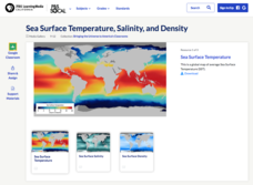
Sea Surface Temperature, Salinity, and Density
Earth's vast ocean is full of mysteries! Science scholars discover the big-picture properties that influence its characteristics at different latitudes using a lesson plan from PBS's Weather and Climate series. After completing a...
Curated OER
Mapping the Ocean Floor
Students construct and interpret a line graph of ocean floor depth and a bar graph comparing the height/depth of several well-known natural and man-made objects and places. In addition, they calculate the depth of two points using sonar...
Curated OER
Trade in the Indian Ocean: Should China End Zheng He's Treasure Voyages?
Students examine the amount of trade that occurs in the Indian Ocean. Using China as an example, they discuss the reasons why it ended its treasure voyages in the area and predict what would have happened if the voyages continued. They...
Curated OER
Mapping Ancient Coastlines
Most of this instructional activity is spent working on the "Bathymetry Worksheet." It includes a graph of the changes in sea level over the past 150,000 years and a bathymetric map of changes in an imaginary coastline over time....
Curated OER
Lesson Plan #3 ~ Ocean Currents
Sixth graders experiment to understand the ocean's currents. In this ocean current lesson plan, 6th graders complete an experiment with two bottles of water and an index card to discover information about the ocean current. ...
Curated OER
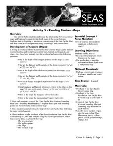
Reading Contour Maps
Students examine contour maps and bathymetry maps and discover how to interpret a contour map of the East Pacific Rise. Students look at a map as a class and answer questions together before working independently on a map of the East...
Curated OER
Continents and Oceans on the Move
Students create an awareness of the vast percentage of water covering the earth. They relate similarities/differences between topographical maps and other maps of various time periods. Students examine how to use a topographical map.
Curated OER
Where in the World? Oceans & Continents
In this geography worksheet, young scholars answer 6 questions using a coded map as a reference, then students identify labeled geographic features.
Curated OER
Understanding a Geological Map
Students identify different types of maps and observe a geological map. In this geology lesson students create a replica map of a geological area that includes a key.
Curated OER
Mapping and Personifying Nations
Eleventh graders analyze the geography, actions, and relationships of countries involved in World War II. They create a map of Europe, Northern Africa, and the Pacific, and analyze and evaluate their self-made map of Europe and the...
Curated OER
2nd Grade - Act. 22: The World Game
Second graders play World Game to become more familiar with continents, oceans, countries and states.
Curated OER
Oceanic Heat Budget Activities
Young scholars map and research imaginary islands located in different parts of the world. They describe the weather and climate of their island and show how local currents, water temperatures and waves may influence the weather patterns.
Curated OER
Explore the Ocean
Learners explore the oceans from their origin. In this oceans lesson plan, students read and discuss excerpts from the Book of Genesis regarding the creation of the ocean. Learners then clean up a mock oil spill, measure the volume and...
Curated OER
Voyage to Kure Viewing Guide
Students complete a worksheet while viewing a video about the oceans. They locate the oceans on a map and identify positive and negative ways in which humans have impacted them. They discuss any questions at the end of the lesson.
Curated OER
Welcome to My World!
Students use maps to locate information. They read the story, "It Looked Like Spilt Milk", view images of the continents and discuss the various continents. Afterward, they make their own Atlas to record information that they can later...
World Maps Online
Introduction to the World Map
Students identify the differences between maps and globes. In this map skills instructional activity, students are shown a globe and a map and recognize the differences. Students use post-it notes to locate several locations on the world...


