Hi, what do you want to do?
Curated OER
Roads of the Past and Present
Third graders compare the paths taken by the pioneers with those taken today. They trace the development and emergence of culture in indigenous communities.
Curated OER
A Trip Back in Time: Missouri quarter reverse
I love time capsules. After reviewing elements of pioneer life, your class will create a time capsule that would have belonged to a pioneer in the 1830s. Each person must write a description of each item they would have brought and why...
Curated OER
Wagons West!
The first pioneers faced many obstacles on their journey west. Middle schoolers read different historical fiction texts (ideas are provided), make connections, and complete a detailed packet (included). Reading guides, journal ideas, and...
Curated OER
A Trip Back in Time
Students investigate the pioneer experience in the 1800s. They view and discuss the images on the Missouri quarter, read a story about pioneer life, complete a worksheet, and create a booklet-form time capsule of pioneer items from the...
Curated OER
A Helping Hand: The Role of Guides During Western Expansion
Students research and examine the lives and culture of western mountain guides during the early to mid 1800s. Students write reports about a guide they research, do a simulation of the guide by keeping a journal, managing money and...
Curated OER
The American West-Knowledge Test
In this American West instructional activity, students complete a 24 questions test about the American West. Answers are included beneath questions on instructional activity.
Curated OER
Mr. Bush in Washington
Learners study about George Washington Bush and write a biography about him in a small group. To gain a better understanding of him, they listen to a biography on a tape about him. They visit various sites about him to help them examine...
Curated OER
Heritage: What if the Mormons had not come to Utah?
Fourth graders use critical thinking, evaluation, and geography skills to find alternative locations that Brigham Young could have taken the Mormons to settle. They present their findings to Brigham Young and the class with a short...
Curated OER
Lesson 6: Native Americans in the West
Students recall their knowledge of Native American people who lived in the West and reflect on how their perspectives differed from pioneers and argonauts of the 19th century.
National Endowment for the Humanities
Neh: Edsit Ement: Go West: Imagining the Oregon Trail
A 2,000-mile trek across a continent-with no idea what awaits you on the other side. Tell your students to put on their traveling shoes and prepare for the journey of their lives! In this lesson, students compare imagined travel...
Bob Dunn
History Globe: The Oregon Trail: 1843 Map
Take a virtual tour of the historic Oregon Trail and see photos of the landmarks along the way. Compare the map of 1843 with a modern map of today.
Curated OER
Bureau of Land Management: Oregon Trail Map [Pdf]
A map of the Oregon Trail and some of its branches.
Other
Historic Trails: Oregon/california Trails
Find a map of the Oregon Trail and California Trail and click Historical Trails tab to discover the hardships and daily grind of traveling on the Oregon Trail.
PBS
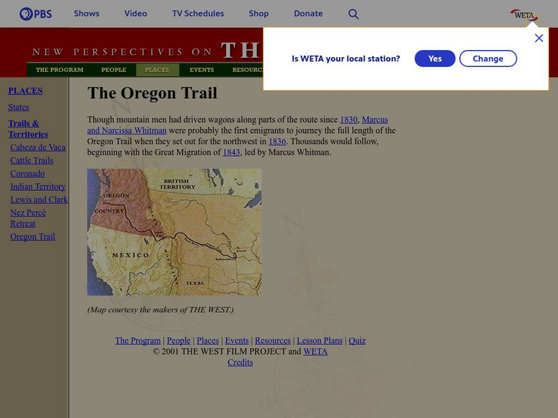
New Perspectives on the West: The Oregon Trail
This site from PBS provides a map of the Oregon Trail, from Independence, Missouri to the Willamette Valley.
University of Richmond
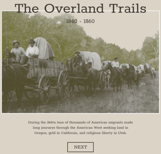
American Panorama: The Overland Trails 1840 1860
Interactive map highlights the emigrations of men and women over the Oregon, California, and Mormon Trails in the 1840s and 50s. Also features a timeline of migration, diary entries from individual migrants, and a flow map showing how...
Library of Congress
Loc: Nation Expansion and Reform: Traveling on the Overland Trails, 1843 1860
Primary source information about traveling the Overland Trails, both to Oregon Country and California.
Curated OER
Etc: Oregon Trail and Other Routes, 1832 1842
A map of western North America between the opening of the Oregon Trail in 1832 to 1842, prior to the establishment of the Provisional Government of Oregon by American settlers in 1843. The map shows the boundary of the Oregon Country,...
Curated OER
Etc: Santa Fe and Oregon Trails to the Pacific Coast, 1840 1850
A map of the western United States in 1840-1850 showing the Oregon Trail and Santa Fe, the two principal overland routes from Independence, Missouri, to the western territories and the Pacific. The map shows the territory boundaries,...
Curated OER
Educational Technology Clearinghouse: Maps Etc: Oregon Controversy, 1792 1846
A map of the Oregon Territory between the time of exploration by George Vancouver (1792) and the Oregon Treaty of 1846. The map is color-coded to show the disputed claims of the British and United States, the Russian American line of...
Curated OER
Etc: Maps Etc: The System of Communication, Western United States, 1850
The chief systems of overland travel and communication during the middle nineteenth century including railroads, stage lines, and trails (Oregon Trail, Spanish Trail, Santa Fe Trail, and the Route of the Forty-niners). The system of...
Curated OER
Educational Technology Clearinghouse: Maps Etc: Trade and Migration, 1840 1850
A map of the United States showing the principal trade and westward migration routes between 1840 and 1850. The map shows state and territory boundaries at the time, major cities, ports, outposts, forts, and settlements, rivers, mountain...
Library of Congress
Loc: Teachers: Journeys West
A series of lessons utilizing primary texts, including narratives, photographs, and maps, through which students explore the following question: "What motivated thousands of people to journey west during the 1800s?"
Apple
Apple Learning Interchange: Classroom Ideas
Do you use Appleworks in your classroom? Would you like some ideas that others have used? This site presents some exemplary lessons from other teachers.


![Bureau of Land Management: Oregon Trail Map [Pdf] Graphic Bureau of Land Management: Oregon Trail Map [Pdf] Graphic](https://static.lp.lexp.cloud/images/attachment_defaults/resource/large/FPO-knovation.png)


