Princeton University
Princeton University Library: Exhibition: Of Maps and Men: Samuel Hearne
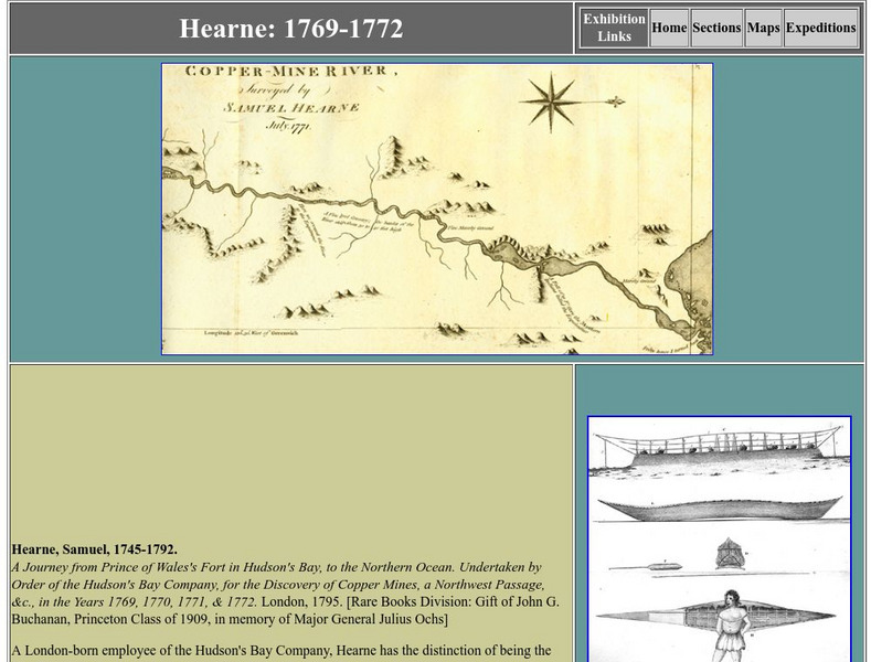
Entry about eighteenth-century explorer Samuel Hearne, from a larger exhibition about the search for a passage to the Orient through Canada. Hearne is credited with surveying the Coppermine River and with being the first European to view...
TeachEngineering
Teach Engineering: Topo Map Mania!
Maps are designed to allow people to travel to a new location without a guide to show the way. They tell us information about areas to which we may or may not have ever been. There are many types of maps available for both recreational...
BBC
Bbc News: Week of 12 23 13: Ugandan M Ps Pass Life in Jail Anti Homosexual Law
In Uganda, a bill has recently been passed that will allow gay people to be sentenced to life in jail because of their sexual orientation. Learn why bill has been condemned by President Obama, and is causing many to flee for out of fear...
Other
Syracuse University of Information Studies: Scott Nicholson
Scott Nicholson helps you find the most appropriate Internet reference tool for your search through an orientation, tutorial and frequently asked questions section. Hyper-links, advice and tips assist in the selection process.
Curated OER
Etc: Maps Etc: United States Canal Zone Isthmus of Panama, 1912
A map from 1912 of the United States Canal Zone in Panama. The map shows the location of the canal, the deepened approaches to the canal, and the locks. The map also shows mountain ranges, railroads, projected railroads, post offices,...
Curated OER
Educational Technology Clearinghouse: Maps Etc: Montreal and Vicinity, 1665
A facsimile of an early map of the vicinity of Montreal circa 1665. The map is oriented with north to the lower right. The map shows the Island of Montreal, Isle Jesus, the St. Lawrence River, Richelieu River, Lac Saint-Pierre, forts,...
Curated OER
Educational Technology Clearinghouse: Maps Etc: Sir John Lederer's Marches, 1672
A facsimile of an early map (1672) showing the three routes taken by explorer John Lederer from the headwaters of the York River inland to the Appalachian Mountains between 1669 and 1670. The map is oriented with north to the right, and...
Curated OER
Educational Technology Clearinghouse: Maps Etc: Mexico City and Vicinity, 1580
A facsimile of a map by Saverio Clavigero (1780) of Tenochtitlan (Mexico City) and vicinity around the time of the Spanish conquest in 1519. This map, according to William H. Prescott (History of the Conquest of Mexico, 1876), defies...
Curated OER
Educational Technology Clearinghouse: Maps Etc: Winthrop Map, 1633
A facsimile of a map by John Winthrop (1633) of the Boston area, including the Merrimac and Concord Rivers, Plum Island, and roads leading to Saugus, Salem, Winesemett, and Meadford. The map is oriented with north to the left.
Curated OER
Educational Technology Clearinghouse: Maps Etc: Connecticut River, 1666
A facsimile of an early Dutch map of the Connecticut River, the eastern boundary claimed by New Netherlands in 1666. The map is oriented with north to the right, and shows the early settlements and native villages, shoreline, and water...
Curated OER
Etc: Lindstrom's Map of New Sweden and Pennsylvania, 1654 1655
A facsimile of an early map by Peter Lindstrom (1654-1655) showing the Delaware Bay and the territories of New Sweden and Pennsylvania. This map is oriented with north to the left, and shows Cape May and Cape Henlopen on the Atlantic,...
Curated OER
Educational Technology Clearinghouse: Maps Etc: Battle of Freemans Farm, 1777
A plan of the Battle of Freeman's Farm (September 19, 1777), also known as the First Saratoga, fought between the British army under John Burgoyne and the Americans under Horatio Gates and Benedict Arnold during the American...
Curated OER
Athropolis: Map of the Arctic
This is a useful map for orienting students to where the Canadian Arctic lies in relation to other Arctic countries. The centre of the map is the North Pole. Clicking on the map brings up weather reports for various locations.
Other
Go to Latin: Argentina Destinations
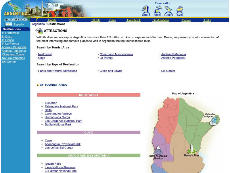
With its diverse geography, Argentina has more than 2.5 million sq. km. to explore and discover. Here is a selection of the most interesting and famous places in Argentina a tourist cannot miss. You can search for a destinations by...
Other
Go to Latin: Argentina Destinations
With its diverse geography, Argentina has more than 2.5 million sq. km. to explore and discover. Here is a selection of the most interesting and famous places in Argentina a tourist cannot miss. You can search for a destination by...
National Geographic
National Geographic: Getting Lost
The National Geographic Society provides this lesson on cardinal directions for primary students that employs common classroom materials.
E-learning for Kids
E Learning for Kids: Math: School Bus: 2 D Space
Students will play learning games to explore parallel lines and two-dimensional shapes.
Curated OER
Go to Latin: Peru Destinations
With a contrasting geography and a rich historical past, Peru is a country with more than 1 million square kilometers to travel and discover. Here is a selection of the most interesting and famous places in Peru a tourist cannot miss....
INTERNET Red 2000
All About Spain: Spain: City Guide
Tourism-oriented information about the principle cities of Spain.
US Navy
United States Naval Observatory Homepage
United States Naval Observatory is a unique observatory run by the Navy. It does some of the grunt work of astronomy -- keeping accurate time, determining positions of stars (astrometry), etc. They are responsible for publishing the...
TeachEngineering
Teach Engineering: Getting to the Point
In this lesson, students learn how to determine location by triangulation. We describe the process of triangulation and practice finding your location on a worksheet, in the classroom, and outdoors.
Other
University of Edinburgh: Glossary of Introductory Computer Graphics Terms
This website, from the University of Edinburgh, provides a lengthy glossary of computer graphics terms written by Olin Lathrop, author of "The Way Computer Graphics Work". This site provides simple definitions of basic terms; no graphics...
Curated OER
Ecuador Explorer: Quito, Ecuador
A detailed introduction to Quito including a geographical description and history. Also includes links to tourist-oriented information such as hotels, museums, and maps.


