Curated OER
Magnetic Fields
In this magnetic field worksheet, students test a compass's magnetic field against a magnet and see how far it lasts. Students follow 6 sets of directions.
Curated OER
A Passport to Asia
Students explore Asia. In this geography skills lesson, students design travel brochures that market Asia by highlighting its location, population, capital, landforms, famous places, and food.
Curated OER
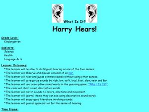
Harry Hears!
Students explore ear anatomy and the sense of hearing. In this hearing lesson plan, students discuss the five senses and view a model of an ear. Students place cotton balls in their ears to simulate loss of hearing. Students use...
Curated OER
Environment: Going Places
First graders learn directional words and apply this skill to map making. They record their steps on paper.
Curated OER
Going Places
First graders study directional words such as North, South, East, West, up and down.
Curated OER
The Colony of Virginia as Far as the Mississippi
Students study George Washington's map and journal of his 1754 expedition to the French. They draw conclusions about the importance of western lands and the problems involved in tapping the resources of the West during that era.
Curated OER
A Long Way from Home: A Hands-on Geography Lesson about World War II
Students build World War II directional signs. In this World War II lesson, students explore the geographic locations of the war as they analyze primary sources and conduct research regarding places of significance in the war. Students...
Curated OER
Modifying Adjective and Adverbs Exercise
In this modifiers worksheet, students fill in the blanks in 24 sentences by choosing the correct adjective or adverb modifier: far, just about, nearly, or slightly.
Curated OER
Introduction to Symbols
Pupils study the concept of picture symbols as a way to express ideas without using words. In this picture symbol lesson, students place symbols on a U.S. map according to meaning. Pupils then review various symbols representing...
Curated OER
What Is A Map?
Students become familiar with a map and what it is used for and become familiar with school and home surroundings. With the familiarity of their surroundings they discover that maps can be created to help them with directions and how to...
Curated OER
Sounding out accuracy, Musical Chairs
Here is a great spin on the classic game, Musical Chairs! Instead of fighting to get the last chair when the music stops, learners will need to read a CVC word to stay in the game. They walk around, whoever is near the word bucket when...
Port Jefferson School District
Climate Patterns
Young climatologists explore the factors that contribute to a region's climate in this two-part earth science activity. To begin, learners are provided with a map of an imaginary planet and are asked to label global wind and...
Curated OER
Creative Position Word Center Activity
Students use positional words to describe the location of objects and demonstrate the ability to follow multi-step oral directions. Seasonal shapes are decorated in relation to the directions and positions stated by the positional word.
Curated OER
Learning Rhymes
Students practice reading and writing in this cross-curricular lesson for the early-elementary classroom. Emphasis is placed on daily practice, individual improvements, and positive reinforcements for jobs well done during the activity.
Curated OER
Walk Across the School
Students explore the concept of location. They discuss the terms right, left, near, far, under, and over, participate in a walk around the school, and display the correct direction for various locations around the school.
Curated OER
Feltboard Storytelling
Young scholars read African folktales and retell the story using feltboard. In this folktale lesson, students read the story Why the Sky is Far Awayand use feltboard to retell the stories.
Curated OER
World Map and Globe
Learners explore symbols. In this beginning map activity, students identify common picture symbols. Learners place post-it notes with symbols drawn on them in the appropriate place on a map.
Curated OER
Explore the Written Word with National Postcard Week
Develop writing and analysis skills with a celebration of the postcard pastime.
K12 Reader
Using Land in Different Ways
After reading about rural, urban, and suburban land use, readers respond to a series of comprehension questions using evidence from the provided passage.
Royal Geographical Society
An Introduction to Maps
First graders are introduced to a variety of maps such as globes, street maps, atlases, and different types of floor plans. The focus of the lesson requires individuals to create their own plan of the classroom using the PowerPoint...
Curated OER
Keith Haring & Social Awareness
Students view four sections of one of Haring's paintings. They describe the people and characters they see. Students participate in a variety of classroom art activities such as: Making a treasure box modeled after Keith Haring's work,...
Curated OER
The Geography - Writing Connection
Students examine and describe the four physical systems of the Earth. Using two of the systems, they practice their writing skills and use vocabulary associated with the different types of landforms. They predict the types of shelters...
Curated OER
Return to Kangaroo Island
In this speaking and listening skills worksheet, students explore, participate and experience in groups of two a treasure map with a hidden treasure as they return to Kangaroo Island.
Curated OER
A View Of Home From The Front Door and From Space
Students discover how distance can change how our view of an object. Students build a representative model of where their home is located from different distances. They create three drawn models of their home from various elevations as...


