Curated OER
Earthquakes: Fifth Grade Lesson Plans and Activities
After learning about P waves and S waves, fifth graders view the intensity of earthquakes by examining seismographs and images of earthquake damage. Young scientists then forecasting future quakes by analyzing data about...
Curated OER
Continental Drift
Students simulate convection waves using a model. For this earth science lesson, students explain the effect of plate movements to Earth's geography. They use the internet to find answers to graphic organizer questions.
Curated OER
Plotting Earthquakes and Volcanoes
For this earthquakes and volcanoes worksheet, students are given the latitude and longitude of earthquakes and volcanoes and they plot them on a world map. They answer questions based on their results.
Curated OER
Looking into Earth with GIS
Students work with data from a seismic wave model in a freely available GIS (geographic information system) program, ArcVoyager SE. Using a GIS, they examine maps and produce graphs to explore variations in seismic wave velocities at...
Curated OER
Tic-Tac-Toe for Layers of the Earth
Eighth graders identify the different layers of the earth. In this earth science lesson, 8th graders choose a project to do from a given list according to their learning style. They present their finished project in class.
Curated OER
Distribution of Active Volcanoes Exercise
Students collect and plot data, then interpret the results and answer questions about the geologic causes and the human effects of volcanic eruption. They participate in a role-play activity and a virtual field trip, as well.
Curated OER
Recent Volcanoes And Earthquakes:
Students investigate the current model for the structure of the Earth. On a world map, they mark areas where they think earthquakes and volcanoes occur and compare those areas with earthquake and volcano location patterns.
Curated OER
Surfing for Earthquakes and Volcanoes
Students search the Internet for data pertaining to the world's volcanic and seismic activity.
Curated OER
Earthquake Analysis
Students analyze and plot the coordinates for several recent earthquakes on a world map. They learn not only about research and geology, but about map-making and data analysis. They think of other ways to analyze the data given.
Curated OER
Volcanoes: Mount Vesuvius
Students explain how volcanoes form. In this earth science lesson, students identify the different types of volcanoes. They create brochures about Mt. Vesuvius before and after the eruption.
Science Education Resource Center at Carleton College
Serc: A Data Rich Exercise for Discovering Plate Boundary Processes
This article in the Journal of Geoscience Education describes a classroom exercise based on four world maps containing earthquake, volcano, topographical and seafloor age data. Students participate in this exercise by using a "jigsaw"...
National Geographic
National Geographic: Plate Tectonics
A short tutorial on plate tectonics. Includes a video, background reading, three questions, fast facts, and a vocabulary list. Discusses the publication of the Tharp-Heezen map of the seafloor in 1977 which paved the way for a much...
Science Education Resource Center at Carleton College
Serc: Discovering Plate Boundaries
A data rich exercise built around four global data maps to help learners discover the processes that occur at plate tectonic boundaries. The lesson plan is based on the jigsaw concept, mixing the students to work in different groups...
National Association of Geoscience Teachers
Nagt: Discovering Plate Boundaries
Students work collaboratively using data maps to discover plate tectonic boundary processes. Data sets used are earthquakes, volcanoes, seafloor age, and topography.
American Geosciences Institute
American Geosciences Institute: Earth Science Week: Mapping Quake Risk
Students use GIS to observe worldwide patterns of earthquakes and volcanoes and analyze the relationships of those patterns to tectonic plate boundaries. Then they identify cities at risk.
Science Education Resource Center at Carleton College
Serc: Analyzing Plate Motion Using Earth Scope Gps Data
In this chapter, you will access Global Positioning System (GPS) data from the Plate Boundary Observatory (PBO) and analyze the data in a spreadsheet to measure the motion of GPS stations in the Pacific Northwest. From your analyses, you...
American Museum of Natural History
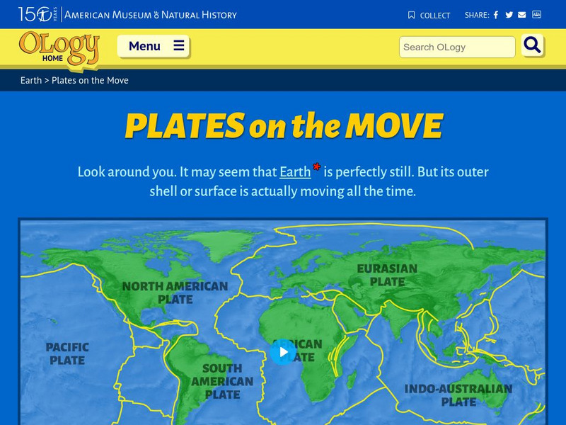
American Museum of Natural History: O Logy: Plates on the Move
Find an interrelated set of tools--maps, animations, diagrams, photographs, and text--to help you understand tectonic plates and how they move.
American Museum of Natural History
American Museum of Natural History: Plates on the Move
Explore how plates move with this interactive site. Students choose locations on the map of Earth to see if the tectonics plate are slipping, spreading, colliding, or subducting.
CK-12 Foundation
Ck 12: Plix: Volcano Map: Oceanic Oceanic Convergent Plate Boundaries
[Free Registration/Login Required] Get an inside look of a subduction zone with the animation on this page. Page includes a interactive animation and a short quiz.
E-learning for Kids
E Learning for Kids: Madagascar: What Are Tectonic Plates and How Are They Moving?
This lesson teaches students about tectonic plates, plate boundaries, and their role in earthquakes and volcanoes.
CK-12 Foundation
Ck 12: Plix: Map for Earth's Tectonic Plates: Earth's Tectonic Plates
[Free Registration/Login Required] Understand what is happening at the plate boundaries with this interactive map of Earth's tectonic plates. This page slso includes a short quiz over plate tectonics.
Curated OER
National Park Service: What on Earth Is Plate Tectonics?
An easy-to-understand explanation of what plate tectonics is. Contains information about the inner parts of the Earth, the difference between the three types of plates, and numerous maps and illustrations.
Extreme Science
Extreme Science: A Lesson in Plate Tectonics
With its clickable map, this site provides text and graphics on spreading boundary, converging boundary, subduction zone, transverse boundaries and faults.
Other
University of Delaware: Plate Tectonics
This site is a very simple overview of plate tectonics. It includes a map of all the major plates and a diagram of the layers of the earth.


