Curated OER
What Do Maps Show?
Students discover the uses for various types of maps. In this geography skills lesson, students discuss the type of maps that exist and what their individual features are. Students then practice using different types of maps.
Curated OER
Introduction to Maps
Students develop their map skills. In this geography lesson, students participate in an activity that requires them to survey their social studies book in order to find different types of maps and purposes for their uses.
Curated OER
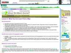
What You Can Learn From a Map
Students discover how to interpret maps. In this geography skills lesson, students explore geographic themes as they complete worksheet activities regarding road maps, shaded relief maps, and topographic maps.
Curated OER
Map Skills
Young scholars examine the nations, battlefields, troop movement of the Germans through Belgium and the location of both fronts during World War I by creating a map. They visualize the strength of the Germans early in the war.
Curated OER
Rivers, Maps, and Math
Students use maps to locate and label the major rivers of North and South America. Using the internet, they identify forests, grasslands, mountain ranges and other landforms on the continents as well. They compare and contrast the...
Curated OER
Ancient River Valley Civilizations
Ziggurats, cuneiform writing, the Tower of Babel, hieroglyphics, pyramids, the Great Wall. Launch a unit on ancient cultures, with a presentation that introduces viewers to ancient Mesopotamia, Babylonia, Sumer, Egypt, Indus, and China....
Curated OER
What You Can Learn From a Map
Students investigate the use of road maps, shadeded relief maps, and topographic maps.
Geography 360°
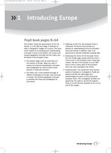
Introducing Europe
Provide your learners with a comprehensive introduction to Europe with this great set of worksheets. Map activities include matching European countries to their capitals and places on a political map, as well as exploring different...
Curated OER
Mapping South America
Students explore South America. In this South American lesson, students use their geography skills to create population, terrain, biomes/vegetation, and major exports maps. Students present their finished maps to their classmates and...
Curated OER
Mapping the Mediasphere
Students compare/contrast the media messages they see in two different communities in their city. They list the elements of art and the principles of design in the photographs they have taken in those two different communities. They...
Curated OER
A Shuttle's Eye View
Students explore the goals of the Shuttle Radar Topography Mission as a springboard to exploring the topographical features of their own state or region. They synthesize their understanding of landforms and topography by mapping their...
Curated OER
Welcome to My World!
Learners use maps to locate information. They read the story, "It Looked Like Spilt Milk", view images of the continents and discuss the various continents. Afterward, they make their own Atlas to record information that they can later...
Curated OER
Geography of Canada
All about Canada! Learners explore the geography and providences of Canada by watching videos, studying maps and conducting internet research. By the end of this lesson, your class should be able to locate major areas and compare and...
Carolina K-12
Who the People? Representative Democracy in North Carolina and Congress
Our elected officials are supposed to represent us, but what does it mean when they aren't like us? Budding citizens explore the demographic makeup of the US Congress, the role of money in political elections, and the Citizens United...
Curated OER
Relief Maps
Students study geographical maps and their functions. In this geography lesson plan students work in groups to build a map to scale.
Curated OER
Silk Roads Big Map
Students create an oversized map from Europe to East Asia. They include information such as Silk Roads, geographical features, major cities and cultural information on their map.
Curated OER
These Maps are for the Birds
Students identify and study New York State Breeding Bird Atlas maps to learn where different bird species nest and how their distributions have changed over time. They also identify how maps serve as representations of a geographic...
Annenberg Foundation
Teaching Geography: Workshop 4—North Africa/Southwest Asia
Can Jerusalem be equitably organized? Can Israel and Palestine be successfully partitioned? Part one of a two-part workshop looks at the geo-political history of Jerusalem while Part two investigates Egypt's dependence of the Nile River...
Curated OER
Maryland’s Chesapeake Bay Landscape Long Ago and Today
Combine a fantastic review of primary source analysis with a study of Captain John Smith's influence on the Chesapeake Bay region in the seventeenth century. Your young historians will use images, a primary source excerpt, and maps...
PBS
The History of Book Banning in America
Harry Potter, Are You There God? It's Me, Margaret, To Kill a Mockingbird. Kids view a slide show and then discuss the seven banned books featured in the presentation and the reasons why the books may have been banned.
Channel Islands Film
The Legendary King
After viewing two documentaries about the history of the Channel islands, individuals craft an essay in which they compare the lives of Juana Maria, the Lone Woman San Nicolar Island, to Lester Holt and his family featured in the...
Curated OER
Overland Trails To The West
Consider the political, physical, and geographical factors that led to and marked the Westward Expansion. Learners will track the various routes developed during the 1800's. They create a first person journal describing what they see,...
Curated OER
Malta: The Landscape
Learners work in small groups to create a topographic map of Malta. They must include labeled line drawings of bordering countries and bodies of water. Students use salt and flour clay to make Malta three dimensional, showing the nearest...
Curated OER
Silk Roads Big Map: A Silk Roads Encounters Project
Students are introduced to the Silk Road and its purpose. Using a map outline, they create an oversized replica of the Silk Road from Europe to Asia. They add political and physical features to the map along with the routes of travelers.


