Hi, what do you want to do?
Curated OER
Little House On The Prarie
Fourth graders focus on the family's journey from Wisconsin to Kansas and their life there among the Indians.
Curated OER
Where is Everybody?#135
Young scholars examine the human uses of school spaces through a variety of activities. They draw the playground during recess and not during recess. They determine how many people use each room at different times before graphing the...
Curated OER
"Czech It Out" - A Look at Eastern Europe
Students research several countries in Eastern Europe. Students compare and contrast several Eastern European countries and then choose a specific country to research and prepare a class presentation with their findings.
Curated OER
The Arctic and Taiga Ecozone of Canada
Students discover the differences in the Arctic and Taiga regions of Canada. They identify physical and human characteristics of both region. They also practice using an atlas.
Curated OER
The Arctic and Taiga Ecozone of Canada
Students examine the various sub-regions of the Arctic and Taiga zones in Canada. Using the online Canadian Atlas, they locate and describe the characteristics of each zone. They organize their information into a chart and share it with...
Curated OER
Geography: Analyzing the Local Environment
Students, in groups, explore the school grounds and organize their findings according to the five themes of geography. They take notes and sketch the grounds. Students divide the school and grounds into regions based on use.
Curated OER
Traveling Along the Indiana Underground Railroad
Students develop a deeper understanding of the role that Indiana played in the Underground Railroad while exploring Indiana Geography.
Curated OER
Got Park? Or if you build it, they will come!
Students use GIS and GPS technology to evaluate, research, locate, and recommend where a new park should be located that benefit the community.
Curated OER
East to West: Africa's Influence on Mexico
Your historians and social anthropologists study the relationship between peoples of ancient Africa and ancient Mesoamerica. They relate in written or verbal form the African presence in the ancient Americas. They create their own...
Curated OER
Immigration Push and Pull Factors
Eighth graders examine significant ideas, beliefs, and themes; organize patterns and events; and analyze how individuals and societies have changed over time in Maryland, the United States, and the world.
Curated OER
Manassas National Battlefield Park
Students complete a variety of activities that go along with the study of and possible fieldtrip to Manassas National Battlefield Park in Virginia.
Curated OER
Native Americans
Students, in groups, research various Native American tribes. They wirte a report about the tribe which includes information about their food and ceremonies, among other things. They create a diorama and a poster that shows how they...
Curated OER
Learning Strategies
Students develop critical thinking skills using questions exploring the Canadian Parliamentary system. The duties of a modern democracy are investigated.
Curated OER
If You Mess With A Wetland, At Least Try to Make Amends!
Eighth graders examine the role of wetlands in an ecosystem. In groups, they use the internet to research how humans have disturbed and ruined the effectiveness of wetlands throughout the country. They pretend they are in charge of...
Curated OER
A Canadian Inventory: The Way We Are!
Students use the Canadian Atlas to discover an inventory of Canada's wealth and usage of resources. Using charts and graphs, they produce a wall of selected data of importance to the country and identify one issue of sustainability. ...
Curated OER
Average Vehicle Occupancy In Your Community
Students determine the average vehicle occupancy in their community. For this transportation lesson students develop and analyze a survey to determine attitudes towards air pollution and transportation.
Association of Religion Data Archives
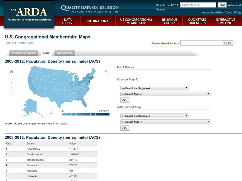
Association of Religion Data Archives: u.s. Population Density Map
Interactive tool that lets you choose a map (Census or Religion), then choose demographic or religious profiles to create a slideshow.
National Geographic
National Geographic: Population Density in the United States
Several factors contribute to the population trends across the United States. This lesson will explore maps to discover and understand these trends.
Geographypods
Geographypods: Theme 1: Population and Settlement
A rich collection of highly engaging learning modules on topics related to population and settlement. Covers six main areas - population growth, population change, population migration, land use, settlement characteristics and patterns,...
Other
Canada: Thematic Maps
At this site find examples of thematic maps from the Canadian census. "A thematic map shows the spatial distribution of one or more specific data themes for standard geographic areas."
Curated OER
Etc: Maps Etc: Population Distributions in Africa, 1920
A map from 1920 of Africa and Madagascar showing the population distribution in the region, keyed to show densities ranging from under 2 persons per square mile to over 250 persons per square mile.
Curated OER
Etc: Maps Etc: Population Distributions in Asia , 1920
A map from 1920 showing the population distributions in Asia.
Columbia University
Nasa: Sedac: Urbanization and Human Settlements
[Free Registration/Login Required] A collection of twenty data sets from SEDAC (Socioeconomic Data and Applications Center) that examine urbanization in major metropolitan areas of the United States in the late 20th and the early 21st...
Curated OER
Etc: Maps Etc: Population Distribution of China, 1971
A map from 1971 showing comparative population distribution patterns of China and the United States. The map illustrates the terrain barriers to population development in China, and the trend to dense populations along the coast and...


