Curated OER
CLIL: A Lesson Plan
Students explore Vancouver. In this Vancouver geography and English language building instructional activity, students brainstorm what they know about Vancouver and predict what their text will cover. Students listen to the informational...
Curated OER
Mapping Districts
Students use maps to learn about the U.S. Census. In this 2010 Census lesson plan, students visualize census data on maps, use map keys to read population maps, and explore the concept of population density.
Curated OER
Lesson 2: Mapping Sub-districts
Learners learn more about the census. For this mapping sub-districts lesson plan, students visualize census data on a map, use a map key to read a population map, and better understand the concept of population density.
Curated OER
Mapping Districts
Pupils become literate in their use of maps. In this 2010 Census lesson plan, students visualize census data on maps, use map keys to read population maps, and explore the concept of population density.
Curated OER
European Climates
Ninth graders study the climate regions of Europe. In this geography skills lesson, 9th graders determine how weather and climate are influenced as they research the climate zones of specific locations and write about the ways that...
Curated OER
Create Your Own Country!
Students create their own countries. In this geography skills lesson, students establish governments, cultural backgrounds, atlas/geography components, national anthems, and national symbols for a country they create.
Curated OER
Famous Rivers Quiz
In this online interactive geography activity, students examine the descriptions of 16 famous rivers and identify them by name within 3 minutes.
Curated OER
Where in the World is Utah Wheat?
Students examine the role of climate and landforms in the use of Utah's land. In this geography lesson, students analyze the relationship between geography and agriculture in the state as they examine data regarding wheat production in...
Curated OER
RACED Comprehension Sheet
In this race worksheet, high schoolers respond to 10 short answer questions regarding geography concepts that feature the letters of the word "raced" as mnemonic hooks.
Curated OER
Geographic Terms Glossary
In this geography worksheet, students learn 60 common geographic terms. Students read the words that are arranged in alphabetical order along with the meanings. There are no questions to answer; this is a glossary.
Curated OER
India: Ten Minute Quiz
In this India instructional activity, learners respond to 7 fill in the blank, 4 true or false, 8 short answer, 4 matching, and 2 multiple choice questions about the geography and culture of the country.
Curated OER
Geography of the Study of the Spanish-speaking People of Texas
Students identify the physical features, demographic characteristics, and history of the four Texas towns featured in Russell Lee's photo essay, "The Spanish-Speaking People of Texas." They conduct Internet research, and create a travel...
Curated OER
Using Local Geography to Make Maps
Learners research, create, and present a scale representation of the county in which they live.
Curated OER
Geography: Water, Water Everywhere
Students discuss flooding and its causes. They view a Powerpoint presentation about floods and prevention methods. After creating a model with clay and pans, they investigate river behavior in various terrains with different amounts of...
Curated OER
Diversity Geography
Students research another country and its people. In this diversity lesson, students work in groups to research an assigned country and develop a short oral report. Students use diversity beans to represent the people of...
Curated OER
Japan
Introduce your class to the beauty, population, architecture, and special places of Japan. They'll learn about the currency, the weather, and how Japan is different or similar to New Zealand. Note: While this presentation makes...
Curated OER
Who We Are: To Know the Characteristics of a Population Within Certain Domains
Students, through research, discover the characteristics of the population of Quebec and compare them to those of Canada as a whole. They create a class presentation about information they found.
Curated OER
Studies of the Eastern Worlds: Population Graphing
Seventh graders participate in several learning/research stations in which they view artwork from various countries of the Eastern world and collect information on the populations of the Eastern countries. They then use this information...
Curated OER
Geography: Analyzing the Local Environment
Students, in groups, explore the school grounds and organize their findings according to the five themes of geography. They take notes and sketch the grounds. Students divide the school and grounds into regions based on use.
Curated OER
Population Changes in U.S. Cities
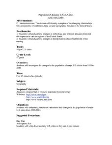
Students investigate the changes in the population of major U.S. cities from 1920 to 2003. They write down as many U.S. cities as they can in one minute. Students discuss the top five cities on their lists and they disucss why there are...
Curated OER
Geography of Korea
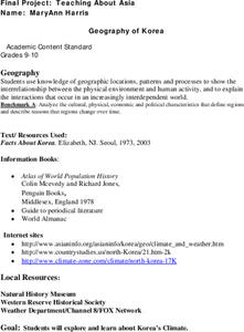
Students are introduced to the geography of Korea. Using the internet, they identify the weather and climate in the country and create a week weather chart for Korea's four seasons. They complete an interview with a local weatherman...
Curated OER
Cultural Geography
In this Cultural Geography worksheet, students fill in answers to ten questions about cultural factors such as language and religion without using a word bank.
Curated OER
The Cultural Geography of Australia, Oceania, and Antarctica
Students use information from the Australian Department of Immigration and Multicultural Affairs Web site to explore multiculturalism and immigration in Australia. They create graphs and charts from immigration data.
Curated OER
Africa Puzzle
In this geography instructional activity, students complete a crossword puzzle about Africa. They identify the capitals of various countries located in Africa, the most fertile area, the largest desert, and the longest river. There are...
Other popular searches
- Population Geography Graph
- Population Geography Map
- Geography Population Density
- Geography World Population
- Population Geography Factors
- Population Geography Data
- Population Geography Brazil
- Geography Population
- Geography Italy Population
- Geography Population Change
- Population Geography India
- World Geography Population


