Curated OER
Population and Productivity: Two P's in a Pod
Students investigate the link between countries' population growth rates and levels of industrialization. They observe that, over time, as a country becomes more industrialized, its population growth rate decreases.
Curated OER
Geography Lesson 1
Students examine relationship between population centers and sports teams, explore influence of weather on attendance, and research influence of geography, traffic flow and disposable income on site selection for sports stadiums.
Curated OER
Population and Air Pollution
Students conduct Internet research to compare the impact of increasing populations and how it affects air pollution in both, the USA and Russia. Students present their finding in a creative manner by developing brochures, bumper...
Curated OER
These Maps are for the Birds
Students identify and study New York State Breeding Bird Atlas maps to learn where different bird species nest and how their distributions have changed over time. They also identify how maps serve as representations of a geographic...
Curated OER
Charts, Maps, and Graphs Lesson on the Holocaust
Young scholars practice interpreting data. In this Holocaust lesson, students research selected Internet sources and examine charts, maps, and graphs regarding the Jewish populations in and out of Europe. Young scholars respond to...
Curated OER
The Geography of Africa
Hop a flight to Africa in this presentation, which includes brilliant and appealing photographs of the continent as well as maps and graphs about its geography, topography, and climate. Those who are researching Africa for a project or...
Curated OER
Mapping South America
Students explore South America. In this South American lesson, students use their geography skills to create population, terrain, biomes/vegetation, and major exports maps. Students present their finished maps to their classmates and...
Curated OER
European Elevation Sort
Given a prepared database of European countries, sixth graders sort the countries in ascending order by elevation and identify the five countries with the highest elevations. This cross-curricular lesson combines elements of computer...
Curated OER
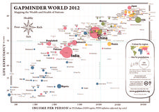
Gapminder World 2012
Here is a very interesting infographic that compares the average life expectancies, per capita incomes, and population sizes of every country in the world in 2012.
Curated OER
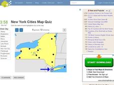
New York Cities Map Quiz
In this online interactive geography activity, students examine a map of New York and identify the 11 noted cities on the map using a pull down menu within 3 minutes.
Curated OER
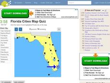
Florida Cities Map Quiz
In this online interactive geography instructional activity, students examine a map of Florida and identify the 12 noted cities on the map using a pull down menu within 3 minutes.
Curated OER
Texas Cities Map Quiz
In this online interactive geography worksheet, students examine a map of Texas and identify the 15 noted cities on the map using a pull down menu within 3 minutes.
Curated OER
4th Grade Geography Multiple Choice
In this grade 4 geography worksheet, 4th graders complete a total of 25 multiple choice questions relating to 4th grade geography concepts. An answer key is provided.
Curated OER
South America Map Quiz
In this online interactive geography quiz worksheet, students examine the map that includes all of South America's countries. Students identify the 13 countries in 2 minutes.
Curated OER
Middle East Map Quiz
For this online interactive geography quiz worksheet, students examine the map that includes 26 Middle Eastern countries. Students identify the names of the countries in 4 minutes.
Curated OER
Central America Map Quiz
In this online interactive geography quiz learning exercise, learners examine the map that includes 22 Central American countries. Students identify the names of the countries in 3 minutes.
Curated OER
California Cities Map Quiz
In this online interactive geography quiz worksheet, students examine the map that includes 12 California cities. Students identify the names of the cities in 3 minutes.
Curated OER
Canada Map Quiz
For this online interactive geography quiz worksheet, students examine the map that includes 13 Canadian provinces and territories. Students identify the names of the provinces and territories in 2...
Curated OER
Geography/Current Events Project
Using the Balkan region as an example, fourth graders review the five themes of geography as a class. They identify the physical and human characteristics of a region before labeling the countries and landforms on a map. They then...
Curated OER
How Big is Big?
Geography learners compare and contrast population densities throughout the world. Using maps, they estimate the relative size of the world's regions and populations. They develop analogies to discover the world they live in and...
Sharp School
Geography Project
This very simple geography project can lead to a lot of useful referential information that can be displayed in your classroom! Learners construct a poster-size map of a country, identifying major demographic points and including pie/bar...
Curated OER
Geography of the United States
Students examine the population growth of the United States. In this Geography lesson, students construct a map of the fifty states. Students create a graph of the population of the USA.
Curated OER
A Look at the Population Density of the United States
Students acquire census information and create maps of the population density of the United States on different scales. They role play the roles of workers of a retail company and they use the population data to market to their customers.
Curated OER
Race and Ethnicity in the United States
Students explore race and ethnicity as it is defined by the U. S. Census Bureau. They compare data from 1900, 1950, and 2000 and identify settlement patterns and changes in population. In groups, they map these changes and discuss...
