Curated OER
Rural Communities
Third graders observe various pictures of rural communities and explain what they see in each of the pictures. They discuss what they believe a rural community is and write their ideas on the board, discover its defintion, and share...
Curated OER
Communicate with a Truck Driver
Sixth graders explore the life of a truck driver. In this transportation lesson, 6th graders map the route that a truck driver may take, communicate with a truck driver, and explore anticipated delivery time of goods that travel on a truck.
Curated OER
Distance Formula
Students determine the distance between two points. In this distance formula lesson plan, groups of students determine the distance between points in real life situations. They calculate the distance from one point in...
Curated OER
Give Me a B: North Dakota Quarter Reverse
Students examine the North Dakota quarter reverse and note the bison. and Badlands displayed on it. After practicing as a group making the B sound, they explore the classrom for more words beginning with that letter. Working in pairs,...
Curated OER
Where Is Hoku?
Students are introduced to map making and reading. Using maps, they identify the cardinal directions and discuss the importance of a legend. They analyze the human characteristics of the classroom and create overhead view maps of the...
Curated OER
Over, Under, In, and Out
Pupils investigate the concept of coin design. They look at the inscriptions found on coins by handling them in class. The design is found in the state of West Virginia. The objects pictured on the coin are described by students and...
Curated OER
Environment: Going Places
First graders learn directional words and apply this skill to map making. They record their steps on paper.
Curated OER
Fundamentalism
Eighth graders explore the historical roots of fundamentalism and determine whether fundamentalism is a religion or a political ideology. They will examine different religious fundamentalist movements around the world noting any...
Curated OER
Globe Lesson 13 - When the Day Changes
Young scholars explore the patterns of day and night. In this geography skills lesson, students read brief selections and examine diagrams that note the transition of day and night around the world. Young scholars respond to the...
Curated OER
Earth Viewer
Pupils explore the Earth. In this space lesson, students view the " Earth and Moon Viewer" web site and complete a related worksheet.
Curated OER
Traveling the Transcontinental from Yesterday to Today
Students examine the impact of the train on the physical landscape and spatial organization of America. They read and analyze various poems, analyze maps, and develop a list of the positive and negative changes brought by the...
Curated OER
Lost Illinois History
Students discuss "The Trail of Tears," why it happened, what it is, and where it began and ended. They work in groups to complete a reading section and answer a series of questions then share the answers with the class. Students take a...
Curated OER
Meteor Showers!
Learners read a story called Orionid Meteors to Shower Earth and answer vocabulary and comprehension questions about it. In this meteor shower lesson plan, students respond to literature by answering questions, view Sky Maps online, and...
Curated OER
Making a Globe
Students examine the mercator projection or nautical chart and observe how global maps do not have the same distance as flat maps. They design handmade globes using the meridians and equator as guides to draw in the land. They paint and...
Curated OER
The Heartland
Students note how personal perceptions influence the understanding of what a region. They look at an agricultural map of what is considered to be the Heartland of the US. They read the words to George Strait's, America's Heartland to see...
Curated OER
Oak Ridges Moraine: Southern Ontario's Sponge
Students examine the characteristics of the Oak Ridge Moraine in Canada. Using a map, the locate the moraine and present and defend a position on how the resources found there should be used. They must use proper geography terminology...
Curated OER
Can You Give Me Directions To the Game?
Students become familiar with the use and capabilities of GIS and use it for research and mapping purposes. They heighten their ability to estimate travel times by incorporating distance, mode of travel and urban congestion into the...
Curated OER
Focused Learning Lesson: World Geography
Students examine the impact that humans have had on the environment and the difficulties the environment can cause. They also examine major physical changes as a result of human action or natural causes.
Curated OER
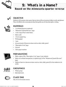
What's in a Name?
Students examine state names that are derived from American Indian words and phrases. They effectively communicate ideas through the use of clear descriptive writing. The reverse of the Montana Quarter is used as inspiration for this...
Curated OER
Math: Road Trip
Twelfth graders use road maps to calculate the distance between two locations. They estimate the cost for fuel and the miles per gallon. They consider other factors such as geography, road conditions, and traffic that may impact the cost.
Curated OER
Rain and Our Environment
First graders understand the importance of rain in our environment by writing a sentence about something in existence that would cease to be without rain. They use describing words to describe the living thing's color and draw and color...
Curated OER
Passport to Literacy
Third graders discuss with their partners what they would need to pack for an international trip and share their brainstormed ideas with the class making a web map. They then write paragraph detailing what they should take on the trip...
Curated OER
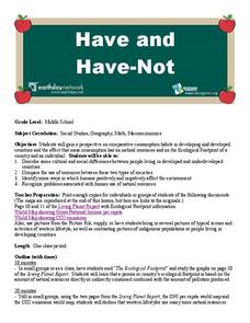
Environment: The Haves and the Have Nots
Students examine consumption habits in developed and developing countries and determine their effects on natural resources. In groups, they assess graphs on the Living Planet Report and observe the connection between consumption and...
Curated OER
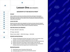
Geography of the Wasatch Front
Students identify the three main types of urban environments by learning characteristic land-cover types. They examine and analyze a thermal image of Salt Lake City. Then they predict surface and air temperatures from aerial photos.

