Curated OER
My Heritage Country Report
Students list five food dishes that are part of their family's heritage. Each student then does research of a country and a recipe (possibly a family recipe). With the help of members of his/her kitchen group, the student prepares the dish.
Curated OER
Passport to the Eastern Hemisphere
Seventh graders create a time line of significant dates in the history of their nation. This requires students to examine the entire history of a country and make informed judgments based on their historical knowledge.
Curated OER
Cinderbank
Fourth graders identify major components of a "Cinderella" story in order to create a database.
Curated OER
Geography: Analyzing the Local Environment
Students, in groups, explore the school grounds and organize their findings according to the five themes of geography. They take notes and sketch the grounds. Students divide the school and grounds into regions based on use.
Curated OER
Different Perspectives of Oregon's Forest Economic Geography
Pupils locate the many forests located in Oregon. In groups, they use the internet to research employment data on wood products made in the state. They discuss how looking at information presented in a different way can change their...
Curated OER
Mapping My Trip to the 2002 Winter Olympics!
Eighth graders map their route from their local community to Salt Lake City, Utah for the Winter Olympics. Using atlases, they gather topographical information and use the internet to research any landmarks they might pass on the way....
Curated OER
The Study of the Spanish-Speaking People of Texas: Understanding Primary Sources
High schoolers analyze Russell Lee's photo essay as a sign of segregation in Texas. They consider the differences between primary and secondary sources and how historians use these sources.
Curated OER
Surface Water Supplies And The Texas Settlements
Students engage in a lesson that is concerned with the allocation and finding of water resources. The location of different settlement areas is considered as one looks how the water is distributed. They map some of the early Spanish and...
Curated OER
Questions for Today: Communities
Students discover how questionnaires help communities to determine the needs of its citizens. They make an analogy between a survey of students about their school and a survey of citizens about their community.
Curated OER
The Four Seasons with "Charlotte's Web"
Students explore the characters and plot of the story, "Charlotte's Web" through the twenty-two lessons of this unit. Characters, facts, and details of the story are recalled and discussed and form the basis of several activities in this...
Curated OER
Water, Water Everywhere
Pupils are introduced to the complex issues of water resources around the globe. In groups, they take on the role of a country and map out the location of water sources. They barter, sell or take over other groups to have access to more...
Curated OER
GIS and Agriculture
Students are introduced GIS systems and how they operate. Using a GIS system, they locate and map the various types of agricultural products grown in Oregon. They rank each county based on the amount of agricultural products produced and...
Curated OER
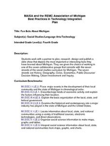
Michigan Fun Facts
Fourth graders work with a partner to plan, rese,a rch design and publish a
slide show that depicts the most important or interesting facts they
have learned about Michigan. They are given the choice of working in
one of the seven...
Curated OER
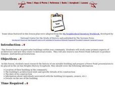
Presenting Your Community
Students research the history of a notable building and prepare a Power Point presentation to be used on the online scrapbook. They research the location of the building in the community, the architectural style and the date of...
Curated OER
Characteristics of Lift and Wing Area
Students use FoilSim to complete the activity and investigate the factors that affect lift and how wing area and lift are related.
Curated OER
Making Sense of the Census
In this unit of lessons, students make sense of the Census. They examine why a census is taken and participate in activities.
Curated OER
Saskatchewan's Population Distribution
Students explore landforms, vegetation, climate and population distribution in Saskatchewan. After discussing an atlas of Saskatchewan, students create their own relief map and climagraphs of Saskathewan. Using specified websistes,...
Curated OER
The Research Paper - Searching for a Subject
Students research a website to look for potential topics for a research paper. They develop a narrowed prioritized subject list on an index card (3X5) using word processing program.
Curated OER
Lewis and Clark
Ninth graders study the plants and animals Lewis and Clark discovered on their expedition. There is a plant illustrator, a plant recorder, an animal illustrator, and an animal recorder. They research the plants and animals and the ...
Curated OER
Exploring the Landscape
Students determine the monotonicity and concavity properties of a function, then apply the First Derivative Test and draw conclusions about the first and second derivatives from these properties.
Curated OER
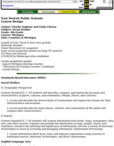
Counties of Michigan
Fourth graders complete an atlas worksheet to become familiar with the types of information found in an atlas.
Curated OER
Pythagorean Theorem Proof
Tenth graders investigate the Pythagorean Theorem. Then they type up a formal paragraph proof of a proof of their choice.
Curated OER
Mapping My Community
Ninth graders are introduced to GPS technology. They complete fieldwork as they visit a specific area of their community to identify and map types of land use in the surveyed area. They use the collected data to create a digital map.
Curated OER
Skills You Need to Succeed
Middle schoolers identify basic skills needed to succeed in the world of work, including communication skills, computation skills, problem solving skills, and interpersonal skills.
