State Library of North Carolina
N Cpedia: Our State Geography in a Snap: Three Regions Overview
Reprinted with permission from the North Carolina Department of Public Instruction, this resource provides maps of North Carolina regions by county.
Other
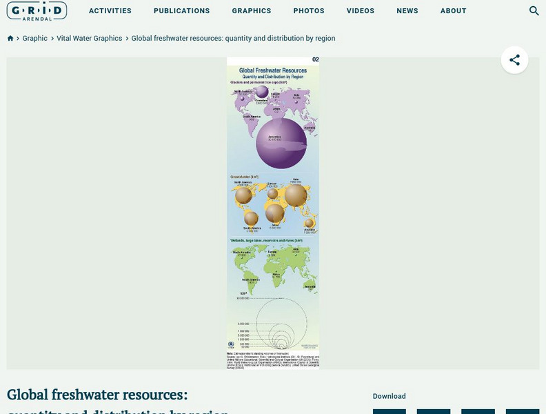
Grid Adrenal: Global Freshwater Resources: Quantity and Distribution by Region
Glaciers and icecaps contain approximately 70% of the world's freshwater, but groundwater is by far the most abundant and readily available source of freshwater. This graphic illustrates the quantity (in cubic kilometres) and...
Columbia University
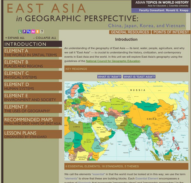
Columbia University: Asia for Educators: East Asia in Geographic Perspective
This teacher resource is devoted to teaching about the geographic history of East Asia. Includes standards information and links to related lesson plans. Also features a downloadable world map (PDF, requires Adobe Reader).
Other
New Mexico State University: Metamorphism and Metamorphic Rocks [Pdf]
A PowerPoint slideshow converted to a PDF, with six slides per page. It explains what metamorphism is, the distribution of metamorphic rocks, the agents of metamorphism, the types of metamorphism, metamorphic grades or degrees, how...
Other
Congo Geography
This site offers a geographical overview of Congo. An interactive map allows to explore different regions of Congo. You may also take the quiz to test your knowledge on Congo.
Curated OER
Etc: Maps Etc: Mineral Regions of the United States, 1910
A map from 1910 of the United States showing the regions of mineral resources. The map is keyed to show areas of gas and petroleum resources, gold and silver deposits, and copper deposits.
Curated OER
Etc: Maps Etc: Railways and Economic Regions of South America, 1911
A map from 1911 of South America showing the primary railways, navigable rivers, and local economic resources. The map is keyed to show regions of coffee, cocoa, rubber, wool and mutton production, cattle breeding, and silver mining,...
Khan Academy
Khan Academy: Activity: Comparing Crops
Take a closer look at some of the earliest farming civilizations and the plants and animals they domesticated. This quick exercise using the Agriculture and Civilization Infographic has you consider the regional differences in...
Other
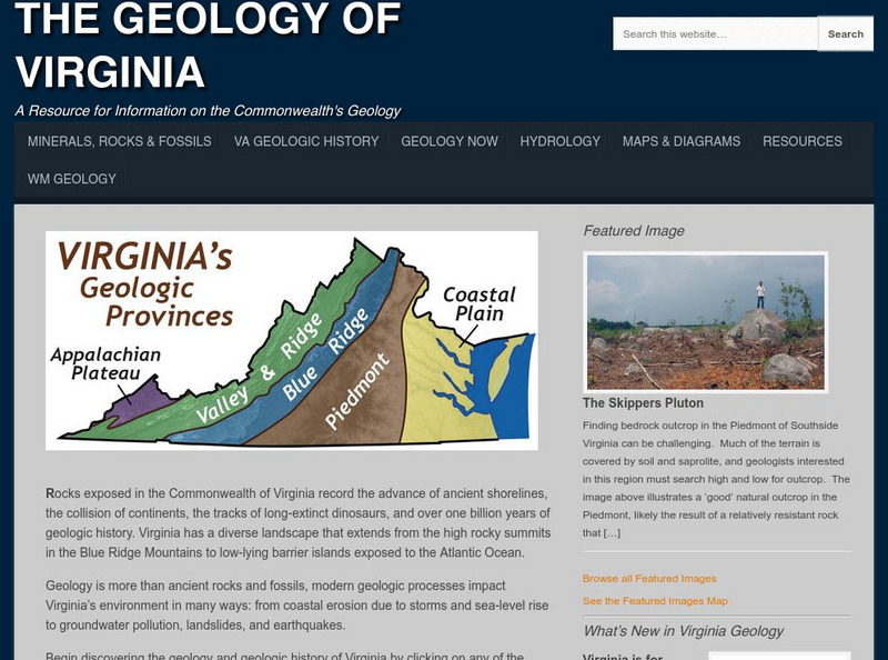
College of William and Mary: The Geology of Virginia
Information about the land forms of Virginia. Explore each region of the state and read about the ancient shorelines, active volcanoes, colliding continents, and dinosaur fossils.
Google
Google Maps: Grand Canyon, Usa
Explore the views of the Grand Canyon. This resource uses the Street View Trekker, a wearable backpack system that allows us to venture to locations only accessible by foot. It showcases areas of the Grand Canyon that otherwise would be...
PBS
Pbs Learning Media: Link Between Arctic Sea Ice and Solar Radiation Absorbed
The Arctic plays an important role in regulating Earth's climate. The region reflects much of the Sun's energy and helps keep the planet cool. Data collected by NASA have revealed that sea ice in the Arctic has steadily declined over the...
PBS
Pbs Learning Media: Albedo Decrease Linked to Vanishing Arctic Sea Ice
Examine this visualization by NASA to understand how the warming of the Arctic region has caused the sea ice extent to decline by 40%, thereby throwing our earth's energy budget off balance. Extensive resources included are teaching...
PBS
Pbs: The Story of India: Map of India
PBS explores India through a detailed map of India and its surrounding countries. Provides details on the location of the country. Identifies important waterways, regions within country, major cities, and mountain ranges.
Other
Didactalia: Mapas Interactivos: Capitals of Asia
An interactive map of Asia for practice in recognizing the capitals of the region. The activity is available in multiple languages.
University of Michigan
University of Michigan: The Great Lakes: An Environmental History [Pdf]
The University of Michigan provides a PowerPoint presentation on the environmental history of the Great Lakes. Provides aerial shots of the Great Lakes from a satellite, various geographical maps over the Great Lake Region, and pictures...
Curated OER
Native American Indian Resources: Native American Housing Styles
A color map and explanation of the various types of Native American house construction in each region of North America.
Curated OER
Native American Indian Resources: Native American Housing Styles
A color map and explanation of the various types of Native American house construction in each region of North America.
Curated OER
Native American Indian Resources: Native American Housing Styles
A color map and explanation of the various types of Native American house construction in each region of North America.
Curated OER
Native American Indian Resources: Native American Housing Styles
A color map and explanation of the various types of Native American house construction in each region of North America.
Other
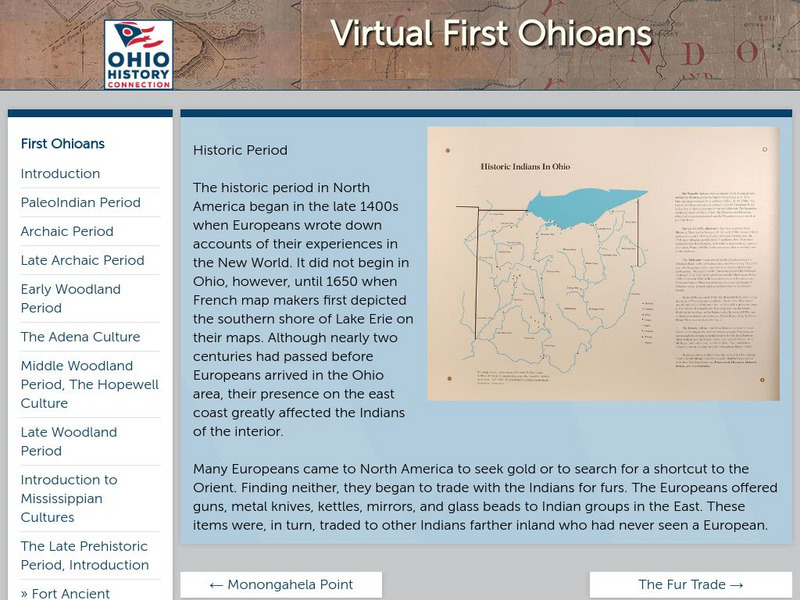
Ohio Historical Society: Historic Period
Enter the Europeans into the woods and plains of central North America. How did this effect the people that were here already? Who was here, and what happened when worlds collide? Click on the thumbnail images for more information on the...
Metropolitan Museum of Art
Metropolitan Museum of Art: Heilbrunn Timeline of Art History
Interactive timeline of art history which can be searched either by geographical region or time period, provides viewers with a comprehensive chronological resource of genre and the art world.
Other
Thailand Photo Gallery
In this gallery there are over 540 photos depicting the people, culture, geography, and architecture of Thailand.
Curated OER
Educational Technology Clearinghouse: Maps Etc: Northeast China, 1971
"Northeast China - the provinces of Heilungkiang, Kirin, and Liaoning - is the most important region of the country and a nationally significant and still-developing center of agricultural production. Most of the Northeast remained...
Curated OER
Educational Technology Clearinghouse: Maps Etc: Asia (Physical), 1868
A map from 1868 of Asia showing physical features and natural resources of the region. The map shows political boundaries of the time, with capitals, major cities, and ports. The map shows mountain systems with black lines of variable...


