Other
Office of Minority Health: Hispanics in the United States
Discusses Hispanics in the United States and their group characteristics. Includes information on the following: size of group and distribution, ethnic composition and historical settlement patterns, nomenclature, major stereotypes about...
ArtsNow
Arts Now Learning: Dance Across the United States of America [Pdf]
These activities will allow students to become explorers and travel across the United States to encounter a variety of land forms. Students will create a story about their trek and then create choreography to match the sequence generated...
A&E Television
History.com: The States
Learn unique facts about each American state. You can also read a more in-depth history of each state, watch videos and play a game about all the states.
Annenberg Foundation
Annenberg Learner: United States History Map: 50 States
Read about the regions of the United States, find the states in those regions on maps, and play a game to locate the states. A great interactive review.
Other
Office of the United States Trade Representative
Explore this site and learn about the inner workings of the Office of the United States Trade Representatives. Use this site to view the hot topics in Trade negotiations around the world.
Other
Usaca: The United States of America Cricket Association
Learn about cricket in the United States. This website provides information on upcoming matches, player profiles, regional clubs, rules and player eligibility, and more.
Other
Earth Journalism Network: Climate Commons
A unique interactive tool that embeds news articles and information about climate change into a map of the United States. Users are able to explore what the impact of climate change at a local, regional or national level, as well as...
PurposeGames
Purpose Games: 50 Most Populous Cities in the Us
Interactive tests players knowledge of the location of the 49 more populous cities in the United States.
ClassFlow
Class Flow: Northeastern Region of the United States
[Free Registration/Login Required] Seven interesting video clips allow the students success in assessing their knowledge of the Northeastern Region of the United States. Students interact with matching capitols to their respective states...
Smithsonian Institution
National Museum of American History: Transportation in America Before 1876
In 1800, the United States was made up of 16 states, all east of the Appalachians, and most people lived within 50 miles of the Atlantic. Oceans and rivers were the nations' highways, providing the only viable way to travel long...
Central Intelligence Agency
Cia: World Factbook: Regional and World Maps
Maps of major areas of the world can be downloaded here. The maps have excellent detail and are in color.
US Department of Labor
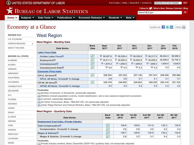
Bureau of Labor Statistics: West Region
The Bureau of Labor Statistics site provides Labor Market data, Consumer Price Index, and Employment Cost Index for the Western Region of the United States.
Other
360 geographics.com
Visit hundreds of panoramas across the United States and Canada. Click on a region and a state or province for a listing of panoramas. Quick Time must be installed in order to use the site.
University of Groningen
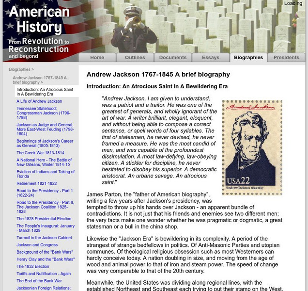
American History: Biographies:andrew Jackson Altrocious Saint in Bewildering Era
Here, read a summary of the life and career of Andrew Jackson, the 7th U.S. President. Part of a larger site about Andrew Jackson's presidency.
ClassFlow
Class Flow: The Southeast Region
[Free Registration/Login Required] This flipchart, created for third grade students studying the various regions of the United States, contains information and Internet links for each state in the southeast region. A crossword puzzle...
University of Groningen
American History: Outlines: The Bank Fight
Although the nullification crisis possessed the seeds of civil war, it was not as critical a political issue as a bitter struggle over the continued existence of the nation's central bank, the second Bank of the United States. The first...
New York Times
New York Times: International
[Free Registration/Login Required] The New York Times is an internationally recognized daily newspaper published in New York City, New York. Content of the international section includes top news and issues from around the world, special...
Curated OER
Etc: Maps Etc: United States Forest Regions, 1901
A map from 1901 of the United States showing the forest regions, coded to show heavily forested and moderately forested areas. Areas of typical forest types are shown, including pine and hardwoods, spruce, birch, and maple in the...
Curated OER
Etc: Maps Etc: Forest Regions of the United States, 1904
A map from 1904 of the United States showing the principal forest regions, including the forests of Alaska.
Curated OER
Etc: Maps Etc: Forest Regions of the United States, 1906
A map from 1906 of the United States showing the principal forest regions, including the forests of Alaska.
Curated OER
Etc: Maps Etc: Forest Planting Regions in the United States, 1919
A map from 19169 of the United States showing the forest planting regions of the United States. The un-shaded areas are treeless except along the streams (riparian).
Curated OER
Etc: Maps Etc: United States Economic Regions, 1900
A map from 1912 of the United States showing the principal industries of the region. The map is color-coded to show the areas of fishing grounds, industrial centers, coal mining areas, petroleum fields, and iron ore fields. This map...
Curated OER
Etc: Maps Etc: Forest Regions of the United States, 1911
A map from 1911 of the United States (from the U.
Curated OER
Etc: Maps Etc: Coal and Iron Deposits in the United States, 1910
A map from 1910 of the contiguous United States showing the regions of iron coal deposits. The map is keyed to show deposits of iron ore, lignite coal, bituminous coal, and anthracite coal in the region.

![Arts Now Learning: Dance Across the United States of America [Pdf] Lesson Plan Arts Now Learning: Dance Across the United States of America [Pdf] Lesson Plan](https://d15y2dacu3jp90.cloudfront.net/images/attachment_defaults/resource/large/FPO-knovation.png)


