Space Awareness
Let's Map the Earth
Before maps went mobile, people actually had to learn how to read maps. Pupils look at map elements in order to understand how to read them and locate specific locations. Finally, young cartographers discover how to make aerial maps.
Curated OER
Maps
If your students are just starting a unit on Geography this could be the introduction you're looking for. This PowerPoint presents a clear and organized overview of the different types of maps people use and why each is important. Tip:...
Curated OER
What Do Maps Show?: Lesson 1 Introduction to Maps
Students brainstorm a list of the different types of maps they have seen or used. Using the activity sheet, they look through a social studies book to find all the maps and to determine what they are used for. Using a poster, they review...
Seterra
Northern Europe: Countries - Map Quiz Game
Remembering geography is a tiring and tedious task to many scholars. Change it up by assigning the map quiz game. Elementary and middle schoolers alike test their knowledge and compete with the clock to match as many countries as...
Curated OER
Introduction To Topographic Map Activities
Students discuss different types of maps, their similarities and differences. Using a Topographical Maps CD-rom program students create their own map.
Curated OER
Maps! Maps! Maps!
Third graders examine and identify different types of maps. They review the types of projections and which maps are better for different information. They answer comprehension questions at the end of the lesson.
Curated OER
Walking on Maps
Students are introduced to the various types of maps and their functions. As a class, they play a game similar to twister to review map concepts. They answer questions about the map and use the internet to view larger maps of the world.
Curated OER
Waldseemuller's Map: World 1507
Students investigate the 1507 word map. In this world geography lesson, students examine the details of each section of the map and then draw conclusions about how the people of 1507 understood the world. Students are evalated on...
Curated OER
Waldseemüller’s Map: World 1507
Students take a closer look at historical maps. In this primary source analysis lesson, students examine the first world map produced by Martin Waldseemuller. Students complete the included map analysis worksheet and then write letters...
Devine Educational Consultancy Services
Geography Student Workbook, Australia
Your youngsters will be experts on the geography of Australia after working with these activities and worksheets, which review the continent's weather, major landforms, dimensions, history, and climate.
Curated OER
Surveying the Land
Students explore the different kinds of maps and the purpose of each. In this Geography lesson, students work in small groups to create a map which includes the use of a map key.
Curated OER
Growth of Florida's Railroads
Based on an examination of Florida's railroad system, this multi-step lesson addresses FCAT requirements specific to Florida. After reading a passage, scholars use a map of the state to label railroad systems. They describe the goods...
Curated OER
Where in the Latitude Are You? A Longitude Here.
Students distinguish between latitude and longitude on the map. In this mapping lesson, students participate in mapping skills to recognize spatial relationships, and where to find natural resources on the map. Students create their own...
Curated OER
Time Zones
Students solve time zone problems and chart travel around the world. In this time zone instructional activity, students learn about the history of time zones and view a time zone map. Students use the time zone map to solve time zone...
Curated OER
Lewis and Clark
Fifth graders use the Internet to research a topic. In this expeditions lesson, 5th graders answer questions about Lewis and Clark based on the movie they watched previously, use the Internet to research Lewis and Clark, write a journal...
Curated OER
Resources of Indiana
Fourth graders examine the resources of Indiana and how they are used to produce goods. In this resources of Indiana instructional activity, 4th graders explore historical periods in Indiana as they relate to its resources. Students...
Curated OER
Waldseemuller's Map: World 1507
Seventh graders analyze various maps. In this Geography instructional activity, 7th graders create a large map as a whole class. Students write a letter to Mr. Waldseemuller.
Curated OER
America Will Be
High schoolers work together to research and create different types of maps of the United States to be used as part of a geography trivia game.Groups research North American annual rainfall, climate, mountain ranges major rivers and...
Curated OER
Introduction to WorldWatcher: Coloring Temperature Maps
Young scholars are introduced to the software program WorldWatcher. In groups, they discover the temperature variations throughout the world and color a map according to the temperatures. They also practice using visualization to...
Aurora Trust
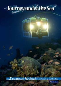
Journey Under the Sea
Discover the interesting world of maritime archaeology and explorations under the sea with this nice set of worksheets, which cover such topics as search tools and techniques of underwater archaeology, carbon dating, vessel types, and...
Curated OER
A Place Called Fairfax
Students are introduced to the various types of maps of Fairfax County, Virginia. Using the maps, they explain the relative and absolute locations of the county and discuss the importance of both. They also discover how the county is...
Curated OER
Name That Continent
Learners practice locating the seven continents, four hemispheres, and four oceans using a large world map and a review song. They also import a world map to the Kid Pix computer program then type in proper labels on the map. There are...
Curated OER
Landscape Diversity in the Yukon Territory
Learners review and analyze a satellite image of the Yukon territory.
Curated OER
Continents of the Globe
Learners identify the continents on the globe. In this map skills lesson, students define the term "continent" and identify the seven continents on the globe.


