Curated OER
Watershed Investigations
Students find maps of the region to show rock formations and soil types and use GIS to compare radon levels. They describe three types of radioactive decay, interpret graphs, and follow steps to develop a nuclear bomb or energy.
Curated OER
Detectives in the Landscape
Fourth graders explore landscapes. In this landscape lesson, 4th graders investigate different elements of landscapes. Students design a visual presentation using photographs taken during a nature walk.
Curated OER
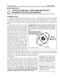
What is the Relationship Between Radioactivity and Radon?
In this radon and radioactivity worksheet, students analyze the data of the isotopes of elements that occur in the decay series of uranium-238. Students answer 6 questions about the isotopes, their half-lives, their potential threat and...
Curated OER
Sampling the Ocean Floor
Students sample goodies from an unseen ocean floor and try to accurately describe their composition. This simulation helps students explain the limitations of sampling and the problem of obtaining representative samples of sea floor...
Curated OER
Nature and Place Names in Arkansas
Middle schoolers examine the way that many place names in Arkansas came to be. By looking at Arkansas highway maps, they find names that come from the characteristics of each of the state's six geographical divisions. This interesting...
Curated OER
Earthquake!
Students gain an understanding of earthquakes. They examine vocabulary associated with earthquakes, how earthquakes happen, and preventive measures taken to diminish damage or harm in the event that an earthquake should happen.
Curated OER
One Part A Mini Lab: Water Contamination
Students investigate the effects of ground water contamination. In this ground water contamination lesson plan, students create a mini well and simulate ground water flow through the well with a contaminate (food coloring). They make...
Curated OER
How Much is Dirt Worth?
Fourth graders graph the percentages of the materials that make up the Earth and complete computations based on their results. For this topsoil lesson, 4th graders diagram the different layers of Earth's composition.
Curated OER
Acid Rain
Students understand the dynamics of acid rain and its impact on the living and non-living environment. They hypothesize how acid rain affects water pH levels in two lake systems with differing watershed features.
Curated OER
Volcanic Activity in the U.S.
Students locate and map ten volcanoes in United States, create chart comparing volcanoes by last eruption, type of volcano, location, and interesting fact, and create Powerpoint slide show describing basic
information about volcanoes and...
Curated OER
What's The Level?
Pupils examine the movement of the water table and saturation zones. They describe the movements of the water table and locate the saturation zones. Students identify the function of each saturation zone. They develop a model of the...
Curated OER
Case of the Missing Pumpkin
Fourth graders explore holidays by participating in a pumpkin activity. In this vegetation instructional activity, 4th graders discuss the different uses for pumpkins, not just Halloween decorations. Students identify the nutrients...


